 with our Megalithic Portal iPhone app")


<< Text Pages >> Berriedale - Chambered Cairn in Scotland in Highlands
Submitted by coldrum on Friday, 02 October 2009 Page Views: 4398
Neolithic and Bronze AgeSite Name: Berriedale Alternative Name: Langwell Water; Langwell House; LangwellCountry: Scotland County: Highlands Type: Chambered Cairn
Map Ref: ND09152223
Latitude: 58.179529N Longitude: 3.546452W
Condition:
| 5 | Perfect |
| 4 | Almost Perfect |
| 3 | Reasonable but with some damage |
| 2 | Ruined but still recognisable as an ancient site |
| 1 | Pretty much destroyed, possibly visible as crop marks |
| 0 | No data. |
| -1 | Completely destroyed |
| 5 | Superb |
| 4 | Good |
| 3 | Ordinary |
| 2 | Not Good |
| 1 | Awful |
| 0 | No data. |
| 5 | Can be driven to, probably with disabled access |
| 4 | Short walk on a footpath |
| 3 | Requiring a bit more of a walk |
| 2 | A long walk |
| 1 | In the middle of nowhere, a nightmare to find |
| 0 | No data. |
| 5 | co-ordinates taken by GPS or official recorded co-ordinates |
| 4 | co-ordinates scaled from a detailed map |
| 3 | co-ordinates scaled from a bad map |
| 2 | co-ordinates of the nearest village |
| 1 | co-ordinates of the nearest town |
| 0 | no data |
Be the first person to rate this site - see the 'Contribute!' box in the right hand menu.
Internal Links:
External Links:
Chambered Cairn in Highlands
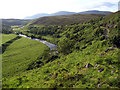
Remains of a chambered cairn.
Canmore
You may be viewing yesterday's version of this page. To see the most up to date information please register for a free account.
Do not use the above information on other web sites or publications without permission of the contributor.
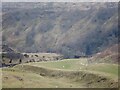
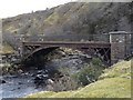
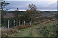
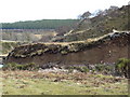
Nearby Images from Geograph Britain and Ireland:
©2023(licence)
©2009(licence)
©2019(licence)
©2009(licence)
©2008(licence)
The above images may not be of the site on this page, they are loaded from Geograph.
Please Submit an Image of this site or go out and take one for us!
Click here to see more info for this site
Nearby sites
Key: Red: member's photo, Blue: 3rd party photo, Yellow: other image, Green: no photo - please go there and take one, Grey: site destroyed
Download sites to:
KML (Google Earth)
GPX (GPS waypoints)
CSV (Garmin/Navman)
CSV (Excel)
To unlock full downloads you need to sign up as a Contributory Member. Otherwise downloads are limited to 50 sites.
Turn off the page maps and other distractions
Nearby sites listing. In the following links * = Image available
307m ESE 102° Cnoc Bad Fhasgaidh Ancient Village or Settlement (ND09452216)
537m SE 131° Creag Buaile Dorach Ancient Village or Settlement (ND09552187)
639m N 349° Tulloch Turnal Broch or Nuraghe (ND09042286)
670m ENE 66° Langwell Tulloch Broch or Nuraghe (ND09772249)
670m ENE 66° Langwell Tulloch Hut Circle* Ancient Village or Settlement (ND09772249)
1.0km E 79° Langwell Plantation Souterrain (Fogou, Earth House) (ND10162240)
1.1km ESE 106° Borgue Langwell Hut Circle Ancient Village or Settlement (ND10162191)
1.2km ESE 109° Borgue Langwell* Broch or Nuraghe (ND10262181)
1.2km WNW 289° Langwell Water Hut Circle Ancient Village or Settlement (ND08002266)
1.8km ENE 65° Langwell House* Cairn (ND10762293)
2.0km NNE 25° Tulach Bad A' Choilich Broch or Nuraghe (ND10052404)
2.3km NE 56° Rinsary Brae Ancient Village or Settlement (ND111235)
2.8km ENE 65° Rinsary Broch or Nuraghe (ND11682335)
3.0km NW 306° Strathy Burn Souterrain (Fogou, Earth House) (ND06742409)
3.2km WNW 285° Langwell Water Earth House Souterrain (Fogou, Earth House) (ND06032313)
3.7km WNW 284° Langwell Water Souterrain (Fogou, Earth House) (ND05602322)
4.0km SSW 209° Ousdale Burn* Broch or Nuraghe (ND07131881)
4.2km WNW 284° Langwell Hut Circle Ancient Village or Settlement (ND05052335)
5.5km NE 40° The Two Dogs* Standing Stone (Menhir) (ND1281026389)
5.6km NE 37° Upper Borgue Standing Stone* Standing Stone (Menhir) (ND12632665)
5.8km NNE 33° Upper Borgue Broch Broch or Nuraghe (ND12432708)
5.9km WNW 291° Langwell Water Enclosure Ancient Village or Settlement (ND03712445)
6.3km WNW 293° Langwell Earth House Souterrain (Fogou, Earth House) (ND03442484)
6.7km NNE 20° Burg Ruadh Broch or Nuraghe (ND11602852)
8.5km NNE 17° Bad Nan Glac Ancient Village or Settlement (ND119303)
View more nearby sites and additional images


 We would like to know more about this location. Please feel free to add a brief description and any relevant information in your own language.
 Wir möchten mehr über diese Stätte erfahren. Bitte zögern Sie nicht, eine kurze Beschreibung und relevante Informationen in Deutsch hinzuzufügen.
 Nous aimerions en savoir encore un peu sur les lieux. S'il vous plaît n'hesitez pas à ajouter une courte description et tous les renseignements pertinents dans votre propre langue.
 Quisieramos informarnos un poco más de las lugares. No dude en añadir una breve descripción y otros datos relevantes en su propio idioma.