


<< Our Photo Pages >> Llanhamlach Standing Stone - Standing Stone (Menhir) in Wales in Powys
Submitted by coin on Saturday, 25 April 2015 Page Views: 4219
Neolithic and Bronze AgeSite Name: Llanhamlach Standing Stone Alternative Name: Maen HirCountry: Wales
NOTE: This site is 1.4 km away from the location you searched for.
County: Powys Type: Standing Stone (Menhir)
Nearest Town: Brecon Nearest Village: Llanhamlach
Map Ref: SO08932675
Latitude: 51.931784N Longitude: 3.325958W
Condition:
| 5 | Perfect |
| 4 | Almost Perfect |
| 3 | Reasonable but with some damage |
| 2 | Ruined but still recognisable as an ancient site |
| 1 | Pretty much destroyed, possibly visible as crop marks |
| 0 | No data. |
| -1 | Completely destroyed |
| 5 | Superb |
| 4 | Good |
| 3 | Ordinary |
| 2 | Not Good |
| 1 | Awful |
| 0 | No data. |
| 5 | Can be driven to, probably with disabled access |
| 4 | Short walk on a footpath |
| 3 | Requiring a bit more of a walk |
| 2 | A long walk |
| 1 | In the middle of nowhere, a nightmare to find |
| 0 | No data. |
| 5 | co-ordinates taken by GPS or official recorded co-ordinates |
| 4 | co-ordinates scaled from a detailed map |
| 3 | co-ordinates scaled from a bad map |
| 2 | co-ordinates of the nearest village |
| 1 | co-ordinates of the nearest town |
| 0 | no data |
Internal Links:
External Links:
I have visited· I would like to visit
NickyD visited on 1st Jan 2016 - their rating: Cond: 4 Amb: 1 Access: 4
coin visited - their rating: Cond: 3 Amb: 1 Access: 4
Average ratings for this site from all visit loggers: Condition: 3.5 Ambience: 1 Access: 4
")
Sunny100 writes: In the book 'The Ancient Stones of Wales' by Chris Barber and John Godfrey Williams', Blorenge Books, 1989, it is called Maen Hir on the Os maps of 1947 and 1951 and as Standing Stone on the 1967 maps. The authors say: "It is a greyish stone about 4 foot 6 inches high and 2 feet square. Here in 1959 some strange photographs were obtained suggesting a concentration of ultra-violet light near the standing stone. 'The Illustrated History and Biography of Brecknockshire' by Edwin Poole (Brecon, 1886), p145, mentions it as traditionally being the spot from which St Peter preached, hence the name of the mansion opposite which is called Peterstone Court". The stone is located on the right-side of the A40 from Abergavenny to Brecon in the hedge opposite Llanhamlach church.
You may be viewing yesterday's version of this page. To see the most up to date information please register for a free account.
")
")
")
Do not use the above information on other web sites or publications without permission of the contributor.
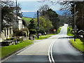
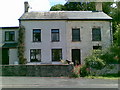
Nearby Images from Geograph Britain and Ireland:
©2016(licence)

©2022(licence)

©2022(licence)

©2022(licence)
©2011(licence)
The above images may not be of the site on this page, they are loaded from Geograph.
Please Submit an Image of this site or go out and take one for us!
Click here to see more info for this site
Nearby sites
Key: Red: member's photo, Blue: 3rd party photo, Yellow: other image, Green: no photo - please go there and take one, Grey: site destroyed
Download sites to:
KML (Google Earth)
GPX (GPS waypoints)
CSV (Garmin/Navman)
CSV (Excel)
To unlock full downloads you need to sign up as a Contributory Member. Otherwise downloads are limited to 50 sites.
Turn off the page maps and other distractions
Nearby sites listing. In the following links * = Image available
351m S 184° The Cross of Moridic (Llanhamlach)* Ancient Cross (SO089264)
984m ESE 112° Ty Illtyd* Chambered Cairn (SO09842637)
1.7km SW 235° Llanfrynach Early Christian Stone* Ancient Cross (SO07512579)
2.3km SSW 193° Pencelli Standing Stone* Standing Stone (Menhir) (SO0836024470)
2.5km NNW 340° Twyn-Llechfaen* Hillfort (SO081291)
3.4km SW 215° Coed y Caerau* Hillfort (SO069240)
3.6km SW 219° Coed y Brenhin Hillfort* Ancient Village or Settlement (SO06592396)
3.7km WNW 295° Slwch Camp* Hillfort (SO056284)
3.9km E 87° Llangors Crannog* Crannog (SO12872688)
4.0km ESE 118° Allt yr Esgair* Hillfort (SO124248)
4.0km ESE 118° Allt yr Esgair 2 Hillfort (SO124248)
4.1km SE 137° Gileston* Standing Stone (Menhir) (SO11672374)
4.2km SW 230° Rhiwiau Well* Holy Well or Sacred Spring (SO0565224123)
4.2km SE 126° Allt yr Esgair 3 Hillfort (SO123242)
4.4km ESE 122° Allt-Yr-Yscrin* Cairn (SO12612435)
4.7km WNW 290° Brecknock Museum* Museum (SO0458528441)
5.0km WNW 297° Priory Well (Powys)* Holy Well or Sacred Spring (SO04522906)
5.1km S 170° Tyle Clydach Hillfort (SO09742175)
5.1km WSW 250° Coed Mawr Hillfort* Hillfort (SO04102512)
5.3km NW 319° Bishop Gower's Well* Holy Well or Sacred Spring (SO0551330776)
5.8km SSE 155° Tump Wood* Hillfort (SO113215)
5.8km WNW 299° Maen-Du Well* Holy Well or Sacred Spring (SO03902963)
6.0km WSW 249° Plas-y-Gaer* Hillfort (SO033247)
6.2km SSE 158° Pen-Y-Wenallt* Hillfort (SO11162095)
6.3km NNE 18° Weston Camp* Hillfort (SO110327)
View more nearby sites and additional images


 We would like to know more about this location. Please feel free to add a brief description and any relevant information in your own language.
 Wir möchten mehr über diese Stätte erfahren. Bitte zögern Sie nicht, eine kurze Beschreibung und relevante Informationen in Deutsch hinzuzufügen.
 Nous aimerions en savoir encore un peu sur les lieux. S'il vous plaît n'hesitez pas à ajouter une courte description et tous les renseignements pertinents dans votre propre langue.
 Quisieramos informarnos un poco más de las lugares. No dude en añadir una breve descripción y otros datos relevantes en su propio idioma.