 with our Megalithic Portal iPhone app")


<< Other Photo Pages >> Ty-Uchaf - Round Barrow(s) in Wales in Flintshire
Submitted by coldrum on Wednesday, 27 January 2010 Page Views: 3401
Neolithic and Bronze AgeSite Name: Ty-UchafCountry: Wales
NOTE: This site is 1.0 km away from the location you searched for.
County: Flintshire Type: Round Barrow(s)
Map Ref: SJ07868095
Latitude: 53.317432N Longitude: 3.384587W
Condition:
| 5 | Perfect |
| 4 | Almost Perfect |
| 3 | Reasonable but with some damage |
| 2 | Ruined but still recognisable as an ancient site |
| 1 | Pretty much destroyed, possibly visible as crop marks |
| 0 | No data. |
| -1 | Completely destroyed |
| 5 | Superb |
| 4 | Good |
| 3 | Ordinary |
| 2 | Not Good |
| 1 | Awful |
| 0 | No data. |
| 5 | Can be driven to, probably with disabled access |
| 4 | Short walk on a footpath |
| 3 | Requiring a bit more of a walk |
| 2 | A long walk |
| 1 | In the middle of nowhere, a nightmare to find |
| 0 | No data. |
| 5 | co-ordinates taken by GPS or official recorded co-ordinates |
| 4 | co-ordinates scaled from a detailed map |
| 3 | co-ordinates scaled from a bad map |
| 2 | co-ordinates of the nearest village |
| 1 | co-ordinates of the nearest town |
| 0 | no data |
Be the first person to rate this site - see the 'Contribute!' box in the right hand menu.
Internal Links:
External Links:
Round Barrow in Flintshire (Sir y Fflint)
"A circular mound, possibly kerbed, 15m in diameter and 0.9m high, disturbed."
Source: Coflein.
You may be viewing yesterday's version of this page. To see the most up to date information please register for a free account.
Do not use the above information on other web sites or publications without permission of the contributor.
coldrum has found this location on Google Street View:
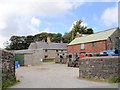
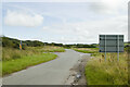
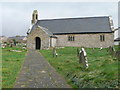
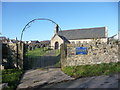
Nearby Images from Geograph Britain and Ireland:
©2007(licence)
©2023(licence)
©2008(licence)
©2012(licence)
©2013(licence)
The above images may not be of the site on this page, they are loaded from Geograph.
Please Submit an Image of this site or go out and take one for us!
Click here to see more info for this site
Nearby sites
Key: Red: member's photo, Blue: 3rd party photo, Yellow: other image, Green: no photo - please go there and take one, Grey: site destroyed
Download sites to:
KML (Google Earth)
GPX (GPS waypoints)
CSV (Garmin/Navman)
CSV (Excel)
To unlock full downloads you need to sign up as a Contributory Member. Otherwise downloads are limited to 50 sites.
Turn off the page maps and other distractions
Nearby sites listing. In the following links * = Image available
563m SSE 162° Gop Farm Bone Cave Cave or Rock Shelter (SJ08028041)
921m WNW 302° Coed-Yr-Esgob Round Barrow(s) (SJ07098146)
1.1km SE 134° Gop-y-Goleuni* Cairn (SJ08668015)
1.2km SE 137° Gop Caves* Cave or Rock Shelter (SJ08648009)
1.3km SE 127° Gop Wood Mound* Cairn (SJ08928012)
1.6km SSE 154° Hen Dy Round Barrow(s) (SJ08547950)
1.8km ESE 108° Bryn-Y-Odyn* Round Barrow(s) (SJ0952380376)
1.8km WSW 241° Graig Fawr (Dyserth)* Standing Stone (Menhir) (SJ06288013)
2.6km ESE 103° Axton Barrows Round Barrow(s) (SJ104803)
2.9km SW 231° Dyserth Church* Ancient Cross (SJ056792)
2.9km SSW 211° Moel Hiraddug* Hillfort (SJ063785)
2.9km SSE 158° Cae Bryn Round Barrow(s) (SJ08917821)
3.0km S 186° Marian Ffrith Hillfort (SJ0746877947)
3.2km S 191° Marion Bach 2 Round Barrow(s) (SJ07217782)
3.5km SSW 192° Marion Bach 1 Round Barrow(s) (SJ07057759)
3.8km S 183° Aelwyd Uchaf (Cottage) Barrows Round Barrow(s) (SJ0758577185)
4.0km SW 236° Ffynnon Fair (Rhuddlan)* Holy Well or Sacred Spring (SJ045788)
4.3km S 182° Llyn-Y-Gorseddau 3 Round Barrow(s) (SJ07647662)
4.4km S 181° Llyn-Y-Gorseddau 2 Round Barrow(s) (SJ07687657)
4.4km S 182° Llyn-Y-Gorseddau 1 Round Barrow(s) (SJ07657651)
4.8km SSE 151° Hendre Bach Round Barrow(s) (SJ10137671)
5.0km SSE 158° Pany Y Dulath Round Barrow(s) (SJ09677624)
5.0km SSE 162° Criafol* Round Barrow(s) (SJ09317611)
5.5km ESE 112° Maen Achwyfan* Ancient Cross (SJ129788)
6.0km SSE 146° Traveller's Inn* Round Barrow(s) (SJ111759)
View more nearby sites and additional images


 We would like to know more about this location. Please feel free to add a brief description and any relevant information in your own language.
 Wir möchten mehr über diese Stätte erfahren. Bitte zögern Sie nicht, eine kurze Beschreibung und relevante Informationen in Deutsch hinzuzufügen.
 Nous aimerions en savoir encore un peu sur les lieux. S'il vous plaît n'hesitez pas à ajouter une courte description et tous les renseignements pertinents dans votre propre langue.
 Quisieramos informarnos un poco más de las lugares. No dude en añadir una breve descripción y otros datos relevantes en su propio idioma.