


<< Text Pages >> Kirkmichael - Stone Circle in Scotland in Perth and Kinross
Submitted by BigSweetie on Thursday, 25 March 2004 Page Views: 4215
Neolithic and Bronze AgeSite Name: KirkmichaelCountry: Scotland
NOTE: This site is 1.1 km away from the location you searched for.
County: Perth and Kinross Type: Stone Circle
Nearest Town: Blairgowrie Nearest Village: Kirkmichael
Map Ref: NO08085985 Landranger Map Number: 43
Latitude: 56.721240N Longitude: 3.503566W
Condition:
| 5 | Perfect |
| 4 | Almost Perfect |
| 3 | Reasonable but with some damage |
| 2 | Ruined but still recognisable as an ancient site |
| 1 | Pretty much destroyed, possibly visible as crop marks |
| 0 | No data. |
| -1 | Completely destroyed |
| 5 | Superb |
| 4 | Good |
| 3 | Ordinary |
| 2 | Not Good |
| 1 | Awful |
| 0 | No data. |
| 5 | Can be driven to, probably with disabled access |
| 4 | Short walk on a footpath |
| 3 | Requiring a bit more of a walk |
| 2 | A long walk |
| 1 | In the middle of nowhere, a nightmare to find |
| 0 | No data. |
| 5 | co-ordinates taken by GPS or official recorded co-ordinates |
| 4 | co-ordinates scaled from a detailed map |
| 3 | co-ordinates scaled from a bad map |
| 2 | co-ordinates of the nearest village |
| 1 | co-ordinates of the nearest town |
| 0 | no data |
Internal Links:
External Links:
Kirkmichael parish was an area that was described by George Chalmers (1887) as possessing “a vast body of Druid remains,” there being “a number of Druid cairns in the vicinity of Druidical circles.” As we know, the term ‘druid’ has long fallen out of favour; and with it in this area, the sites themselves have taken a similar fate.
Found just south of the village, on raised ground 100 yards west of the river, this stone circle is not listed in any of the archaeological catalogues, but its existence was thankfully recorded in one of the essays by regional historian Charles Fergusson. (1899)
More details at megalithix.wordpress.com
You may be viewing yesterday's version of this page. To see the most up to date information please register for a free account.
Do not use the above information on other web sites or publications without permission of the contributor.
Nearby Images from Geograph Britain and Ireland:
©2007(licence)
©2014(licence)
©2018(licence)
©2012(licence)
©2012(licence)
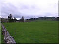
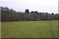
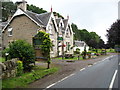
The above images may not be of the site on this page, they are loaded from Geograph.
Please Submit an Image of this site or go out and take one for us!
Click here to see more info for this site
Nearby sites
Key: Red: member's photo, Blue: 3rd party photo, Yellow: other image, Green: no photo - please go there and take one, Grey: site destroyed
Download sites to:
KML (Google Earth)
GPX (GPS waypoints)
CSV (Garmin/Navman)
CSV (Excel)
To unlock full downloads you need to sign up as a Contributory Member. Otherwise downloads are limited to 50 sites.
Turn off the page maps and other distractions
Nearby sites listing. In the following links * = Image available
3.3km SSE 159° Balnabroich* Standing Stones (NO0917556752)
3.4km NNW 327° Giant's Grave, Enochdhu* Standing Stone (Menhir) (NO06296279)
3.8km NW 325° Enochdhu* Standing Stone (Menhir) (NO060630)
4.2km NW 322° Kindrogan Standing Stones (NO056632)
4.2km NW 324° Croft House Stone* Standing Stone (Menhir) (NO057633)
4.2km SSW 206° Pitcarmick Burn Standing Stone (Menhir) (NO06165610)
4.6km NNW 348° Slimestone* Standing Stone (Menhir) (NO0722364367)
4.9km ENE 58° Glenkilrie Stone Circle (NO123624)
5.7km NW 320° Witch's Stone, Straloch Standing Stone (Menhir) (NO04516431)
5.7km NW 311° Straloch* Standing Stone (Menhir) (NO038637)
6.4km N 353° Faire na Paitig* Stone Circle (NO07456620)
7.3km E 82° The Borland Stone* Standing Stone (Menhir) (NO1536160677)
8.8km SSE 154° Cally Standing Stones (NO118519)
9.1km NE 37° Broughdearg* Stone Circle (NO1374567047)
9.5km WSW 251° Black Spout Wood Homestead Ancient Village or Settlement (NN990570)
10.4km S 172° Sheriffmuir Cairn (NO09244949)
10.6km NNE 14° Spittal of Glenshee Modern Stone Circle* Modern Stone Circle etc (NO10927004)
10.7km NNE 14° Spittal of Glenshee Standing Stone* Standing Stone (Menhir) (NO1086770194)
10.9km NNE 18° Grave of Diarmid* Stone Circle (NO117701)
11.2km SE 126° Rannagulzion Standing Stone (Menhir) (NO1753)
11.5km ESE 114° Drumderg 1 (Tullymurdoch) Rock Art (NO18525497)
11.6km SSW 195° Sancta Crux Well* Holy Well or Sacred Spring (NO049487)
12.2km WSW 237° Tigh Na Ruaich* Stone Circle (NN97625346)
12.7km SW 225° Haugh Cottages* Class III Pictish Cross Slab (NN988511)
12.9km SSE 162° Muir of Gormach Stone Circle (NO11734751)
View more nearby sites and additional images


 We would like to know more about this location. Please feel free to add a brief description and any relevant information in your own language.
 Wir möchten mehr über diese Stätte erfahren. Bitte zögern Sie nicht, eine kurze Beschreibung und relevante Informationen in Deutsch hinzuzufügen.
 Nous aimerions en savoir encore un peu sur les lieux. S'il vous plaît n'hesitez pas à ajouter une courte description et tous les renseignements pertinents dans votre propre langue.
 Quisieramos informarnos un poco más de las lugares. No dude en añadir una breve descripción y otros datos relevantes en su propio idioma.