


<< Our Photo Pages >> Tulloch of Achavarn - Broch or Nuraghe in Scotland in Caithness
Submitted by cosmic on Sunday, 14 October 2007 Page Views: 3489
Iron Age and Later PrehistorySite Name: Tulloch of AchavarnCountry: Scotland
NOTE: This site is 1.4 km away from the location you searched for.
County: Caithness Type: Broch or Nuraghe
Nearest Town: Thurso
Map Ref: ND08545962
Latitude: 58.515088N Longitude: 3.571665W
Condition:
| 5 | Perfect |
| 4 | Almost Perfect |
| 3 | Reasonable but with some damage |
| 2 | Ruined but still recognisable as an ancient site |
| 1 | Pretty much destroyed, possibly visible as crop marks |
| 0 | No data. |
| -1 | Completely destroyed |
| 5 | Superb |
| 4 | Good |
| 3 | Ordinary |
| 2 | Not Good |
| 1 | Awful |
| 0 | No data. |
| 5 | Can be driven to, probably with disabled access |
| 4 | Short walk on a footpath |
| 3 | Requiring a bit more of a walk |
| 2 | A long walk |
| 1 | In the middle of nowhere, a nightmare to find |
| 0 | No data. |
| 5 | co-ordinates taken by GPS or official recorded co-ordinates |
| 4 | co-ordinates scaled from a detailed map |
| 3 | co-ordinates scaled from a bad map |
| 2 | co-ordinates of the nearest village |
| 1 | co-ordinates of the nearest town |
| 0 | no data |
Internal Links:
External Links:
I have visited· I would like to visit
SolarMegalith visited on 10th Jul 2011 - their rating: Cond: 1 Amb: 3 Access: 4
")
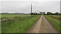
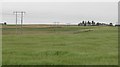
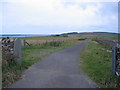
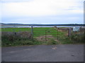
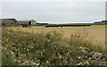
Remains of a broch situated above Loch Calder.
You may be viewing yesterday's version of this page. To see the most up to date information please register for a free account.
")
")
")
")
Do not use the above information on other web sites or publications without permission of the contributor.
Nearby Images from Geograph Britain and Ireland:
©2010(licence)
©2010(licence)
©2007(licence)
©2007(licence)
©2021(licence)
The above images may not be of the site on this page, they are loaded from Geograph.
Please Submit an Image of this site or go out and take one for us!
Click here to see more info for this site
Nearby sites
Key: Red: member's photo, Blue: 3rd party photo, Yellow: other image, Green: no photo - please go there and take one, Grey: site destroyed
Download sites to:
KML (Google Earth)
GPX (GPS waypoints)
CSV (Garmin/Navman)
CSV (Excel)
To unlock full downloads you need to sign up as a Contributory Member. Otherwise downloads are limited to 50 sites.
Turn off the page maps and other distractions
Nearby sites listing. In the following links * = Image available
2.4km N 7° Framside* Broch or Nuraghe (ND08906199)
2.5km ENE 66° Upper Sour Broch or Nuraghe (ND10856056)
2.7km NE 41° North Calder* Broch or Nuraghe (ND10356160)
2.7km NW 326° Tulach An T-sionnaich Chambered Cairn (ND07046192)
2.8km NW 321° Tulloch of Assery (A and B)* Chambered Cairn (ND06826188)
3.3km E 89° Housle Cairn Broch or Nuraghe (ND11905960)
3.8km WSW 255° Monadh Nan Carn* Chambered Cairn (ND04885874)
3.8km WSW 249° Sithean Dubh Chambered Cairn (ND04975834)
3.8km W 277° Broubster (Caithness)* Stone Circle (ND04776014)
3.8km E 96° Tulloch of Milton* Chambered Cairn (ND12355911)
4.0km W 273° Aultan Broubster* Stone Circle (ND04555991)
4.3km SSW 201° Dorrery* Stone Circle (ND06895565)
4.5km WNW 292° Torr A' Chaise Cairn (ND04446139)
4.7km SSW 212° Beinn Freiceadain Hillfort (ND05945574)
4.8km WSW 252° Carn Liath, Shurrery* Cairn (ND03895822)
5.0km WSW 239° Tulach Gorm (Forse Water) Broch or Nuraghe (ND04185710)
5.2km WSW 239° Shurrery Stone Circle (ND040570)
5.3km SSE 158° Achingoul Broch or Nuraghe (ND10475463)
5.5km NNE 18° Geise Broch* Broch or Nuraghe (ND10366480)
6.3km SE 133° Achies West* Broch or Nuraghe (ND13055522)
6.4km ENE 57° Carsgoe Broch or Nuraghe (ND1463)
6.4km E 84° Sibster Broch or Nuraghe (ND14996011)
6.7km NE 42° Tulloch of Shalmstry* Broch or Nuraghe (ND13166443)
6.7km SE 125° Achies East* Broch or Nuraghe (ND14005565)
7.0km ENE 73° Springfield Chambered Cairn Chambered Cairn (ND1533161521)
View more nearby sites and additional images


 We would like to know more about this location. Please feel free to add a brief description and any relevant information in your own language.
 Wir möchten mehr über diese Stätte erfahren. Bitte zögern Sie nicht, eine kurze Beschreibung und relevante Informationen in Deutsch hinzuzufügen.
 Nous aimerions en savoir encore un peu sur les lieux. S'il vous plaît n'hesitez pas à ajouter une courte description et tous les renseignements pertinents dans votre propre langue.
 Quisieramos informarnos un poco más de las lugares. No dude en añadir una breve descripción y otros datos relevantes en su propio idioma.