


<< Text Pages >> Murthly Castle - Standing Stone (Menhir) in Scotland in Perth and Kinross
Submitted by BigSweetie on Thursday, 25 March 2004 Page Views: 9814
Neolithic and Bronze AgeSite Name: Murthly CastleCountry: Scotland County: Perth and Kinross Type: Standing Stone (Menhir)
Nearest Town: Perth Nearest Village: Murthly
Map Ref: NO07053956 Landranger Map Number: 52
Latitude: 56.538819N Longitude: 3.513077W
Condition:
| 5 | Perfect |
| 4 | Almost Perfect |
| 3 | Reasonable but with some damage |
| 2 | Ruined but still recognisable as an ancient site |
| 1 | Pretty much destroyed, possibly visible as crop marks |
| 0 | No data. |
| -1 | Completely destroyed |
| 5 | Superb |
| 4 | Good |
| 3 | Ordinary |
| 2 | Not Good |
| 1 | Awful |
| 0 | No data. |
| 5 | Can be driven to, probably with disabled access |
| 4 | Short walk on a footpath |
| 3 | Requiring a bit more of a walk |
| 2 | A long walk |
| 1 | In the middle of nowhere, a nightmare to find |
| 0 | No data. |
| 5 | co-ordinates taken by GPS or official recorded co-ordinates |
| 4 | co-ordinates scaled from a detailed map |
| 3 | co-ordinates scaled from a bad map |
| 2 | co-ordinates of the nearest village |
| 1 | co-ordinates of the nearest town |
| 0 | no data |
Be the first person to rate this site - see the 'Contribute!' box in the right hand menu.
Internal Links:
External Links:
Standing Stone in Perthshire
Have you visited this site? Please add a comment below.
You may be viewing yesterday's version of this page. To see the most up to date information please register for a free account.
Do not use the above information on other web sites or publications without permission of the contributor.
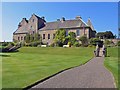
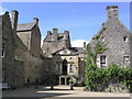
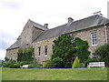
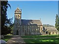
Nearby Images from Geograph Britain and Ireland:
©2007(licence)
©2009(licence)
©2009(licence)
©2007(licence)
©2006(licence)
The above images may not be of the site on this page, they are loaded from Geograph.
Please Submit an Image of this site or go out and take one for us!
Click here to see more info for this site
Nearby sites
Key: Red: member's photo, Blue: 3rd party photo, Yellow: other image, Green: no photo - please go there and take one, Grey: site destroyed
Download sites to:
KML (Google Earth)
GPX (GPS waypoints)
CSV (Garmin/Navman)
CSV (Excel)
To unlock full downloads you need to sign up as a Contributory Member. Otherwise downloads are limited to 50 sites.
Turn off the page maps and other distractions
Nearby sites listing. In the following links * = Image available
2.5km WSW 238° Staredam Standing Stones* Standing Stones (NO049383)
2.6km SW 229° Muirheadston Stone Circle (NO05053790)
2.6km N 3° East Cult* Stone Row / Alignment (NO0722642159)
3.0km WNW 299° Newtyle* Standing Stones (NO0449241062)
3.4km ENE 58° Glendelvine House Standing Stone (Menhir) (NO09954130)
3.4km ESE 107° Murthly* Stone Circle (NO10273852)
3.5km SW 233° Witch's Stone* Standing Stone (Menhir) (NO042375)
4.1km N 6° Ninewells* Cairn (NO07574360)
5.0km WSW 253° Craig Obney Vitrified Fort (NO02243822)
5.3km SSW 195° Pitsundry* Stone Circle (NO0558834454)
5.5km WNW 302° Dunkeld Cathedral Sculptured Stone* Early Christian Sculptured Stone (NO024426)
6.5km S 174° Loak Stone Standing Stone (Menhir) (NO07573305)
6.6km WNW 300° Dunkeld Park* Standing Stone (Menhir) (NO0142642993)
6.6km S 173° Loak Court Hill Round Barrow(s) (NO07733301)
6.6km WSW 238° Tullybeagles* Stone Circle (NO013362)
7.0km WNW 298° King's Seat Hillfort (NO00934303)
7.3km ENE 72° Tower of Lethendy Class III Pictish Cross Slab (NO140417)
7.3km SSE 167° Newmill souterrain* Souterrain (Fogou, Earth House) (NO08513239)
7.6km S 189° Cowford Standing Stone (Menhir) (NO05633205)
7.7km SSE 160° Overbenchil* Standing Stone (Menhir) (NO095322)
8.0km ENE 63° Aikenhead Farm (Blairgowrie) Rock Art (NO143430)
8.3km S 171° Gellybank* Standing Stones (NO082313)
8.4km ESE 112° Cargill Symbol Stone Class I Pictish Symbol Stone (NO14773623)
8.6km WSW 244° Sack Stone* Standing Stone (Menhir) (NN9925535973)
8.7km E 89° The Tron* Modern Stone Circle etc (NO1575439489)
View more nearby sites and additional images


 We would like to know more about this location. Please feel free to add a brief description and any relevant information in your own language.
 Wir möchten mehr über diese Stätte erfahren. Bitte zögern Sie nicht, eine kurze Beschreibung und relevante Informationen in Deutsch hinzuzufügen.
 Nous aimerions en savoir encore un peu sur les lieux. S'il vous plaît n'hesitez pas à ajouter une courte description et tous les renseignements pertinents dans votre propre langue.
 Quisieramos informarnos un poco más de las lugares. No dude en añadir una breve descripción y otros datos relevantes en su propio idioma.