


<< Text Pages >> Birrel Sike - Ancient Village or Settlement in England in Cumbria
Submitted by Andy B on Tuesday, 30 March 2010 Page Views: 3982
Multi-periodSite Name: Birrel SikeCountry: England
NOTE: This site is 1.2 km away from the location you searched for.
County: Cumbria Type: Ancient Village or Settlement
Nearest Town: Egremont Nearest Village: Calderbridge
Map Ref: NY071073
Latitude: 54.452564N Longitude: 3.43435W
Condition:
| 5 | Perfect |
| 4 | Almost Perfect |
| 3 | Reasonable but with some damage |
| 2 | Ruined but still recognisable as an ancient site |
| 1 | Pretty much destroyed, possibly visible as crop marks |
| 0 | No data. |
| -1 | Completely destroyed |
| 5 | Superb |
| 4 | Good |
| 3 | Ordinary |
| 2 | Not Good |
| 1 | Awful |
| 0 | No data. |
| 5 | Can be driven to, probably with disabled access |
| 4 | Short walk on a footpath |
| 3 | Requiring a bit more of a walk |
| 2 | A long walk |
| 1 | In the middle of nowhere, a nightmare to find |
| 0 | No data. |
| 5 | co-ordinates taken by GPS or official recorded co-ordinates |
| 4 | co-ordinates scaled from a detailed map |
| 3 | co-ordinates scaled from a bad map |
| 2 | co-ordinates of the nearest village |
| 1 | co-ordinates of the nearest town |
| 0 | no data |
Internal Links:
External Links:
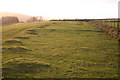
There is a large cairn, numerous small tumuli, and apparent hut-circles in a field
More information at Pastscape
Also a "Stone Pike" at NY07820782, marked on the map as a sheepfold, "I dont see how this can be the case given the size location and views of other sites" writes an anonymous poster
You may be viewing yesterday's version of this page. To see the most up to date information please register for a free account.
Do not use the above information on other web sites or publications without permission of the contributor.
Nearby Images from Geograph Britain and Ireland:
©2009(licence)
©2006(licence)
©2009(licence)
©2006(licence)
©2006(licence)
The above images may not be of the site on this page, they are loaded from Geograph.
Please Submit an Image of this site or go out and take one for us!
Click here to see more info for this site
Nearby sites
Key: Red: member's photo, Blue: 3rd party photo, Yellow: other image, Green: no photo - please go there and take one, Grey: site destroyed
Download sites to:
KML (Google Earth)
GPX (GPS waypoints)
CSV (Garmin/Navman)
CSV (Excel)
To unlock full downloads you need to sign up as a Contributory Member. Otherwise downloads are limited to 50 sites.
Turn off the page maps and other distractions
Nearby sites listing. In the following links * = Image available
1.5km N 5° Thornholme farm* Ancient Village or Settlement (NY0727008760)
2.4km N 6° Tongue How Settlement* Ancient Village or Settlement (NY074097)
2.5km N 357° Tongue How Cairn* Ring Cairn (NY070098)
2.8km ENE 74° Sampson's Bratfull* Long Barrow (NY098080)
3.1km NNW 334° Friar's Well Barrow Cemetery (NY058101)
3.1km ENE 72° Stockdale Moor* Cairn (NY101082)
3.4km N 1° Capelcrag Beck* Ring Cairn (NY07231072)
3.5km S 177° Gosforth Holy Well* Holy Well or Sacred Spring (NY07190383)
3.7km S 177° Gosforth Cross* Ancient Cross (NY07230357)
3.8km SSW 199° Gretigate C Stone Circle (NY058037)
3.8km SSW 199° Gretigate B Stone Circle (NY058037)
4.0km SSW 200° Gretigate A Stone Circle (NY057036)
4.3km NW 319° Yewcroft* Stone Circle (NY043106)
4.4km NNW 348° Swarth Fell funerary cairn* Round Cairn (NY06241167)
5.2km W 262° Beckermet Ancient Crosses (St John's Church)* Ancient Cross (NY01890671)
5.5km E 83° Mecklin Park Cairn (NY126079)
5.7km WSW 257° Beckermet Ancient Crosses (St Bridget's)* Ancient Cross (NY015061)
6.2km SW 216° Grey Croft* Stone Circle (NY03340238)
6.8km N 350° Blakeley Raise* Stone Circle (NY06011403)
7.1km SSE 162° Irton Cross* Ancient Cross (NY0916000455)
7.7km SE 133° Irton Pike Ring Cairn Ring Cairn (NY1261601907)
8.3km WNW 293° Egremont Stone Circle (NX995107)
10.4km N 356° Lamplugh Stone Circle (NY065177)
10.6km S 185° Drigg sand dunes* Ancient Mine, Quarry or other Industry (SD059968)
11.0km ESE 113° Low Longrigg NE* Stone Circle (NY172028)
View more nearby sites and additional images


 We would like to know more about this location. Please feel free to add a brief description and any relevant information in your own language.
 Wir möchten mehr über diese Stätte erfahren. Bitte zögern Sie nicht, eine kurze Beschreibung und relevante Informationen in Deutsch hinzuzufügen.
 Nous aimerions en savoir encore un peu sur les lieux. S'il vous plaît n'hesitez pas à ajouter une courte description et tous les renseignements pertinents dans votre propre langue.
 Quisieramos informarnos un poco más de las lugares. No dude en añadir una breve descripción y otros datos relevantes en su propio idioma.