


<< Our Photo Pages >> Gwynfan Ring Cairn - Cairn in Wales in Powys
Submitted by geoffstickland on Wednesday, 05 August 2020 Page Views: 648
Neolithic and Bronze AgeSite Name: Gwynfan Ring Cairn Alternative Name: Gwyfaen CairnCountry: Wales
NOTE: This site is 2.1 km away from the location you searched for.
County: Powys Type: Cairn
Nearest Town: Llandrindod Wells Nearest Village: Llanyre
Map Ref: SO02566344
Latitude: 52.260465N Longitude: 3.429078W
Condition:
| 5 | Perfect |
| 4 | Almost Perfect |
| 3 | Reasonable but with some damage |
| 2 | Ruined but still recognisable as an ancient site |
| 1 | Pretty much destroyed, possibly visible as crop marks |
| 0 | No data. |
| -1 | Completely destroyed |
| 5 | Superb |
| 4 | Good |
| 3 | Ordinary |
| 2 | Not Good |
| 1 | Awful |
| 0 | No data. |
| 5 | Can be driven to, probably with disabled access |
| 4 | Short walk on a footpath |
| 3 | Requiring a bit more of a walk |
| 2 | A long walk |
| 1 | In the middle of nowhere, a nightmare to find |
| 0 | No data. |
| 5 | co-ordinates taken by GPS or official recorded co-ordinates |
| 4 | co-ordinates scaled from a detailed map |
| 3 | co-ordinates scaled from a bad map |
| 2 | co-ordinates of the nearest village |
| 1 | co-ordinates of the nearest town |
| 0 | no data |
Internal Links:
External Links:
I have visited· I would like to visit
geoffstickland has visited here
")
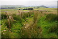
A ruined round cairn round cairn about 25' in diameter and 18" high topped by a large, modern clearance heap of miscellaneous stones. Coflein is uncertain of the date but it is reminiscent of other Bronze Age cairns in this area. It is recorded on the OS 1:25 map as a cairn.
You may be viewing yesterday's version of this page. To see the most up to date information please register for a free account.
")
Do not use the above information on other web sites or publications without permission of the contributor.
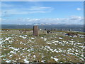
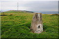
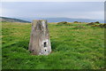
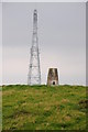
Nearby Images from Geograph Britain and Ireland:
©2007(licence)
©2012(licence)
©2012(licence)
©2012(licence)
©2012(licence)
The above images may not be of the site on this page, they are loaded from Geograph.
Please Submit an Image of this site or go out and take one for us!
Click here to see more info for this site
Nearby sites
Key: Red: member's photo, Blue: 3rd party photo, Yellow: other image, Green: no photo - please go there and take one, Grey: site destroyed
Download sites to:
KML (Google Earth)
GPX (GPS waypoints)
CSV (Garmin/Navman)
CSV (Excel)
To unlock full downloads you need to sign up as a Contributory Member. Otherwise downloads are limited to 50 sites.
Turn off the page maps and other distractions
Nearby sites listing. In the following links * = Image available
1.7km NNW 341° Dolmaengwyn* Standing Stone (Menhir) (SO02056506)
2.2km SSW 195° Dol Y Fan Cairn* Cairn (SO01946135)
3.8km SE 129° Rock Park* Holy Well or Sacred Spring (SO055610)
4.1km ESE 123° The Temple, Llandrindod Wells* Stone Circle (SO0598261105)
4.5km SE 124° Llandrindod Wells* Holy Well or Sacred Spring (SO0627460806)
4.6km S 180° Newmead Farm* Natural Stone / Erratic / Other Natural Feature (SO025588)
4.7km NW 304° Carn Wen - The Druid's circle* Ring Cairn (SN98686614)
4.7km W 260° Cae Garw Cairn* Cairn (SN97886268)
4.9km WSW 245° Banc Ystrdd-Wen* Ring Cairn (SN981615)
5.0km WSW 256° Cryn-Fryn* Ring Cairn (SN977623)
5.0km W 272° Llanwrthwl* Standing Stone (Menhir) (SN9757263720)
5.0km SW 231° Garth Cairns 1&2* Cairn (SN9854260365)
5.1km SW 231° Llethr Waun-lwyd Cairns* Cairn (SN98546033)
5.3km ESE 123° Little Hill Cairn (SO0692960454)
5.4km SW 235° Carn Wen (Garth) Cairn* Cairn (SN98106046)
5.4km SW 232° Ffynnon Mary Cairn* Cairn (SN98216015)
5.5km ESE 116° Pantpurlas* Round Barrow(s) (SO0752460940)
5.6km SSW 192° Newbridge on Wye* Standing Stone (Menhir) (SO01305802)
5.7km ESE 112° Bongam Bank* Cairn (SO0779761255)
5.7km SW 231° Blaengwynolwyn Uchaf 1, 2, 3* Cairn (SN9808859916)
5.7km ESE 121° The Beacon (Powys)* Ring Cairn (SO0744660403)
5.7km SSW 208° Pen-Llys* Hillfort (SN998584)
5.9km SE 126° Broomy Hill North* Standing Stone (Menhir) (SO07235988)
6.0km SE 129° Broomy Hill Centre* Standing Stone (Menhir) (SO07165953)
6.1km SE 134° Broomy Hill South* Standing Stone (Menhir) (SO06905913)
View more nearby sites and additional images


 We would like to know more about this location. Please feel free to add a brief description and any relevant information in your own language.
 Wir möchten mehr über diese Stätte erfahren. Bitte zögern Sie nicht, eine kurze Beschreibung und relevante Informationen in Deutsch hinzuzufügen.
 Nous aimerions en savoir encore un peu sur les lieux. S'il vous plaît n'hesitez pas à ajouter une courte description et tous les renseignements pertinents dans votre propre langue.
 Quisieramos informarnos un poco más de las lugares. No dude en añadir una breve descripción y otros datos relevantes en su propio idioma.