


<< Our Photo Pages >> Coed Fenn-Fach - Hillfort in Wales in Powys
Submitted by Garn on Monday, 23 September 2002 Page Views: 6078
Iron Age and Later PrehistorySite Name: Coed Fenn-FachCountry: Wales County: Powys Type: Hillfort
Nearest Town: Brecon Nearest Village: Llanspyddid
Map Ref: SO014294 Landranger Map Number: 160
Latitude: 51.954317N Longitude: 3.436202W
Condition:
| 5 | Perfect |
| 4 | Almost Perfect |
| 3 | Reasonable but with some damage |
| 2 | Ruined but still recognisable as an ancient site |
| 1 | Pretty much destroyed, possibly visible as crop marks |
| 0 | No data. |
| -1 | Completely destroyed |
| 5 | Superb |
| 4 | Good |
| 3 | Ordinary |
| 2 | Not Good |
| 1 | Awful |
| 0 | No data. |
| 5 | Can be driven to, probably with disabled access |
| 4 | Short walk on a footpath |
| 3 | Requiring a bit more of a walk |
| 2 | A long walk |
| 1 | In the middle of nowhere, a nightmare to find |
| 0 | No data. |
| 5 | co-ordinates taken by GPS or official recorded co-ordinates |
| 4 | co-ordinates scaled from a detailed map |
| 3 | co-ordinates scaled from a bad map |
| 2 | co-ordinates of the nearest village |
| 1 | co-ordinates of the nearest town |
| 0 | no data |
Internal Links:
External Links:
I have visited· I would like to visit
SumDoood would like to visit
Garn has visited here
")
Have you visited this site? Please add a comment below.
You may be viewing yesterday's version of this page. To see the most up to date information please register for a free account.
")
")
")
Do not use the above information on other web sites or publications without permission of the contributor.
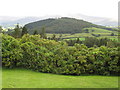
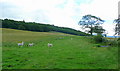
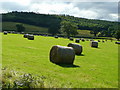
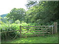
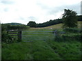
Nearby Images from Geograph Britain and Ireland:
©2008(licence)
©2008(licence)
©2008(licence)
©2011(licence)
©2008(licence)
The above images may not be of the site on this page, they are loaded from Geograph.
Please Submit an Image of this site or go out and take one for us!
Click here to see more info for this site
Nearby sites
Key: Red: member's photo, Blue: 3rd party photo, Yellow: other image, Green: no photo - please go there and take one, Grey: site destroyed
Download sites to:
KML (Google Earth)
GPX (GPS waypoints)
CSV (Garmin/Navman)
CSV (Excel)
To unlock full downloads you need to sign up as a Contributory Member. Otherwise downloads are limited to 50 sites.
Turn off the page maps and other distractions
Nearby sites listing. In the following links * = Image available
854m NNE 19° Fennifach* Standing Stone (Menhir) (SO017302)
1.2km S 189° St Cattwg's Church (Llanspyddid)* Early Christian Sculptured Stone (SO01192818)
1.5km NNW 327° Battle (Powys)* Standing Stone (Menhir) (SO0062730638)
1.8km ENE 58° Pen-y-Crug Hillfort* Hillfort (SO02943033)
2.5km E 84° Maen-Du Well* Holy Well or Sacred Spring (SO03902963)
2.8km WNW 294° Aberyscir* Ring Cairn (SN98883057)
2.8km WSW 239° Twyn-y-Gaer (Llanspyddid)* Hillfort (SN990280)
3.1km E 95° Priory Well (Powys)* Holy Well or Sacred Spring (SO04522906)
3.2km ESE 109° Brecknock Museum* Museum (SO044283)
3.6km NNE 32° The Cross of Briamail (Llandefaelog)* Ancient Cross (SO034324)
3.9km N 351° Battle Hill Cairn 1* Cairn (SO00833328)
3.9km N 351° Battle Hill Cairn 2* Cairn (SO00853331)
4.3km ESE 102° Slwch Camp* Hillfort (SO056284)
4.3km ENE 70° Bishop Gower's Well* Holy Well or Sacred Spring (SO0551330776)
4.5km WNW 284° Twyn-y-Gaer (Trallong)* Hillfort (SN970306)
4.8km SW 232° Mynydd Illtud Standing Stone 1* Standing Stone (Menhir) (SN97602651)
4.8km W 271° St David's Church (Trallong)* Early Christian Sculptured Stone (SN966296)
5.1km SSE 147° Coed Mawr Hillfort* Hillfort (SO04102512)
5.1km SSE 157° Plas-y-Gaer* Hillfort (SO033247)
6.4km SW 231° Mynydd Illtud Standing Stone 2* Standing Stone (Menhir) (SN963255)
6.7km NNW 333° Carn y Fan* Hillfort (SN985354)
6.7km E 91° Twyn-Llechfaen* Hillfort (SO081291)
6.8km WSW 238° Blaen Camlais Standing Stones* Standing Stones (SN9560525889)
6.8km SE 140° Rhiwiau Well* Holy Well or Sacred Spring (SO0565224123)
7.0km NNE 33° Twyn-y-Gaer (Llaneglwys)* Hillfort (SO054352)
View more nearby sites and additional images


 We would like to know more about this location. Please feel free to add a brief description and any relevant information in your own language.
 Wir möchten mehr über diese Stätte erfahren. Bitte zögern Sie nicht, eine kurze Beschreibung und relevante Informationen in Deutsch hinzuzufügen.
 Nous aimerions en savoir encore un peu sur les lieux. S'il vous plaît n'hesitez pas à ajouter une courte description et tous les renseignements pertinents dans votre propre langue.
 Quisieramos informarnos un poco más de las lugares. No dude en añadir una breve descripción y otros datos relevantes en su propio idioma.