


<< Our Photo Pages >> Langridge Wood Cist - Burial Chamber or Dolmen in England in Devon
Submitted by Andy B on Thursday, 17 September 2009 Page Views: 5786
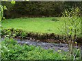
Neolithic and Bronze AgeSite Name: Langridge Wood CistCountry: England County: Devon Type: Burial Chamber or Dolmen
Map Ref: ST01403740
Latitude: 51.127364N Longitude: 3.410396W
Condition:
| 5 | Perfect |
| 4 | Almost Perfect |
| 3 | Reasonable but with some damage |
| 2 | Ruined but still recognisable as an ancient site |
| 1 | Pretty much destroyed, possibly visible as crop marks |
| 0 | No data. |
| -1 | Completely destroyed |
| 5 | Superb |
| 4 | Good |
| 3 | Ordinary |
| 2 | Not Good |
| 1 | Awful |
| 0 | No data. |
| 5 | Can be driven to, probably with disabled access |
| 4 | Short walk on a footpath |
| 3 | Requiring a bit more of a walk |
| 2 | A long walk |
| 1 | In the middle of nowhere, a nightmare to find |
| 0 | No data. |
| 5 | co-ordinates taken by GPS or official recorded co-ordinates |
| 4 | co-ordinates scaled from a detailed map |
| 3 | co-ordinates scaled from a bad map |
| 2 | co-ordinates of the nearest village |
| 1 | co-ordinates of the nearest town |
| 0 | no data |
Internal Links:
External Links:
I have visited· I would like to visit
lauraaurora visited on 26th Apr 2022 - their rating: Cond: 4 Amb: 4 Access: 4
")
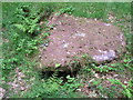
It is lined with slate slabs, and a large 5ft square capstone still partially covers its top.
The mound that would have surrounded it was dug into in 1820 for road stone When the cist was disturbed a skeleton was found inside and this was reinterred in the churchyard at nearby Treborough
Source, with photos: Everything Exmoor
You may be viewing yesterday's version of this page. To see the most up to date information please register for a free account.
")
")
")
")
Do not use the above information on other web sites or publications without permission of the contributor.
Nearby Images from Geograph Britain and Ireland:
©2010(licence)
©2005(licence)
©2011(licence)
©2012(licence)
©2010(licence)
The above images may not be of the site on this page, they are loaded from Geograph.
Please Submit an Image of this site or go out and take one for us!
Click here to see more info for this site
Nearby sites
Key: Red: member's photo, Blue: 3rd party photo, Yellow: other image, Green: no photo - please go there and take one, Grey: site destroyed
Download sites to:
KML (Google Earth)
GPX (GPS waypoints)
CSV (Garmin/Navman)
CSV (Excel)
To unlock full downloads you need to sign up as a Contributory Member. Otherwise downloads are limited to 50 sites.
Turn off the page maps and other distractions
Nearby sites listing. In the following links * = Image available
1.6km WNW 291° Druids Combe wood boundary stone Marker Stone (SS99923799)
2.7km SSW 197° Wiveliscombe Barrow* Round Barrow(s) (ST00553486)
2.9km S 177° Naked Boy stone* Standing Stone (Menhir) (ST01493447)
3.1km SW 232° Leather Barrow Round Barrow(s) (SS98903553)
3.5km SSE 155° Huish Champflower Barrow* Round Barrow(s) (ST0286234167)
3.8km NE 49° St Pancras Well* Holy Well or Sacred Spring (ST043398)
4.3km S 174° Dun's Stone Natural Stone / Erratic / Other Natural Feature (ST018331)
5.2km WSW 250° Cutcombe Barrow* Round Barrow(s) (SS9649635711)
5.5km NNW 331° Bat's Castle* Hillfort (SS988422)
6.5km W 265° Lype Hill Barrows* Barrow Cemetery (SS949370)
6.6km ESE 122° Elworthy Barrows hillfort* Hillfort (ST070338)
7.0km WNW 304° Timberscobe Wood Hill Fort Hillfort (SS956414)
7.1km NNW 335° St. Leonard's Well (Dunster)* Holy Well or Sacred Spring (SS9850443867)
7.2km NE 43° St Decumen's Well* Holy Well or Sacred Spring (ST064426)
7.4km NE 54° Battlegore* Round Barrow(s) (ST07454162)
8.3km NE 42° Watchet Market House Museum* Museum (ST0710043439)
8.8km E 82° Curdon Camp Hillfort (ST102385)
10.6km ENE 78° Trendle Ring* Ancient Village or Settlement (ST118394)
11.5km E 79° Thorncombe Barrow* Cairn (ST12733942)
11.6km ENE 71° Beacon Hill Platform Cairn* Barrow Cemetery (ST12434101)
11.9km WNW 296° Joaney How Cairn (SS90814279)
11.9km WNW 296° Robin How* Cairn (SS90764273)
11.9km E 80° Thorncombe Hill Cairns* Barrow Cemetery (ST13183914)
12.4km E 82° Halsway Tumuli* Barrow Cemetery (ST137389)
12.4km SE 137° Kings Castle Hillfort (ST097282)
View more nearby sites and additional images


 We would like to know more about this location. Please feel free to add a brief description and any relevant information in your own language.
 Wir möchten mehr über diese Stätte erfahren. Bitte zögern Sie nicht, eine kurze Beschreibung und relevante Informationen in Deutsch hinzuzufügen.
 Nous aimerions en savoir encore un peu sur les lieux. S'il vous plaît n'hesitez pas à ajouter une courte description et tous les renseignements pertinents dans votre propre langue.
 Quisieramos informarnos un poco más de las lugares. No dude en añadir una breve descripción y otros datos relevantes en su propio idioma.