


<< Other Photo Pages >> Wagmore Rigg - Ancient Village or Settlement in Scotland in Caithness
Submitted by durhamnature on Saturday, 15 September 2012 Page Views: 2324
Multi-periodSite Name: Wagmore RiggCountry: Scotland
NOTE: This site is 1.6 km away from the location you searched for.
County: Caithness Type: Ancient Village or Settlement
Map Ref: ND00292614
Latitude: 58.212717N Longitude: 3.698705W
Condition:
| 5 | Perfect |
| 4 | Almost Perfect |
| 3 | Reasonable but with some damage |
| 2 | Ruined but still recognisable as an ancient site |
| 1 | Pretty much destroyed, possibly visible as crop marks |
| 0 | No data. |
| -1 | Completely destroyed |
| 5 | Superb |
| 4 | Good |
| 3 | Ordinary |
| 2 | Not Good |
| 1 | Awful |
| 0 | No data. |
| 5 | Can be driven to, probably with disabled access |
| 4 | Short walk on a footpath |
| 3 | Requiring a bit more of a walk |
| 2 | A long walk |
| 1 | In the middle of nowhere, a nightmare to find |
| 0 | No data. |
| 5 | co-ordinates taken by GPS or official recorded co-ordinates |
| 4 | co-ordinates scaled from a detailed map |
| 3 | co-ordinates scaled from a bad map |
| 2 | co-ordinates of the nearest village |
| 1 | co-ordinates of the nearest town |
| 0 | no data |
Internal Links:
External Links:
")
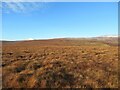
Group of homesteads, described as galleried dwellings. Visible as ruins on the hillside.
You may be viewing yesterday's version of this page. To see the most up to date information please register for a free account.
Do not use the above information on other web sites or publications without permission of the contributor.
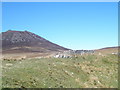
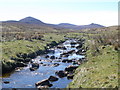
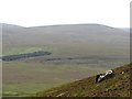
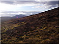
Nearby Images from Geograph Britain and Ireland:
©2010(licence)
©2010(licence)
©2010(licence)
©2011(licence)
©2023(licence)
The above images may not be of the site on this page, they are loaded from Geograph.
Please Submit an Image of this site or go out and take one for us!
Click here to see more info for this site
Nearby sites
Key: Red: member's photo, Blue: 3rd party photo, Yellow: other image, Green: no photo - please go there and take one, Grey: site destroyed
Download sites to:
KML (Google Earth)
GPX (GPS waypoints)
CSV (Garmin/Navman)
CSV (Excel)
To unlock full downloads you need to sign up as a Contributory Member. Otherwise downloads are limited to 50 sites.
Turn off the page maps and other distractions
Nearby sites listing. In the following links * = Image available
3.4km ESE 111° Langwell Earth House Souterrain (Fogou, Earth House) (ND03442484)
3.8km ESE 115° Langwell Water Enclosure Ancient Village or Settlement (ND03712445)
5.5km ESE 119° Langwell Hut Circle Ancient Village or Settlement (ND05052335)
6.0km ESE 117° Langwell Water Souterrain (Fogou, Earth House) (ND05602322)
6.5km ESE 116° Langwell Water Earth House Souterrain (Fogou, Earth House) (ND06032313)
6.7km ESE 106° Strathy Burn Souterrain (Fogou, Earth House) (ND06742409)
7.3km S 185° Kilphedir* Broch or Nuraghe (NC99431891)
8.1km SSW 206° Kildonan NE* Multiple Stone Rows / Avenue (NC96541898)
8.2km S 174° Caen Burn 2 Broch or Nuraghe (ND0118)
8.2km SSW 192° Eldrable Broch or Nuraghe (NC98331816)
8.4km ESE 113° Langwell Water Hut Circle Ancient Village or Settlement (ND08002266)
8.8km S 171° Caen Burn 1 Broch or Nuraghe (ND015174)
8.9km SSW 211° Kildonan SW* Multiple Stone Rows / Avenue (NC9550918564)
9.2km SW 217° Balvalaich* Broch or Nuraghe (NC94521898)
9.3km ESE 109° Tulloch Turnal Broch or Nuraghe (ND09042286)
9.6km SSW 213° Gailiable Broch or Nuraghe (NC94871823)
9.7km ESE 112° Berriedale Chambered Cairn (ND09152223)
10.0km E 101° Tulach Bad A' Choilich Broch or Nuraghe (ND10052404)
10.0km ESE 112° Cnoc Bad Fhasgaidh Ancient Village or Settlement (ND09452216)
10.0km SE 136° Ousdale Burn* Broch or Nuraghe (ND07131881)
10.1km ESE 110° Langwell Tulloch Broch or Nuraghe (ND09772249)
10.1km ESE 110° Langwell Tulloch Hut Circle* Ancient Village or Settlement (ND09772249)
10.2km ESE 113° Creag Buaile Dorach Ancient Village or Settlement (ND09552187)
10.4km SW 224° Kilearnan Hill* Broch or Nuraghe (NC92931882)
10.4km W 262° Carn Nam Buth* Broch or Nuraghe (NC89892498)
View more nearby sites and additional images


 We would like to know more about this location. Please feel free to add a brief description and any relevant information in your own language.
 Wir möchten mehr über diese Stätte erfahren. Bitte zögern Sie nicht, eine kurze Beschreibung und relevante Informationen in Deutsch hinzuzufügen.
 Nous aimerions en savoir encore un peu sur les lieux. S'il vous plaît n'hesitez pas à ajouter une courte description et tous les renseignements pertinents dans votre propre langue.
 Quisieramos informarnos un poco más de las lugares. No dude en añadir una breve descripción y otros datos relevantes en su propio idioma.