


<< Text Pages >> Carnedd Wen (Llandderfel) - Cairn in Wales in Gwynedd
Submitted by postman on Thursday, 15 November 2012 Page Views: 3298
Neolithic and Bronze AgeSite Name: Carnedd Wen (Llandderfel)Country: Wales County: Gwynedd Type: Cairn
Nearest Town: Bala Nearest Village: Llandderfel
Map Ref: SJ000352
Latitude: 52.904898N Longitude: 3.488264W
Condition:
| 5 | Perfect |
| 4 | Almost Perfect |
| 3 | Reasonable but with some damage |
| 2 | Ruined but still recognisable as an ancient site |
| 1 | Pretty much destroyed, possibly visible as crop marks |
| 0 | No data. |
| -1 | Completely destroyed |
| 5 | Superb |
| 4 | Good |
| 3 | Ordinary |
| 2 | Not Good |
| 1 | Awful |
| 0 | No data. |
| 5 | Can be driven to, probably with disabled access |
| 4 | Short walk on a footpath |
| 3 | Requiring a bit more of a walk |
| 2 | A long walk |
| 1 | In the middle of nowhere, a nightmare to find |
| 0 | No data. |
| 5 | co-ordinates taken by GPS or official recorded co-ordinates |
| 4 | co-ordinates scaled from a detailed map |
| 3 | co-ordinates scaled from a bad map |
| 2 | co-ordinates of the nearest village |
| 1 | co-ordinates of the nearest town |
| 0 | no data |
Internal Links:
External Links:
Cairn in Gwynedd
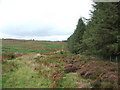
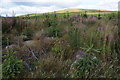
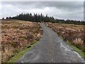
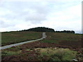
Park on the B4391, walk north through felled forestry place, then go up the hill east. This is not a normal looking cairn. It is said by Coflein.... A round cairn 20 meters in diameter and 1m tall, the central part of the cairn is contained by a circular wall 12.5 meters across..... but it is more likely that the retaining wall is the cairn, someone at some time has gone to a lot of trouble to change it's appearance into what we see today, a rather ineffective sheep pen? an over engineered wind break ? The circular wall is at times 5-6 feet thick with entrances at the north and south, the south entrance has what looks like wind shelters built at the end of the wall.
A very strange cairn , but in very pretty countryside, the Berwyns are close and lovely and Snowdonia far but also lovely.
Coflein site no. 303418.
You may be viewing yesterday's version of this page. To see the most up to date information please register for a free account.
 (PID:98955)")
 (PID:98954)")
 (PID:98953)")
 (PID:98952)")
Do not use the above information on other web sites or publications without permission of the contributor.
Nearby Images from Geograph Britain and Ireland:

©2007(licence)
©2007(licence)
©2011(licence)
©2019(licence)
©2007(licence)
The above images may not be of the site on this page, they are loaded from Geograph.
Please Submit an Image of this site or go out and take one for us!
Click here to see more info for this site
Nearby sites
Key: Red: member's photo, Blue: 3rd party photo, Yellow: other image, Green: no photo - please go there and take one, Grey: site destroyed
Download sites to:
KML (Google Earth)
GPX (GPS waypoints)
CSV (Garmin/Navman)
CSV (Excel)
To unlock full downloads you need to sign up as a Contributory Member. Otherwise downloads are limited to 50 sites.
Turn off the page maps and other distractions
Nearby sites listing. In the following links * = Image available
1.4km ENE 61° Craig yr Arian* Chambered Cairn (SJ01243584)
2.6km NNE 25° Branas Uchaf* Chambered Cairn (SJ01123752)
3.0km NW 311° Ffynnon Derfel* Holy Well or Sacred Spring (SH97773723)
3.5km ESE 104° Penagored Standing Stone* Standing Stone (Menhir) (SJ034343)
3.6km SW 234° Carnedd Wen (Llangywer) Cairn (SH97033315)
3.8km ESE 119° Rhyd y Gethin Standing Stone (Menhir) (SJ03303330)
3.9km SE 127° Yr Aran* Barrow Cemetery (SJ03053279)
4.2km ESE 111° Cefn Penagored Cairn and Ring Cairn* Cairn (SJ039336)
4.4km ESE 111° Cefn Penagored Ridge Cairns* Cairn (SJ041335)
4.5km NE 37° Tyfos* Stone Circle (SJ02843876)
5.0km ESE 116° Nant Esgeiriau* Round Cairn (SJ044329)
5.0km ESE 109° Cwm Tywyll* Ring Cairn (SJ04683346)
5.2km ESE 110° Pennant* Round Cairn (SJ04823331)
5.8km N 352° Cefn Caer Euni* Ring Cairn (SH993410)
5.9km NW 324° Coed y Bedo* Standing Stone (Menhir) (SH96664003)
5.9km E 80° Cerrig Bwlch Y Fedw* Stone Circle (SJ05873615)
5.9km ENE 69° Moel Ty Uchaf* Stone Circle (SJ05613717)
6.1km N 359° Caer Euni* Hillfort (SJ000413)
6.1km WNW 282° Pabell Llywarch Hen* Stone Circle (SH940366)
6.5km NE 46° Tyn y Coed* Chambered Cairn (SJ0476839603)
7.1km W 276° Bala Modern Eisteddfod Stone Circle* Modern Stone Circle etc (SH9293836035)
7.4km ESE 115° Moel Sych* Cairn (SJ066319)
7.5km SE 127° Cwm Rhiwiau* Stone Circle (SJ059305)
7.6km ESE 108° Cadair Berwyn* Cairn (SJ072327)
7.6km SE 130° Rhos y Beddau (Rows)* Multiple Stone Rows / Avenue (SJ0579530205)
View more nearby sites and additional images


 We would like to know more about this location. Please feel free to add a brief description and any relevant information in your own language.
 Wir möchten mehr über diese Stätte erfahren. Bitte zögern Sie nicht, eine kurze Beschreibung und relevante Informationen in Deutsch hinzuzufügen.
 Nous aimerions en savoir encore un peu sur les lieux. S'il vous plaît n'hesitez pas à ajouter une courte description et tous les renseignements pertinents dans votre propre langue.
 Quisieramos informarnos un poco más de las lugares. No dude en añadir una breve descripción y otros datos relevantes en su propio idioma.