

<< Our Photo Pages >> Cwm Cadlan 3 - Ring Cairn in Wales in Powys
Submitted by coin on Friday, 29 May 2015 Page Views: 1560
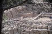
Neolithic and Bronze AgeSite Name: Cwm Cadlan 3 Alternative Name: Cwm Cadlan Ring Cairn III SAM 137ACountry: Wales
NOTE: This site is 1.5 km away from the location you searched for.
County: Powys Type: Ring Cairn
Nearest Town: Merthyr Tydfil Nearest Village: Penderyn
Map Ref: SN98641101
Latitude: 51.788533N Longitude: 3.470946W
Condition:
| 5 | Perfect |
| 4 | Almost Perfect |
| 3 | Reasonable but with some damage |
| 2 | Ruined but still recognisable as an ancient site |
| 1 | Pretty much destroyed, possibly visible as crop marks |
| 0 | No data. |
| -1 | Completely destroyed |
| 5 | Superb |
| 4 | Good |
| 3 | Ordinary |
| 2 | Not Good |
| 1 | Awful |
| 0 | No data. |
| 5 | Can be driven to, probably with disabled access |
| 4 | Short walk on a footpath |
| 3 | Requiring a bit more of a walk |
| 2 | A long walk |
| 1 | In the middle of nowhere, a nightmare to find |
| 0 | No data. |
| 5 | co-ordinates taken by GPS or official recorded co-ordinates |
| 4 | co-ordinates scaled from a detailed map |
| 3 | co-ordinates scaled from a bad map |
| 2 | co-ordinates of the nearest village |
| 1 | co-ordinates of the nearest town |
| 0 | no data |
Internal Links:
External Links:
I have visited· I would like to visit
coin visited on 24th May 2015 - their rating: Cond: 3 Amb: 4 Access: 4
")
You may be viewing yesterday's version of this page. To see the most up to date information please register for a free account.
Do not use the above information on other web sites or publications without permission of the contributor.
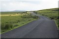
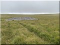
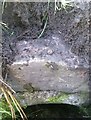
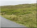
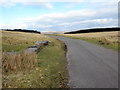
Nearby Images from Geograph Britain and Ireland:
©2007(licence)
©2020(licence)
©2020(licence)
©2020(licence)
©2018(licence)
The above images may not be of the site on this page, they are loaded from Geograph.
Please Submit an Image of this site or go out and take one for us!
Click here to see more info for this site
Nearby sites
Key: Red: member's photo, Blue: 3rd party photo, Yellow: other image, Green: no photo - please go there and take one, Grey: site destroyed
Download sites to:
KML (Google Earth)
GPX (GPS waypoints)
CSV (Garmin/Navman)
CSV (Excel)
To unlock full downloads you need to sign up as a Contributory Member. Otherwise downloads are limited to 50 sites.
Turn off the page maps and other distractions
Nearby sites listing. In the following links * = Image available
108m SW 235° Cwm Cadlan 1* Round Cairn (SN98551095)
348m WSW 245° Cwm Cadlan 2* Ring Cairn (SN98321087)
665m NNW 347° Twyn Bryn Glas Cairn* Cairn (SN9850011660)
946m SW 225° Cefn Sychpant* Round Cairn (SN97951036)
1.3km NW 316° Blaen Cadlan Uchaf* Cairn (SN9772011990)
1.5km NW 322° Cadair Fawr Cairn* Cairn (SN9773612218)
1.9km NNW 326° Cadair Fawr east cairn* Cairn (SN9760912631)
2.5km SSW 211° Mynydd y Glog* Cairn (SN97270886)
2.7km NNW 331° Cefn Esgair Ring Cairn (SN974134)
3.0km NW 309° Blaen Hepste* Henge (SN9633012960)
3.2km ENE 72° Fedw Standing Stone Standing Stone (Menhir) (SO01701191)
3.5km NE 54° Cefn Car Standing Stones* Standing Stones (SO01491299)
3.6km E 80° Coedcae'r Gwarthog* Barrow Cemetery (SO02241154)
3.8km E 92° Cefn Cil-Sanws* Ring Cairn (SO02421081)
4.7km NE 51° Nant Gwinau* Stone Row / Alignment (SO02361390)
5.0km WNW 287° Carn yr Arian* Round Cairn (SN93901253)
5.5km NW 320° Pen Fathor Uchaf* Cairn (SN95211528)
5.6km NNW 333° Bedd Llywarch* Standing Stones (SN96251604)
6.7km E 82° Bryn Glas Cairns (Pontsticill)* Barrow Cemetery (SO05271177)
6.8km NE 40° Bwlch Gwyn 1 Standing Stone (Menhir) (SO03121612)
6.8km NE 40° Bwlch Gwyn 2 Standing Stone (Menhir) (SO03151611)
7.5km WNW 292° Gelli-Nedd* Hillfort (SN91741400)
7.5km WNW 282° Dyffryn Nedd Hillfort (SN913127)
7.9km ENE 72° Waun Rydd Cairn 1 Cairn (SO0625513310)
8.0km E 82° Abercriban Ciarn 1 Round Cairn (SO06651201)
View more nearby sites and additional images


 We would like to know more about this location. Please feel free to add a brief description and any relevant information in your own language.
 Wir möchten mehr über diese Stätte erfahren. Bitte zögern Sie nicht, eine kurze Beschreibung und relevante Informationen in Deutsch hinzuzufügen.
 Nous aimerions en savoir encore un peu sur les lieux. S'il vous plaît n'hesitez pas à ajouter une courte description et tous les renseignements pertinents dans votre propre langue.
 Quisieramos informarnos un poco más de las lugares. No dude en añadir una breve descripción y otros datos relevantes en su propio idioma.