

<< Our Photo Pages >> Haugh Of Aberuthven - Standing Stone (Menhir) in Scotland in Perth and Kinross
Submitted by BigSweetie on Friday, 11 June 2004 Page Views: 9468
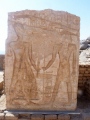
Neolithic and Bronze AgeSite Name: Haugh Of AberuthvenCountry: Scotland County: Perth and Kinross Type: Standing Stone (Menhir)
Nearest Town: Auchterarder Nearest Village: Aberuthven
Map Ref: NN97711643 Landranger Map Number: 58
Latitude: 56.329164N Longitude: 3.65583W
Condition:
| 5 | Perfect |
| 4 | Almost Perfect |
| 3 | Reasonable but with some damage |
| 2 | Ruined but still recognisable as an ancient site |
| 1 | Pretty much destroyed, possibly visible as crop marks |
| 0 | No data. |
| -1 | Completely destroyed |
| 5 | Superb |
| 4 | Good |
| 3 | Ordinary |
| 2 | Not Good |
| 1 | Awful |
| 0 | No data. |
| 5 | Can be driven to, probably with disabled access |
| 4 | Short walk on a footpath |
| 3 | Requiring a bit more of a walk |
| 2 | A long walk |
| 1 | In the middle of nowhere, a nightmare to find |
| 0 | No data. |
| 5 | co-ordinates taken by GPS or official recorded co-ordinates |
| 4 | co-ordinates scaled from a detailed map |
| 3 | co-ordinates scaled from a bad map |
| 2 | co-ordinates of the nearest village |
| 1 | co-ordinates of the nearest town |
| 0 | no data |
Be the first person to rate this site - see the 'Contribute!' box in the right hand menu.
Internal Links:
External Links:
")
The OS Name Book recorded in 1860 that this stone was supposed to be all that remained of a "Druidical Temple" although it didn't cite any references. The site is also marked on the 1867 OS map as "supposed remains of Druidical Temple".
More recently, aerial photos taken in 1987 showed that the stone is surrounded by a probable henge showing up as faint cropmarks. There is a ditch of width 1 to 2.5m and diameter of around 21 to 22m, and the stone stands in the S sector of this enclosure, just inside the line of the ditch which seems to be interrupted. Within 400m of this site are to be found the cropmark remains of a second henge, a barrow and three further enclosures.
Haugh Of Aberuthven - directions
Head S from Perth on the A9, and after approximately 10.0km take the turn-off to the right for Aberuthven. The village is small and doesn't have a car park, but there is space to park on the street. To save yourself a walk, park as close as possible to the bridge across the river at the S edge of the village. Cross the bridge on foot, and take the first road on the right, and then immediately the next turn to the right, up a rough farm track, past some cottages on your right. Walk up the track, and after a couple of hundred metres you will pass Loanhead farm on your right.
Continue up the track, and you will see Belhie farm straight ahead of you. Keep walking towards Belhie for another couple of hundred metres, until you see a track off to your right heading along the field boundary to a gate at the edge of some trees. Walk along to this gate, which will take you into the field that the stone is in. After climbing over the gate, follow the edge of the field round to your right to get closer to the stone. If there are crops in the field, it's still possible to get decent photographs from the far edge of the field.
You may be viewing yesterday's version of this page. To see the most up to date information please register for a free account.
")
")
")
")
")
Do not use the above information on other web sites or publications without permission of the contributor.
Click here to see more info for this site
Nearby sites
Key: Red: member's photo, Blue: 3rd party photo, Yellow: other image, Green: no photo - please go there and take one, Grey: site destroyed
Download sites to:
KML (Google Earth)
GPX (GPS waypoints)
CSV (Garmin/Navman)
CSV (Excel)
To unlock full downloads you need to sign up as a Contributory Member. Otherwise downloads are limited to 50 sites.
Turn off the page maps and other distractions
Nearby sites listing. In the following links * = Image available
701m SSW 205° Loanhead (Aberuthven) Stone Circle (NN974158)
2.0km SSE 164° Westerton Timber Hall Ancient Village or Settlement (NN9821414444)
2.2km NW 319° Trinity Well (Trinity Gask) Holy Well or Sacred Spring (NN96311812)
3.8km SW 223° St Mackessog’s Well* Holy Well or Sacred Spring (NN950137)
4.2km E 97° Leadketty Stone Circle (NO01921581)
4.3km E 92° Leadketty Stone Circle (NO020162)
4.5km ESE 111° Dunning* Standing Stone (Menhir) (NO01851469)
4.6km ESE 114° Dupplin Cross* Ancient Cross (NO01901448)
4.6km WSW 257° Belted Stane, Calfward Standing Stone (Menhir) (NN93181548)
4.9km W 268° North Mains B Timber Circle (NN928164)
4.9km W 267° North Mains A Timber Circle (NN928163)
5.0km S 187° Ogle Hill Hillfort (NN96941148)
5.0km ESE 113° Dun Knock (Dunning)* Hillfort (NO0230914317)
5.1km W 266° North Mains Strathallan round barrow* Round Barrow(s) (NN92621621)
6.2km SW 229° Auchterarder* Standing Stones (NN929125)
6.4km SE 135° Gray Stone (Dunning)* Standing Stone (Menhir) (NO02191180)
7.5km E 80° Forteviot Cross* Sculptured Stone (NO0518017527)
7.5km E 80° St Andrew's Church (Forteviot) Class III Pictish Cross Slab (NO052175)
7.6km E 85° Forteviot Timber Circle (NO053169)
7.8km E 81° Forteviot Dagger Burial* Cist (NO055175)
8.2km NNE 19° Bachilton Stone Circle (NO005241)
8.5km SW 217° Gleneagles B* Standing Stone (Menhir) (NN92430981)
8.5km NW 323° New Fowlis* Stone Circle (NN92712329)
8.8km SW 218° Gleneagles A* Standing Stone (Menhir) (NN9211509625)
9.1km NW 326° Fowlis Wester 1* Class II Pictish Symbol Stone (NN92772404)
View more nearby sites and additional images


 We would like to know more about this location. Please feel free to add a brief description and any relevant information in your own language.
 Wir möchten mehr über diese Stätte erfahren. Bitte zögern Sie nicht, eine kurze Beschreibung und relevante Informationen in Deutsch hinzuzufügen.
 Nous aimerions en savoir encore un peu sur les lieux. S'il vous plaît n'hesitez pas à ajouter une courte description et tous les renseignements pertinents dans votre propre langue.
 Quisieramos informarnos un poco más de las lugares. No dude en añadir una breve descripción y otros datos relevantes en su propio idioma.