 with our Megalithic Portal iPhone app")


<< Text Pages >> Gwar-y-Felin - Ring Cairn in Wales in Powys
Submitted by vicky on Monday, 23 September 2002 Page Views: 3865
Neolithic and Bronze AgeSite Name: Gwar-y-FelinCountry: Wales
NOTE: This site is 2.8 km away from the location you searched for.
County: Powys Type: Ring Cairn
Nearest Town: Brecon Nearest Village: Heol Senni
Map Ref: SN925349 Landranger Map Number: 160
Latitude: 52.002097N Longitude: 3.567386W
Condition:
| 5 | Perfect |
| 4 | Almost Perfect |
| 3 | Reasonable but with some damage |
| 2 | Ruined but still recognisable as an ancient site |
| 1 | Pretty much destroyed, possibly visible as crop marks |
| 0 | No data. |
| -1 | Completely destroyed |
| 5 | Superb |
| 4 | Good |
| 3 | Ordinary |
| 2 | Not Good |
| 1 | Awful |
| 0 | No data. |
| 5 | Can be driven to, probably with disabled access |
| 4 | Short walk on a footpath |
| 3 | Requiring a bit more of a walk |
| 2 | A long walk |
| 1 | In the middle of nowhere, a nightmare to find |
| 0 | No data. |
| 5 | co-ordinates taken by GPS or official recorded co-ordinates |
| 4 | co-ordinates scaled from a detailed map |
| 3 | co-ordinates scaled from a bad map |
| 2 | co-ordinates of the nearest village |
| 1 | co-ordinates of the nearest town |
| 0 | no data |
Internal Links:
External Links:
Ring Cairn in Powys
Have you visited this site? Please add a comment below.
You may be viewing yesterday's version of this page. To see the most up to date information please register for a free account.
Do not use the above information on other web sites or publications without permission of the contributor.
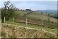
Nearby Images from Geograph Britain and Ireland:
©2009(licence)
©2009(licence)
©2009(licence)
©2009(licence)
©2009(licence)
The above images may not be of the site on this page, they are loaded from Geograph.
Please Submit an Image of this site or go out and take one for us!
Click here to see more info for this site
Nearby sites
Key: Red: member's photo, Blue: 3rd party photo, Yellow: other image, Green: no photo - please go there and take one, Grey: site destroyed
Download sites to:
KML (Google Earth)
GPX (GPS waypoints)
CSV (Garmin/Navman)
CSV (Excel)
To unlock full downloads you need to sign up as a Contributory Member. Otherwise downloads are limited to 50 sites.
Turn off the page maps and other distractions
Nearby sites listing. In the following links * = Image available
3.4km N 351° Ynys Hir* Cairn (SN92073823)
3.4km N 352° Ynys-Hir* Stone Circle (SN921383)
3.8km NE 37° Y Crug Round Barrow(s) (SN949379)
4.1km WNW 293° Llyn Nant-Llys Round Barrow(s) (SN888366)
4.1km WNW 298° Bryn Melin Ring Cairn (SN889369)
4.2km NW 321° Hirllwyn Hillfort (SN899382)
4.3km NNE 31° Twyn Cerrig-Cadarn Ring Cairn (SN948385)
5.1km WNW 290° Garn Wen (Maescar)* Ring Cairn (SN87723677)
5.4km S 177° Coed Gibraltar* Promontory Fort / Cliff Castle (SN92622954)
5.8km WNW 286° Dixies Corner* Hillfort (SN86983660)
5.9km N 7° Garn Wen (Trallong)* Round Cairn (SN93404076)
6.0km E 84° Carn y Fan* Hillfort (SN985354)
6.2km NE 48° Cefn Merthy Cynog Cairn (West)* Cairn (SN97223894)
6.2km SE 133° Twyn-y-Gaer (Trallong)* Hillfort (SN970306)
6.3km NE 49° Cefn Merthyr Cynog Cairn (East)* Cairn (SN97383894)
6.4km NE 49° Cefn Merthyr Cynog Mound* Cairn (SN97393902)
6.5km SW 227° Varlen Cairn* Cairn (SN87643060)
6.5km WNW 286° Clawdd Brythonic Enclosure* Hillfort (SN86253687)
6.7km SE 141° St David's Church (Trallong)* Early Christian Sculptured Stone (SN966296)
6.7km NW 325° Cefn Iolo Enclosure* Misc. Earthwork (SN88794050)
7.0km S 179° Defynnog Stone* Early Christian Sculptured Stone (SN92532793)
7.2km WSW 244° Blaen Clydach Fach Cairn 2* Cairn (SN86003185)
7.2km WSW 242° Blaen Clydach Fach Cairn 1* Cairn (SN86043170)
7.3km WNW 282° Clywyd Watsh Defensive Enclosure* Hillfort (SN85353653)
7.4km SW 228° St David's Church, Llywel* Marker Stone (SN86953005)
View more nearby sites and additional images


 We would like to know more about this location. Please feel free to add a brief description and any relevant information in your own language.
 Wir möchten mehr über diese Stätte erfahren. Bitte zögern Sie nicht, eine kurze Beschreibung und relevante Informationen in Deutsch hinzuzufügen.
 Nous aimerions en savoir encore un peu sur les lieux. S'il vous plaît n'hesitez pas à ajouter une courte description et tous les renseignements pertinents dans votre propre langue.
 Quisieramos informarnos un poco más de las lugares. No dude en añadir una breve descripción y otros datos relevantes en su propio idioma.