


<< Our Photo Pages >> Kirkton Fort and Settlement - Hillfort in Scotland in South Lanarkshire
Submitted by ginger-tt on Sunday, 08 November 2009 Page Views: 3906
Iron Age and Later PrehistorySite Name: Kirkton Fort and SettlementCountry: Scotland
NOTE: This site is 0.4 km away from the location you searched for.
County: South Lanarkshire Type: Hillfort
Map Ref: NS946216
Latitude: 55.476821N Longitude: 3.669108W
Condition:
| 5 | Perfect |
| 4 | Almost Perfect |
| 3 | Reasonable but with some damage |
| 2 | Ruined but still recognisable as an ancient site |
| 1 | Pretty much destroyed, possibly visible as crop marks |
| 0 | No data. |
| -1 | Completely destroyed |
| 5 | Superb |
| 4 | Good |
| 3 | Ordinary |
| 2 | Not Good |
| 1 | Awful |
| 0 | No data. |
| 5 | Can be driven to, probably with disabled access |
| 4 | Short walk on a footpath |
| 3 | Requiring a bit more of a walk |
| 2 | A long walk |
| 1 | In the middle of nowhere, a nightmare to find |
| 0 | No data. |
| 5 | co-ordinates taken by GPS or official recorded co-ordinates |
| 4 | co-ordinates scaled from a detailed map |
| 3 | co-ordinates scaled from a bad map |
| 2 | co-ordinates of the nearest village |
| 1 | co-ordinates of the nearest town |
| 0 | no data |
Internal Links:
External Links:
")
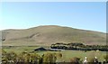
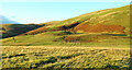
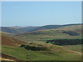
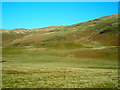
It is one of three such forts situated on the same hill. It can be seen From the A702 and the M74 or close up from the aptly named Camps Road. Not to be confused with the fort of the same name just around the corner on the same hill.
You may be viewing yesterday's version of this page. To see the most up to date information please register for a free account.
")
Do not use the above information on other web sites or publications without permission of the contributor.
Nearby Images from Geograph Britain and Ireland:
©2007(licence)
©2021(licence)
©2009(licence)
©2007(licence)
©2007(licence)
The above images may not be of the site on this page, they are loaded from Geograph.
Please Submit an Image of this site or go out and take one for us!
Click here to see more info for this site
Nearby sites
Key: Red: member's photo, Blue: 3rd party photo, Yellow: other image, Green: no photo - please go there and take one, Grey: site destroyed
Download sites to:
KML (Google Earth)
GPX (GPS waypoints)
CSV (Garmin/Navman)
CSV (Excel)
To unlock full downloads you need to sign up as a Contributory Member. Otherwise downloads are limited to 50 sites.
Turn off the page maps and other distractions
Nearby sites listing. In the following links * = Image available
537m ENE 67° Castle Crawford Farm Fort* Hillfort (NS951218)
1.1km W 279° Kirkton Fort* Hillfort (NS935218)
2.2km N 353° Arbory Hill* Hillfort (NS944238)
2.5km E 90° Normangill Rig Cairn* Cairn (NS97092153)
2.7km ENE 77° Normangill Henge* Henge (NS97252212)
3.6km NNW 346° Cold Chapel prehistoric settlement* Ancient Village or Settlement (NS93782512)
4.6km WNW 289° Blackhill Hillfort (NS9032423216)
5.1km SSE 159° Bodsberry Hill* Hillfort (NS963168)
6.7km N 5° Devonshaw Hill* Hillfort (NS954283)
8.4km NW 309° Wildshaw Burn* Stone Circle (NS882271)
8.5km S 172° Daer valley Ancient Village or Settlement (NS956132)
13.4km E 84° Nether Dod* Stone Circle (NT08032279)
13.6km NE 34° Snaip Hill* Hillfort (NT02463269)
13.7km NNE 32° Culterpark Hill* Hillfort (NT02213305)
13.8km NE 39° Nisbet* Hillfort (NT03543216)
15.0km E 80° Menzion* Standing Stones (NT0949023980)
15.1km E 80° Giant's Stone (Scottish Borders)* Standing Stone (Menhir) (NT09532399)
15.2km N 5° Fallburn at Tinto Hillfort (NS96193674)
16.4km N 11° Boatbridge Quarry Cist (NS981376)
16.5km NNE 24° Biggar Cursus Cursus (NT01663657)
17.1km NE 41° Mitchelhill Rings Hillfort (NT06283417)
17.8km NE 48° Knowe Kniffling* Hillfort (NT08163323)
18.0km ENE 66° Patervan Settlement* Ancient Village or Settlement (NT11252854)
18.1km ENE 65° Patervan Cairn, Buildings & Mound* Cairn (NT11192885)
18.3km NE 48° Mill Rings Misc. Earthwork (NT08493357)
View more nearby sites and additional images


 We would like to know more about this location. Please feel free to add a brief description and any relevant information in your own language.
 Wir möchten mehr über diese Stätte erfahren. Bitte zögern Sie nicht, eine kurze Beschreibung und relevante Informationen in Deutsch hinzuzufügen.
 Nous aimerions en savoir encore un peu sur les lieux. S'il vous plaît n'hesitez pas à ajouter une courte description et tous les renseignements pertinents dans votre propre langue.
 Quisieramos informarnos un poco más de las lugares. No dude en añadir una breve descripción y otros datos relevantes en su propio idioma.