


<< Text Pages >> Gubber Hill - Standing Stone (Menhir) in Scotland in Clackmannanshire
Submitted by Anonymous on Saturday, 27 October 2007 Page Views: 9142
Neolithic and Bronze AgeSite Name: Gubber Hill Alternative Name: InglewoodCountry: Scotland
NOTE: This site is 1.4 km away from the location you searched for.
County: Clackmannanshire Type: Standing Stone (Menhir)
Nearest Town: Alloa
Map Ref: NS948875
Latitude: 56.068722N Longitude: 3.691392W
Condition:
| 5 | Perfect |
| 4 | Almost Perfect |
| 3 | Reasonable but with some damage |
| 2 | Ruined but still recognisable as an ancient site |
| 1 | Pretty much destroyed, possibly visible as crop marks |
| 0 | No data. |
| -1 | Completely destroyed |
| 5 | Superb |
| 4 | Good |
| 3 | Ordinary |
| 2 | Not Good |
| 1 | Awful |
| 0 | No data. |
| 5 | Can be driven to, probably with disabled access |
| 4 | Short walk on a footpath |
| 3 | Requiring a bit more of a walk |
| 2 | A long walk |
| 1 | In the middle of nowhere, a nightmare to find |
| 0 | No data. |
| 5 | co-ordinates taken by GPS or official recorded co-ordinates |
| 4 | co-ordinates scaled from a detailed map |
| 3 | co-ordinates scaled from a bad map |
| 2 | co-ordinates of the nearest village |
| 1 | co-ordinates of the nearest town |
| 0 | no data |
Internal Links:
External Links:
Standing Stone in Clackmannanshire
Between Lornshill and the woods at Inglewood on the east of gubber hill, fallen standing stone on ancient path from Dumyat to Clackmannan over the high muir. Possibly connects to standing stone at Comely Bank near the road to Clackmannan as thay both stand on the old path, or whats left of it. Area holds stunning views at sunset in winter and the moon rises behind the Kings Seat.
You may be viewing yesterday's version of this page. To see the most up to date information please register for a free account.
Do not use the above information on other web sites or publications without permission of the contributor.
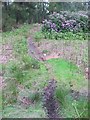
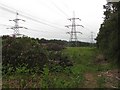
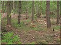
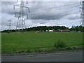
Nearby Images from Geograph Britain and Ireland:
©2011(licence)
©2011(licence)
©2011(licence)
©2006(licence)

©2024(licence)
The above images may not be of the site on this page, they are loaded from Geograph.
Please Submit an Image of this site or go out and take one for us!
Click here to see more info for this site
Nearby sites
Key: Red: member's photo, Blue: 3rd party photo, Yellow: other image, Green: no photo - please go there and take one, Grey: site destroyed
Download sites to:
KML (Google Earth)
GPX (GPS waypoints)
CSV (Garmin/Navman)
CSV (Excel)
To unlock full downloads you need to sign up as a Contributory Member. Otherwise downloads are limited to 50 sites.
Turn off the page maps and other distractions
Nearby sites listing. In the following links * = Image available
1.5km WNW 297° Greenfield Park, Alloa Stone Row / Alignment (NS935882)
1.7km W 269° Market Cross (Kincardine)* Ancient Cross (NS9312087515)
2.2km NNW 338° Tulliallan Castle Sculptured Stone (NS94058952)
3.3km NE 42° Castle Hill (Culross) Hillfort (NS97118992)
5.3km NNW 327° Hawk Hill Stone Circle (NS920920)
5.5km NW 317° Lady Well (Clackmannan) Holy Well or Sacred Spring (NS91129166)
5.7km NW 319° Stone of Mannan* Standing Stone (Menhir) (NS91119188)
5.7km NW 319° Mercat Cross (Clackmannan)* Ancient Cross (NS9111091889)
6.3km NNW 337° Grassmainston Well (Clackmannan) Holy Well or Sacred Spring (NS9247893403)
6.6km NW 319° Hawk Hill (Alloa) Stone Circle (NS906926)
6.9km NW 317° Parkmill Cross (Alloa) Ancient Cross (NS9013392661)
7.8km SSE 156° Kinneil Fortlet Ancient Village or Settlement (NS97748031)
7.8km NW 312° Hawk Hill Cairn (Alloa) Cairn (NS89119282)
7.8km S 176° Inveravon Roman Fort Ancient Village or Settlement (NS95107969)
7.9km S 172° Inveravon Roman Camp Not Known (by us) (NS95777965)
8.1km E 95° Tuilyies* Standing Stones (NT02918658)
8.3km S 170° Inveravon Temporary Camps 1 & 2 Not Known (by us) (NS96117933)
8.4km N 352° Balhearty Standing Stone (Menhir) (NS9378295816)
8.4km SW 233° Arthur’s O’on Ancient Temple (NS87968262)
8.4km SE 139° Kinglass Park Marching Camp Not Known (by us) (NT00178097)
8.5km S 178° Polmonthill Temporary Camp Not Known (by us) (NS94867895)
8.6km S 182° Little Kerse Temporary Camp Not Known (by us) (NS94327892)
8.6km SSW 199° Mumrills Roman Fort Hillfort (NS91867942)
8.8km W 270° Castleton 8* Rock Art (NS86028771)
8.9km W 274° Castleton 1* Rock Art (NS85878840)
View more nearby sites and additional images
Ancient Pig DNA Study Sheds New Light On Colonization Of Europe By Early Farmers >>


 We would like to know more about this location. Please feel free to add a brief description and any relevant information in your own language.
 Wir möchten mehr über diese Stätte erfahren. Bitte zögern Sie nicht, eine kurze Beschreibung und relevante Informationen in Deutsch hinzuzufügen.
 Nous aimerions en savoir encore un peu sur les lieux. S'il vous plaît n'hesitez pas à ajouter une courte description et tous les renseignements pertinents dans votre propre langue.
 Quisieramos informarnos un poco más de las lugares. No dude en añadir una breve descripción y otros datos relevantes en su propio idioma.