

<< Our Photo Pages >> Crugian Bach Stone Circle - Stone Circle in Wales in Powys
Submitted by cerrig on Sunday, 06 June 2010 Page Views: 6535
Neolithic and Bronze AgeSite Name: Crugian Bach Stone CircleCountry: Wales
NOTE: This site is 0.3 km away from the location you searched for.
County: Powys Type: Stone Circle
Nearest Town: Rhayader Nearest Village: Elan
Map Ref: SN9314762402
Latitude: 52.249387N Longitude: 3.566612W
Condition:
| 5 | Perfect |
| 4 | Almost Perfect |
| 3 | Reasonable but with some damage |
| 2 | Ruined but still recognisable as an ancient site |
| 1 | Pretty much destroyed, possibly visible as crop marks |
| 0 | No data. |
| -1 | Completely destroyed |
| 5 | Superb |
| 4 | Good |
| 3 | Ordinary |
| 2 | Not Good |
| 1 | Awful |
| 0 | No data. |
| 5 | Can be driven to, probably with disabled access |
| 4 | Short walk on a footpath |
| 3 | Requiring a bit more of a walk |
| 2 | A long walk |
| 1 | In the middle of nowhere, a nightmare to find |
| 0 | No data. |
| 5 | co-ordinates taken by GPS or official recorded co-ordinates |
| 4 | co-ordinates scaled from a detailed map |
| 3 | co-ordinates scaled from a bad map |
| 2 | co-ordinates of the nearest village |
| 1 | co-ordinates of the nearest town |
| 0 | no data |
Internal Links:
External Links:
I have visited· I would like to visit
Bladup would like to visit
cerrig has visited here
")
One of the circle stones on the North East is another small slab type stone, about 1 foot tall, aligned on the centre stone and also on a peak to the South. On this peak , unsited from the circle, are the cairns of Gamriw. Along this line in the valley beyond is the stone row of Saith Maen(Rhayader)
About 50 meters to the North West is a leaning standing stone, about 3 feet tall. Noticeably triangular in section. If stood up straight the flat sides would point to various monuments; namely the circle, Drygarn Fawr cairns, and another very large recumbent to the South East.
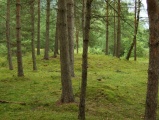
It should be noted that the official grid references for this circle are hundreds of meters out at best, and the only way i found it was by matching a photo to the surroundings. The grid reference given here is off my GPS. The circle is easily missed, as reeds cover the taller stones.
You may be viewing yesterday's version of this page. To see the most up to date information please register for a free account.
")
")
")
")
")
")
")
")
")
")
")
")
")
")
")
")
")
")
")
")
")
")
")
")
")
These are just the first 25 photos of Crugian Bach Stone Circle. If you log in with a free user account you will be able to see our entire collection.
Do not use the above information on other web sites or publications without permission of the contributor.
Click here to see more info for this site
Nearby sites
Key: Red: member's photo, Blue: 3rd party photo, Yellow: other image, Green: no photo - please go there and take one, Grey: site destroyed
Download sites to:
KML (Google Earth)
GPX (GPS waypoints)
CSV (Garmin/Navman)
CSV (Excel)
To unlock full downloads you need to sign up as a Contributory Member. Otherwise downloads are limited to 50 sites.
Turn off the page maps and other distractions
Nearby sites listing. In the following links * = Image available
147m W 268° Crugian Bach prehistoric monument complex* Barrow Cemetery (SN930624)
457m WSW 256° Gro Hill Cairns* Cairn (SN927623)
532m WSW 254° Gro Hill Cairn 2* Cairn (SN92636227)
555m WSW 258° Gro Hill Cist* Cist (SN926623)
623m WSW 240° Gro Hill Cairn 5* Cairn (SN926621)
712m WSW 244° Gro Hill Cairn 4* Cairn (SN925621)
796m S 185° Waun Sarn Cairn* Cairn (SN93066161)
894m NNW 345° Ty'n Y Pant Cairn* Cairn (SN92936327)
920m N 355° Ty'n Y Pant Stone* Standing Stone (Menhir) (SN93086332)
949m W 275° Gro Hill Cairn 7* Cairn (SN922625)
966m WSW 257° Gro Hill Cairn 8* Cairn (SN922622)
991m WSW 251° Gro Hill Cairn 6* Cairn (SN922621)
1.4km WSW 243° Garn Lwyd Cairn* Ring Cairn (SN919618)
1.5km SE 130° y Gamriw 1* Ring Cairn (SN943614)
2.2km NNW 348° Elan Valley Visitor Centre* Modern Stone Circle etc (SN9272064599)
2.3km ESE 107° y Gamriw 2* Cairn (SN953617)
2.5km NNE 24° Carn Gafallt Cairn (SN94256469)
2.6km WNW 283° Rhos Y Gelynnen Cairn* Cairn (SN9062163055)
2.7km WNW 283° Rhos y Gelynen Stones* Stone Row / Alignment (SN9054363085)
2.7km SE 138° Saith Maen WSW* Stone Row / Alignment (SN9492160315)
3.0km SE 126° Carnau Cefn-y-Ffordd Standing Stone* Standing Stone (Menhir) (SN955606)
3.1km SW 225° Llwydnant Cairn II* Cairn (SN9090560238)
3.2km W 273° Gurnos Hill Cairn* Cairn (SN89976262)
3.2km NNW 345° Carreg Bica Cairn* Round Cairn (SN924655)
3.2km SE 127° Carnau Cefn-y-Ffordd Ring Cairns* Ring Cairn (SN957604)
View more nearby sites and additional images


 We would like to know more about this location. Please feel free to add a brief description and any relevant information in your own language.
 Wir möchten mehr über diese Stätte erfahren. Bitte zögern Sie nicht, eine kurze Beschreibung und relevante Informationen in Deutsch hinzuzufügen.
 Nous aimerions en savoir encore un peu sur les lieux. S'il vous plaît n'hesitez pas à ajouter une courte description et tous les renseignements pertinents dans votre propre langue.
 Quisieramos informarnos un poco más de las lugares. No dude en añadir una breve descripción y otros datos relevantes en su propio idioma.