


<< Other Photo Pages >> New Mill Farm Enclosure - Ancient Village or Settlement in Wales in Mid Glamorgan
Submitted by TheCaptain on Friday, 12 October 2018 Page Views: 2034
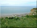
Multi-periodSite Name: New Mill Farm EnclosureCountry: Wales County: Mid Glamorgan Type: Ancient Village or Settlement
Nearest Town: Bridgend Nearest Village: Monknash
Map Ref: SS91156978
Latitude: 51.416553N Longitude: 3.566685W
Condition:
| 5 | Perfect |
| 4 | Almost Perfect |
| 3 | Reasonable but with some damage |
| 2 | Ruined but still recognisable as an ancient site |
| 1 | Pretty much destroyed, possibly visible as crop marks |
| 0 | No data. |
| -1 | Completely destroyed |
| 5 | Superb |
| 4 | Good |
| 3 | Ordinary |
| 2 | Not Good |
| 1 | Awful |
| 0 | No data. |
| 5 | Can be driven to, probably with disabled access |
| 4 | Short walk on a footpath |
| 3 | Requiring a bit more of a walk |
| 2 | A long walk |
| 1 | In the middle of nowhere, a nightmare to find |
| 0 | No data. |
| 5 | co-ordinates taken by GPS or official recorded co-ordinates |
| 4 | co-ordinates scaled from a detailed map |
| 3 | co-ordinates scaled from a bad map |
| 2 | co-ordinates of the nearest village |
| 1 | co-ordinates of the nearest town |
| 0 | no data |
Internal Links:
External Links:
I have visited· I would like to visit
TheCaptain has visited here
")
See Coflein entry .
You may be viewing yesterday's version of this page. To see the most up to date information please register for a free account.
Do not use the above information on other web sites or publications without permission of the contributor.
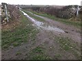
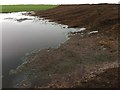
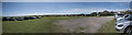
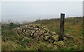
Nearby Images from Geograph Britain and Ireland:
©2017(licence)
©2017(licence)
©2015(licence)
©2022(licence)
©2021(licence)
The above images may not be of the site on this page, they are loaded from Geograph.
Please Submit an Image of this site or go out and take one for us!
Click here to see more info for this site
Nearby sites
Key: Red: member's photo, Blue: 3rd party photo, Yellow: other image, Green: no photo - please go there and take one, Grey: site destroyed
Download sites to:
KML (Google Earth)
GPX (GPS waypoints)
CSV (Garmin/Navman)
CSV (Excel)
To unlock full downloads you need to sign up as a Contributory Member. Otherwise downloads are limited to 50 sites.
Turn off the page maps and other distractions
Nearby sites listing. In the following links * = Image available
564m SSE 156° Nash Point Barrows* Round Barrow(s) (SS91376926)
1.3km SSE 164° Nash Point* Promontory Fort / Cliff Castle (SS915685)
1.6km SSE 160° Cae'r-Eglwys Long Cairn* Long Barrow (SS91666825)
2.4km NW 323° Cwm Bach Hillfort Hillfort (SS89727175)
3.9km NW 320° Dunraven* Hillfort (SS887728)
5.4km ESE 115° Castle Ditches (Glamorgan)* Hillfort (SS960674)
5.6km E 100° St Illtud's Cross* Early Christian Sculptured Stone (SS96626872)
6.0km NNW 332° Heol y Mynydd Round Barrow* Round Barrow(s) (SS8841275126)
7.3km ENE 72° St Anne's Well (Llanmihangel)* Holy Well or Sacred Spring (SS98117190)
7.3km ENE 72° Llanmihangel Early Christian Sculptured Stone (SS98137187)
7.8km NNW 336° Ogmore Cross Shaft* Early Christian Sculptured Stone (SS88177698)
8.3km NE 48° Corrwg Mounds (W) Cairn (SS97477518)
8.6km NE 50° Corrwg Mounds (E) Cairn (SS97857515)
8.6km NNW 343° Chapel Hill Camp Hillfort (SS88887806)
8.9km NW 323° Merthyr Mawr Warren 3 Cairn (SS859770)
9.0km NW 320° Merthyr Mawr Warren 2 Cairn (SS855768)
9.2km NNE 28° St Canna's Church (Llangan)* Ancient Cross (SS957778)
9.2km NE 40° Penllyn Wells* Holy Well or Sacred Spring (SS973767)
9.5km NW 318° Merthyr Mawr Warren 1 Cairn (SS850770)
9.5km NNW 329° Cae Summerhouse* Ancient Village or Settlement (SS86397798)
9.8km N 353° Bridgend Recreation Centre* Standing Stone (Menhir) (SS90217951)
10.3km NNE 15° St Crallog (Coychurch)* Ancient Cross (SS93997970)
10.3km NNE 15° Ebissar Stone* Ancient Cross (SS93997971)
10.6km NNW 332° Tythegston* Chambered Tomb (SS86467925)
10.6km NW 314° St John's Well (South Glamorgan)* Holy Well or Sacred Spring (SS8366877335)
View more nearby sites and additional images


 We would like to know more about this location. Please feel free to add a brief description and any relevant information in your own language.
 Wir möchten mehr über diese Stätte erfahren. Bitte zögern Sie nicht, eine kurze Beschreibung und relevante Informationen in Deutsch hinzuzufügen.
 Nous aimerions en savoir encore un peu sur les lieux. S'il vous plaît n'hesitez pas à ajouter une courte description et tous les renseignements pertinents dans votre propre langue.
 Quisieramos informarnos un poco más de las lugares. No dude en añadir una breve descripción y otros datos relevantes en su propio idioma.