


<< Our Photo Pages >> Garn Wen (Maescar) - Ring Cairn in Wales in Powys
Submitted by geoffstickland on Wednesday, 03 March 2004 Page Views: 4560
Neolithic and Bronze AgeSite Name: Garn Wen (Maescar)Country: Wales County: Powys Type: Ring Cairn
Nearest Town: Llandovery Nearest Village: Llandeilo 'r Fan
Map Ref: SN87723677 Landranger Map Number: 160
Latitude: 52.017956N Longitude: 3.637601W
Condition:
| 5 | Perfect |
| 4 | Almost Perfect |
| 3 | Reasonable but with some damage |
| 2 | Ruined but still recognisable as an ancient site |
| 1 | Pretty much destroyed, possibly visible as crop marks |
| 0 | No data. |
| -1 | Completely destroyed |
| 5 | Superb |
| 4 | Good |
| 3 | Ordinary |
| 2 | Not Good |
| 1 | Awful |
| 0 | No data. |
| 5 | Can be driven to, probably with disabled access |
| 4 | Short walk on a footpath |
| 3 | Requiring a bit more of a walk |
| 2 | A long walk |
| 1 | In the middle of nowhere, a nightmare to find |
| 0 | No data. |
| 5 | co-ordinates taken by GPS or official recorded co-ordinates |
| 4 | co-ordinates scaled from a detailed map |
| 3 | co-ordinates scaled from a bad map |
| 2 | co-ordinates of the nearest village |
| 1 | co-ordinates of the nearest town |
| 0 | no data |
Internal Links:
External Links:
I have visited· I would like to visit
geoffstickland has visited here
 (PID:214615)")
Coflein site no. 101
On the Epynt Military Training Ground and marked with their characteristic star signs.
Page originally by Vicky
You may be viewing yesterday's version of this page. To see the most up to date information please register for a free account.
Do not use the above information on other web sites or publications without permission of the contributor.
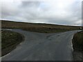
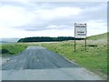
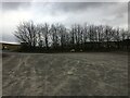
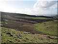
Nearby Images from Geograph Britain and Ireland:
©2022(licence)

©2009(licence)
©2008(licence)
©2022(licence)
©2010(licence)
The above images may not be of the site on this page, they are loaded from Geograph.
Please Submit an Image of this site or go out and take one for us!
Click here to see more info for this site
Nearby sites
Key: Red: member's photo, Blue: 3rd party photo, Yellow: other image, Green: no photo - please go there and take one, Grey: site destroyed
Download sites to:
KML (Google Earth)
GPX (GPS waypoints)
CSV (Garmin/Navman)
CSV (Excel)
To unlock full downloads you need to sign up as a Contributory Member. Otherwise downloads are limited to 50 sites.
Turn off the page maps and other distractions
Nearby sites listing. In the following links * = Image available
757m WSW 256° Dixies Corner* Hillfort (SN86983660)
1.1km E 98° Llyn Nant-Llys Round Barrow(s) (SN888366)
1.2km E 82° Bryn Melin Ring Cairn (SN889369)
1.5km W 273° Clawdd Brythonic Enclosure* Hillfort (SN86253687)
2.4km W 263° Clywyd Watsh Defensive Enclosure* Hillfort (SN85353653)
2.6km NE 55° Hirllwyn Hillfort (SN899382)
3.9km NNE 15° Cefn Iolo Enclosure* Misc. Earthwork (SN88794050)
4.6km ENE 70° Ynys Hir* Cairn (SN92073823)
4.6km ENE 69° Ynys-Hir* Stone Circle (SN921383)
5.1km ESE 110° Gwar-y-Felin Ring Cairn (SN925349)
5.2km SSW 198° Blaen Clydach Fach Cairn 2* Cairn (SN86003185)
5.3km SSW 197° Blaen Clydach Fach Cairn 1* Cairn (SN86043170)
5.5km NNW 328° Abererbwll Roman Fortlet* Hillfort (SN84944152)
6.2km S 179° Varlen Cairn* Cairn (SN87643060)
6.8km S 185° St David's Church, Llywel* Marker Stone (SN86953005)
6.9km NE 54° Garn Wen (Trallong)* Round Cairn (SN93404076)
7.2km SW 215° Y Pigwn standing stone* Standing Stone (Menhir) (SN83423103)
7.2km SW 216° Trecastle Mountain ENE* Stone Circle (SN83343109)
7.2km SW 218° Pigwn Stone Circle 3* Stone Circle (SN83203117)
7.2km SW 216° Trecastle Mountain WSW* Stone Circle (SN83313107)
7.2km SW 217° Trecastle Mountain Row* Stone Row / Alignment (SN8327331053)
7.2km E 80° Y Crug Round Barrow(s) (SN949379)
7.3km SW 219° Y Pigwn cairn 1* Cairn (SN83063119)
7.3km ENE 75° Twyn Cerrig-Cadarn Ring Cairn (SN948385)
7.3km NW 324° Sugar Loaf Hill Fort* Hillfort (SN83484278)
View more nearby sites and additional images


 We would like to know more about this location. Please feel free to add a brief description and any relevant information in your own language.
 Wir möchten mehr über diese Stätte erfahren. Bitte zögern Sie nicht, eine kurze Beschreibung und relevante Informationen in Deutsch hinzuzufügen.
 Nous aimerions en savoir encore un peu sur les lieux. S'il vous plaît n'hesitez pas à ajouter une courte description et tous les renseignements pertinents dans votre propre langue.
 Quisieramos informarnos un poco más de las lugares. No dude en añadir una breve descripción y otros datos relevantes en su propio idioma.