


<< Our Photo Pages >> Halwell Camp North East - Hillfort in England in Devon
Submitted by vicky on Monday, 07 October 2002 Page Views: 6181
Iron Age and Later PrehistorySite Name: Halwell Camp North EastCountry: England
NOTE: This site is 6.3 km away from the location you searched for.
County: Devon Type: Hillfort
Nearest Town: Dartmouth Nearest Village: Hallwell
Map Ref: SX784532 Landranger Map Number: 202
Latitude: 50.366103N Longitude: 3.711103W
Condition:
| 5 | Perfect |
| 4 | Almost Perfect |
| 3 | Reasonable but with some damage |
| 2 | Ruined but still recognisable as an ancient site |
| 1 | Pretty much destroyed, possibly visible as crop marks |
| 0 | No data. |
| -1 | Completely destroyed |
| 5 | Superb |
| 4 | Good |
| 3 | Ordinary |
| 2 | Not Good |
| 1 | Awful |
| 0 | No data. |
| 5 | Can be driven to, probably with disabled access |
| 4 | Short walk on a footpath |
| 3 | Requiring a bit more of a walk |
| 2 | A long walk |
| 1 | In the middle of nowhere, a nightmare to find |
| 0 | No data. |
| 5 | co-ordinates taken by GPS or official recorded co-ordinates |
| 4 | co-ordinates scaled from a detailed map |
| 3 | co-ordinates scaled from a bad map |
| 2 | co-ordinates of the nearest village |
| 1 | co-ordinates of the nearest town |
| 0 | no data |
Internal Links:
External Links:
I have visited· I would like to visit
TheWhiteRider has visited here
")
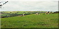
The earthworks, NE and SW are cut through by the road.
Have you visited this site? Please add a comment below.
You may be viewing yesterday's version of this page. To see the most up to date information please register for a free account.
")
Do not use the above information on other web sites or publications without permission of the contributor.
Nearby Images from Geograph Britain and Ireland:
©2006(licence)
©2014(licence)
©2006(licence)
©2010(licence)
©2020(licence)
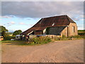
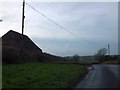
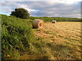
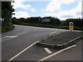
The above images may not be of the site on this page, they are loaded from Geograph.
Please Submit an Image of this site or go out and take one for us!
Click here to see more info for this site
Nearby sites
Key: Red: member's photo, Blue: 3rd party photo, Yellow: other image, Green: no photo - please go there and take one, Grey: site destroyed
Download sites to:
KML (Google Earth)
GPX (GPS waypoints)
CSV (Garmin/Navman)
CSV (Excel)
To unlock full downloads you need to sign up as a Contributory Member. Otherwise downloads are limited to 50 sites.
Turn off the page maps and other distractions
Nearby sites listing. In the following links * = Image available
1.5km SW 219° Ritson Barrows Barrow Cemetery (SX77435204)
1.9km SW 215° Halwell Camp South West* Hillfort (SX77255165)
6.5km WSW 258° Blackdown Rings Hillfort (SX720520)
7.3km N 11° Leech Wells* Holy Well or Sacred Spring (SX799603)
7.5km NNE 13° Totnes Museum* Museum (SX8030060419)
7.5km NNE 14° The Brutus Stone* Marker Stone (SX8035760411)
9.2km SSE 164° Slapton Castle Hillfort (SX808443)
10.5km WSW 248° Oldaport Promontory Fort Promontory Fort / Cliff Castle (SX68554940)
10.9km WNW 282° Ugborough Parish Church Prehistoric Earthwork* Ancient Village or Settlement (SX67755575)
11.6km ENE 68° Broadsands Chambered Tomb* Chambered Tomb (SX89315732)
11.6km NW 315° Brent Hill* Hillfort (SX7039061670)
12.9km NW 320° Tynacombe Ring Cairn (SX70376328)
12.9km WNW 294° Ugborough Beacon Cairns* Cairn (SX6675558770)
13.0km WNW 296° Ugborough Beacon Propped Stone* Natural Stone / Erratic / Other Natural Feature (SX6674859106)
13.2km WSW 241° Bigbury Tumuli* Barrow Cemetery (SX667470)
13.3km WNW 286° Cantrell* Multiple Stone Rows / Avenue (SX6568957160)
13.4km WNW 291° Cuckoo Ball Chambered Tomb* Chambered Tomb (SX6596058188)
13.5km WNW 292° Butterdon Hill Long Cairn* Long Barrow (SX6601258591)
13.5km WNW 299° Scad Brook* Ancient Village or Settlement (SX6667759981)
13.8km WNW 303° Corringdon Ball settlement* Ancient Village or Settlement (SX66956088)
13.8km NW 305° Treeland Brake* Stone Row / Alignment (SX673614)
13.8km WNW 294° Butterdon East* Stone Row / Alignment (SX65905920)
13.9km WNW 292° Butterdon Stone Circle* Stone Circle (SX6562958814)
13.9km WNW 292° Butterdon Hill Cairns* Cairn (SX6560158766)
13.9km WNW 300° Lower Glasscombe* Cist (SX6650660502)
View more nearby sites and additional images


 We would like to know more about this location. Please feel free to add a brief description and any relevant information in your own language.
 Wir möchten mehr über diese Stätte erfahren. Bitte zögern Sie nicht, eine kurze Beschreibung und relevante Informationen in Deutsch hinzuzufügen.
 Nous aimerions en savoir encore un peu sur les lieux. S'il vous plaît n'hesitez pas à ajouter une courte description et tous les renseignements pertinents dans votre propre langue.
 Quisieramos informarnos un poco más de las lugares. No dude en añadir una breve descripción y otros datos relevantes en su propio idioma.