

<< Our Photo Pages >> Little Urchany - Clava Cairn in Scotland in Highlands
Submitted by Anonymous on Tuesday, 09 July 2002 Page Views: 8706
Neolithic and Bronze AgeSite Name: Little UrchanyCountry: Scotland
NOTE: This site is 7.2 km away from the location you searched for.
County: Highlands Type: Clava Cairn
Map Ref: NH8665648566 Landranger Map Number: 27
Latitude: 57.513040N Longitude: 3.893665W
Condition:
| 5 | Perfect |
| 4 | Almost Perfect |
| 3 | Reasonable but with some damage |
| 2 | Ruined but still recognisable as an ancient site |
| 1 | Pretty much destroyed, possibly visible as crop marks |
| 0 | No data. |
| -1 | Completely destroyed |
| 5 | Superb |
| 4 | Good |
| 3 | Ordinary |
| 2 | Not Good |
| 1 | Awful |
| 0 | No data. |
| 5 | Can be driven to, probably with disabled access |
| 4 | Short walk on a footpath |
| 3 | Requiring a bit more of a walk |
| 2 | A long walk |
| 1 | In the middle of nowhere, a nightmare to find |
| 0 | No data. |
| 5 | co-ordinates taken by GPS or official recorded co-ordinates |
| 4 | co-ordinates scaled from a detailed map |
| 3 | co-ordinates scaled from a bad map |
| 2 | co-ordinates of the nearest village |
| 1 | co-ordinates of the nearest town |
| 0 | no data |
Be the first person to rate this site - see the 'Contribute!' box in the right hand menu.
Internal Links:
External Links:
I have visited· I would like to visit
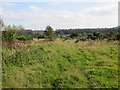
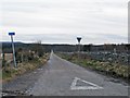
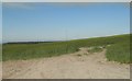
livingstone visited on 27th Feb 2011 - their rating: Cond: 2 Amb: 3 Access: 3 The actual cairn cannot be seen from the road but field clearance gives the impression of a cairn. Only when you have walked to the top of the hill can you see the real cairn in the next field. Condition not good, access not great, but still worth a visit.
PeteCrane5 have visited here
")
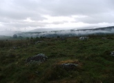
Indicated on the OS Map as a ring cairn, Little Urchany is a ruinous Clava-type cairn with an impressive kerb of large bulders around most of its circumference. In addition, three upright stones—perhaps the remains of a stone circle—stand within the kerb.
Information from hamilton.
You may be viewing yesterday's version of this page. To see the most up to date information please register for a free account.
")
")
")
")
Do not use the above information on other web sites or publications without permission of the contributor.
Nearby Images from Geograph Britain and Ireland:
©2007(licence)
©2014(licence)
©2015(licence)
©2009(licence)
©2019(licence)
The above images may not be of the site on this page, they are loaded from Geograph.
Please Submit an Image of this site or go out and take one for us!
Click here to see more info for this site
Nearby sites
Key: Red: member's photo, Blue: 3rd party photo, Yellow: other image, Green: no photo - please go there and take one, Grey: site destroyed
Download sites to:
KML (Google Earth)
GPX (GPS waypoints)
CSV (Garmin/Navman)
CSV (Excel)
To unlock full downloads you need to sign up as a Contributory Member. Otherwise downloads are limited to 50 sites.
Turn off the page maps and other distractions
Nearby sites listing. In the following links * = Image available
2.4km NNW 335° Cawdor* Standing Stone (Menhir) (NH857508)
4.5km NNW 344° Hangman's Hill* Cairn (NH85515289)
4.6km NNW 343° Barrow Stone Circle* Modern Stone Circle etc (NH85405298)
4.8km NNW 344° Kinchyle Cairns* Cairn (NH85445323)
5.1km ENE 75° Shion Hillock Cairn* Cairn (NH91644978)
5.5km NE 48° Laikenbuie Cairnfield* Cairn (NH90865220)
5.6km NE 46° Laikenbuie Ring Cairn* Ring Cairn (NH90875234)
5.8km ENE 56° Arr Wood Cairn* Cairn (NH91625167)
6.0km NW 316° Loch of the Clans Crannog* Crannog (NH82575297)
6.6km ENE 78° Achnatone* Stone Circle (NH932498)
7.7km WSW 258° Dalgrambich Farm* Standing Stones (NH79104715)
8.0km NNW 328° Kebbuck Stone* Class I / Class II Hybrid Pictish Symbol Stone (NH826555)
8.3km ESE 109° Levrattich Cairn* Round Cairn (NH9447045680)
8.7km W 267° Dalcross Mains* Stone Circle (NH779484)
8.9km NE 39° Auldearn Stone Circle* Stone Circle (NH9246755309)
9.0km ENE 68° Easter Clunes* Cairn (NH95105166)
9.0km NE 44° Auldearn Stone Row* Stone Row / Alignment (NH93125486)
9.1km ENE 69° Easter Clune 1* Clava Cairn (NH95245162)
9.2km SE 129° Glenferness* Class II Pictish Symbol Stone (NH93664261)
9.2km WSW 252° Cantraybruich* Clava Cairn (NH77834594)
10.0km ENE 58° Moyness* Stone Circle (NH95275364)
11.3km WSW 248° Mains of Clava SE* Cairn (NH76054457)
11.4km ENE 65° Hanover Cairn (NH971531)
11.4km NE 55° Golford Ring Cairn* Ring Cairn (NH96165488)
11.5km WSW 248° Balnuaran of Clava (Stone)* Standing Stone (Menhir) (NH758446)
View more nearby sites and additional images


 We would like to know more about this location. Please feel free to add a brief description and any relevant information in your own language.
 Wir möchten mehr über diese Stätte erfahren. Bitte zögern Sie nicht, eine kurze Beschreibung und relevante Informationen in Deutsch hinzuzufügen.
 Nous aimerions en savoir encore un peu sur les lieux. S'il vous plaît n'hesitez pas à ajouter une courte description et tous les renseignements pertinents dans votre propre langue.
 Quisieramos informarnos un poco más de las lugares. No dude en añadir una breve descripción y otros datos relevantes en su propio idioma.