


<< Our Photo Pages >> Drum Nantygorlan - Standing Stone (Menhir) in Wales in Powys
Submitted by Elenydd on Sunday, 28 May 2006 Page Views: 4130
Neolithic and Bronze AgeSite Name: Drum NantygorlanCountry: Wales
NOTE: This site is 0.2 km away from the location you searched for.
County: Powys Type: Standing Stone (Menhir)
Map Ref: SN8340259394
Latitude: 52.220376N Longitude: 3.708253W
Condition:
| 5 | Perfect |
| 4 | Almost Perfect |
| 3 | Reasonable but with some damage |
| 2 | Ruined but still recognisable as an ancient site |
| 1 | Pretty much destroyed, possibly visible as crop marks |
| 0 | No data. |
| -1 | Completely destroyed |
| 5 | Superb |
| 4 | Good |
| 3 | Ordinary |
| 2 | Not Good |
| 1 | Awful |
| 0 | No data. |
| 5 | Can be driven to, probably with disabled access |
| 4 | Short walk on a footpath |
| 3 | Requiring a bit more of a walk |
| 2 | A long walk |
| 1 | In the middle of nowhere, a nightmare to find |
| 0 | No data. |
| 5 | co-ordinates taken by GPS or official recorded co-ordinates |
| 4 | co-ordinates scaled from a detailed map |
| 3 | co-ordinates scaled from a bad map |
| 2 | co-ordinates of the nearest village |
| 1 | co-ordinates of the nearest town |
| 0 | no data |
Be the first person to rate this site - see the 'Contribute!' box in the right hand menu.
Internal Links:
External Links:
")
You may be viewing yesterday's version of this page. To see the most up to date information please register for a free account.
Do not use the above information on other web sites or publications without permission of the contributor.
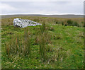
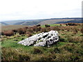
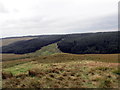
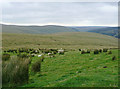
Nearby Images from Geograph Britain and Ireland:
©2009(licence)
©2023(licence)
©2017(licence)
©2009(licence)
©2009(licence)
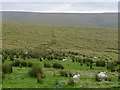
The above images may not be of the site on this page, they are loaded from Geograph.
Please Submit an Image of this site or go out and take one for us!
Click here to see more info for this site
Nearby sites
Key: Red: member's photo, Blue: 3rd party photo, Yellow: other image, Green: no photo - please go there and take one, Grey: site destroyed
Download sites to:
KML (Google Earth)
GPX (GPS waypoints)
CSV (Garmin/Navman)
CSV (Excel)
To unlock full downloads you need to sign up as a Contributory Member. Otherwise downloads are limited to 50 sites.
Turn off the page maps and other distractions
Nearby sites listing. In the following links * = Image available
1.8km SSE 162° Maesnant Cairn* Cairn (SN83915771)
3.0km ESE 108° Drygarn Fawr* Cairn (SN86285841)
3.3km SW 220° Castell Llygoden Platform Cairn* Cairn (SN81205689)
3.6km E 92° Carreg Yr Ast Cairn* Cairn (SN87005916)
3.7km SW 236° Eagair Gerwyn Cairn Cemetary* Cairn (SN80265736)
4.0km NE 48° Pen Maen Wern* Standing Stone (Menhir) (SN86446201)
4.1km SE 141° Cefn Craig Gwesyn* Cairn (SN85895619)
4.3km ENE 78° Esgair Ganol Cairn* Cairn (SN8765060227)
4.9km SSE 164° Esgair Irfon Cairn* Cairn (SN84645464)
5.1km SE 124° Afon Cammarch* Cairn (SN87565642)
5.1km ENE 66° Waun Lydan* Standing Stone (Menhir) (SN88136136)
5.4km ENE 67° Cerrig Plwm Cairn* Cairn (SN88446134)
5.4km NW 321° Crug Gynon Cairn (SN801637)
5.4km ENE 69° Rhiwnant Prehistoric Ancient Settlement* Ancient Village or Settlement (SN88556119)
5.5km ENE 69° Craig Rhiwnant Cairn 1* Cairn (SN8860261294)
5.6km ENE 68° Craig Rhiwnant Cairns 2* Cairn (SN8865661340)
5.8km ENE 77° Esgair Hafod* Ring Cairn (SN891606)
6.1km W 264° Cefn y Cnuc Cairn* Cairn (SN7731658859)
6.2km NNE 23° Cerrig-Y-Gadeir* Cairn (SN860650)
6.2km SE 144° Careg Lwyd Standing Stone* Standing Stone (Menhir) (SN86925425)
6.5km ENE 78° Esgair Ceiliog* Ring Cairn (SN8977060636)
6.6km E 96° Bwlch-y-Ddau-Faen Cairn* Cairn (SN90015859)
6.7km W 260° Cefn Cerrig Cairn/Round Barrow* Round Barrow(s) (SN7673258333)
6.9km NW 307° Pen-Y-Bwlch E ,Cairn Cairn (SN780637)
7.1km SSE 163° Ffynnon Ddewi (Abergwesyn)* Holy Well or Sacred Spring (SN8529852598)
View more nearby sites and additional images


 We would like to know more about this location. Please feel free to add a brief description and any relevant information in your own language.
 Wir möchten mehr über diese Stätte erfahren. Bitte zögern Sie nicht, eine kurze Beschreibung und relevante Informationen in Deutsch hinzuzufügen.
 Nous aimerions en savoir encore un peu sur les lieux. S'il vous plaît n'hesitez pas à ajouter une courte description et tous les renseignements pertinents dans votre propre langue.
 Quisieramos informarnos un poco más de las lugares. No dude en añadir una breve descripción y otros datos relevantes en su propio idioma.