


<< Text Pages >> Hoscombe NW - Standing Stones in England in Somerset
Submitted by vicky on Sunday, 22 December 2002 Page Views: 6261
Neolithic and Bronze AgeSite Name: Hoscombe NWCountry: England
NOTE: This site is 0.2 km away from the location you searched for.
County: Somerset Type: Standing Stones
Map Ref: SS830441 Landranger Map Number: 181
Latitude: 51.184118N Longitude: 3.675405W
Condition:
| 5 | Perfect |
| 4 | Almost Perfect |
| 3 | Reasonable but with some damage |
| 2 | Ruined but still recognisable as an ancient site |
| 1 | Pretty much destroyed, possibly visible as crop marks |
| 0 | No data. |
| -1 | Completely destroyed |
| 5 | Superb |
| 4 | Good |
| 3 | Ordinary |
| 2 | Not Good |
| 1 | Awful |
| 0 | No data. |
| 5 | Can be driven to, probably with disabled access |
| 4 | Short walk on a footpath |
| 3 | Requiring a bit more of a walk |
| 2 | A long walk |
| 1 | In the middle of nowhere, a nightmare to find |
| 0 | No data. |
| 5 | co-ordinates taken by GPS or official recorded co-ordinates |
| 4 | co-ordinates scaled from a detailed map |
| 3 | co-ordinates scaled from a bad map |
| 2 | co-ordinates of the nearest village |
| 1 | co-ordinates of the nearest town |
| 0 | no data |
Internal Links:
External Links:
Pair of Standing Stones in Somerset
Have you visited this site? Please add a comment below.
You may be viewing yesterday's version of this page. To see the most up to date information please register for a free account.
Do not use the above information on other web sites or publications without permission of the contributor.
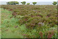
Nearby Images from Geograph Britain and Ireland:
©2010(licence)
©2014(licence)
©2014(licence)
©2010(licence)
©2010(licence)
The above images may not be of the site on this page, they are loaded from Geograph.
Please Submit an Image of this site or go out and take one for us!
Click here to see more info for this site
Nearby sites
Key: Red: member's photo, Blue: 3rd party photo, Yellow: other image, Green: no photo - please go there and take one, Grey: site destroyed
Download sites to:
KML (Google Earth)
GPX (GPS waypoints)
CSV (Garmin/Navman)
CSV (Excel)
To unlock full downloads you need to sign up as a Contributory Member. Otherwise downloads are limited to 50 sites.
Turn off the page maps and other distractions
Nearby sites listing. In the following links * = Image available
251m SSE 152° Hoscombe SE* Stone Row / Alignment (SS8311443876)
474m SE 130° Porlock Allotment SW* Multiple Stone Rows / Avenue (SS8335543785)
987m WSW 256° Kittuck* Multiple Stone Rows / Avenue (SS8203443885)
1.1km ENE 74° Coley Water, South* Stone Row / Alignment (SS84074438)
1.2km ENE 57° Porlock Allotment NE* Standing Stones (SS84014471)
1.5km S 179° Madacombe Barrows Barrow Cemetery (SS830426)
1.6km S 175° Madacombe* Stone Row / Alignment (SS831425)
1.6km ENE 68° Porlock Circle* Stone Circle (SS84514467)
1.7km ENE 69° Porlock Common SW* Multiple Stone Rows / Avenue (SS8457544654)
1.9km SSE 157° Alderman's Barrow* Round Barrow(s) (SS837423)
2.4km NNE 34° Porlock Common North East* Stone Row / Alignment (SS8434946032)
2.7km SSE 150° Almsworthy* Stone Circle (SS8430941698)
2.9km WSW 237° Swap Hill* Standing Stones (SS80554261)
2.9km WSW 239° Swap Hill (N)* Standing Stone (Menhir) (SS80514266)
2.9km SW 233° Beckham Hill* Multiple Stone Rows / Avenue (SS8063242382)
2.9km WSW 253° Toms Hill* Multiple Stone Rows / Avenue (SS80184329)
3.0km ENE 73° Berry Castle (Exmoor) Hillfort (SS859449)
3.1km SSW 196° Larkbarrow Corner Standing Stone* Standing Stone (Menhir) (SS82084116)
3.2km NE 46° Whit Stones* Standing Stones (SS8532846255)
3.2km SSW 193° Larkbarrow Corner Stone Setting* Standing Stones (SS82224097)
3.3km SE 126° Wilmersham Common North* Stone Row / Alignment (SS8561242129)
3.3km N 2° Culbone Stone* Early Christian Sculptured Stone (SS8321047374)
3.3km SSW 193° Wester Mill Multiple Stone Rows / Avenue (SS822409)
3.3km N 6° Culbone Hill* Stone Row / Alignment (SS83434738)
3.4km SE 127° Wilmersham Common South* Multiple Stone Rows / Avenue (SS85664197)
View more nearby sites and additional images


 We would like to know more about this location. Please feel free to add a brief description and any relevant information in your own language.
 Wir möchten mehr über diese Stätte erfahren. Bitte zögern Sie nicht, eine kurze Beschreibung und relevante Informationen in Deutsch hinzuzufügen.
 Nous aimerions en savoir encore un peu sur les lieux. S'il vous plaît n'hesitez pas à ajouter une courte description et tous les renseignements pertinents dans votre propre langue.
 Quisieramos informarnos un poco más de las lugares. No dude en añadir una breve descripción y otros datos relevantes en su propio idioma.