

<< Our Photo Pages >> Twitchen barrows - Barrow Cemetery in England in Devon
Submitted by Bladup on Thursday, 25 September 2014 Page Views: 1997
Neolithic and Bronze AgeSite Name: Twitchen barrowsCountry: England
NOTE: This site is 3.2 km away from the location you searched for.
County: Devon Type: Barrow Cemetery
Nearest Town: Dulverton
Map Ref: SS804323
Latitude: 51.077521N Longitude: 3.708668W
Condition:
| 5 | Perfect |
| 4 | Almost Perfect |
| 3 | Reasonable but with some damage |
| 2 | Ruined but still recognisable as an ancient site |
| 1 | Pretty much destroyed, possibly visible as crop marks |
| 0 | No data. |
| -1 | Completely destroyed |
| 5 | Superb |
| 4 | Good |
| 3 | Ordinary |
| 2 | Not Good |
| 1 | Awful |
| 0 | No data. |
| 5 | Can be driven to, probably with disabled access |
| 4 | Short walk on a footpath |
| 3 | Requiring a bit more of a walk |
| 2 | A long walk |
| 1 | In the middle of nowhere, a nightmare to find |
| 0 | No data. |
| 5 | co-ordinates taken by GPS or official recorded co-ordinates |
| 4 | co-ordinates scaled from a detailed map |
| 3 | co-ordinates scaled from a bad map |
| 2 | co-ordinates of the nearest village |
| 1 | co-ordinates of the nearest town |
| 0 | no data |
Internal Links:
External Links:
")
The smaller easternmost mound measures 11.5m in diameter and is 1.4m high and contains an excavation hollow at its centre. The larger western mound is 19.4m in diameter and 1.3m high and has been heavily disturbed.
These barrows have legends attached to them concerning ghostly figures.
You may be viewing yesterday's version of this page. To see the most up to date information please register for a free account.
")
Do not use the above information on other web sites or publications without permission of the contributor.
Nearby Images from Geograph Britain and Ireland:
©2012(licence)
©2006(licence)
©2015(licence)
©2015(licence)
©2015(licence)
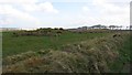
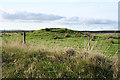
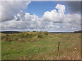
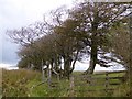
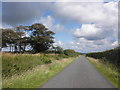
The above images may not be of the site on this page, they are loaded from Geograph.
Please Submit an Image of this site or go out and take one for us!
Click here to see more info for this site
Nearby sites
Key: Red: member's photo, Blue: 3rd party photo, Yellow: other image, Green: no photo - please go there and take one, Grey: site destroyed
Download sites to:
KML (Google Earth)
GPX (GPS waypoints)
CSV (Garmin/Navman)
CSV (Excel)
To unlock full downloads you need to sign up as a Contributory Member. Otherwise downloads are limited to 50 sites.
Turn off the page maps and other distractions
Nearby sites listing. In the following links * = Image available
2.7km NNE 30° Green Barrow* Round Barrow(s) (SS81793456)
4.0km ENE 58° Withypool Circle* Stone Circle (SS83833431)
4.2km ENE 58° Withypool Hill Barrow* Round Barrow(s) (SS84013445)
4.7km NW 311° Long Holcombe (S)* Standing Stone (Menhir) (SS76943543)
4.7km NW 319° Long Holcombe (N) Standing Stone (Menhir) (SS77383593)
5.1km NW 307° The Buttery Stone* Standing Stone (Menhir) (SS76403550)
5.2km NNW 349° Cow Castle* Hillfort (SS795374)
5.2km NNW 343° Horsen Stone Rows Multiple Stone Rows / Avenue (SS790373)
5.4km ESE 121° West Anstey Long Stone* Standing Stone (Menhir) (SS84932942)
5.9km ESE 120° West Anstey Barrows* Barrow Cemetery (SS85452918)
6.4km E 90° Tarr Steps Prehistoric Bridge* Ancient Trackway (SS86773211)
6.9km WNW 303° Two Barrows (Kinsford Gate)* Barrow Cemetery (SS747362)
6.9km NNW 330° Halscombe* Multiple Stone Rows / Avenue (SS7702238336)
7.5km ENE 73° Wambarrows* Barrow Cemetery (SS87613431)
7.6km SW 217° Garliford Hillfort (SS757263)
7.7km WNW 303° Kinsford Gate Tumulus Round Barrow(s) (SS740366)
7.8km W 266° Bampfylde Hill Barrows* Barrow Cemetery (SS726319)
8.3km ESE 106° Brewer's Castle Hillfort (SS88332977)
8.4km WNW 301° Five Barrows (Devon)* Barrow Cemetery (SS733368)
8.5km WNW 303° White Ladder* Multiple Stone Rows / Avenue (SS7337337076)
8.6km ESE 107° Mounsey Castle Hillfort (SS88562955)
8.6km E 80° Caratacus Stone* Standing Stone (Menhir) (SS88973355)
8.8km NW 311° Squallacombe NE Standing Stones (SS739382)
8.8km N 10° Wester Mill Multiple Stone Rows / Avenue (SS822409)
8.8km NW 311° Squallacombe Centre* Multiple Stone Rows / Avenue (SS73813822)
View more nearby sites and additional images


 We would like to know more about this location. Please feel free to add a brief description and any relevant information in your own language.
 Wir möchten mehr über diese Stätte erfahren. Bitte zögern Sie nicht, eine kurze Beschreibung und relevante Informationen in Deutsch hinzuzufügen.
 Nous aimerions en savoir encore un peu sur les lieux. S'il vous plaît n'hesitez pas à ajouter une courte description et tous les renseignements pertinents dans votre propre langue.
 Quisieramos informarnos un poco más de las lugares. No dude en añadir una breve descripción y otros datos relevantes en su propio idioma.