


<< Text Pages >> Altanduin - Broch or Nuraghe in Scotland in Sutherland
Submitted by SolarMegalith on Monday, 14 March 2011 Page Views: 5193
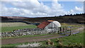
Iron Age and Later PrehistorySite Name: Altanduin Alternative Name: Allt an Duin 2Country: Scotland County: Sutherland Type: Broch or Nuraghe
Nearest Town: Kildonan
Map Ref: NC80972605
Latitude: 58.207114N Longitude: 4.027258W
Condition:
| 5 | Perfect |
| 4 | Almost Perfect |
| 3 | Reasonable but with some damage |
| 2 | Ruined but still recognisable as an ancient site |
| 1 | Pretty much destroyed, possibly visible as crop marks |
| 0 | No data. |
| -1 | Completely destroyed |
| 5 | Superb |
| 4 | Good |
| 3 | Ordinary |
| 2 | Not Good |
| 1 | Awful |
| 0 | No data. |
| 5 | Can be driven to, probably with disabled access |
| 4 | Short walk on a footpath |
| 3 | Requiring a bit more of a walk |
| 2 | A long walk |
| 1 | In the middle of nowhere, a nightmare to find |
| 0 | No data. |
| 5 | co-ordinates taken by GPS or official recorded co-ordinates |
| 4 | co-ordinates scaled from a detailed map |
| 3 | co-ordinates scaled from a bad map |
| 2 | co-ordinates of the nearest village |
| 1 | co-ordinates of the nearest town |
| 0 | no data |
Internal Links:
External Links:
Broch in Sutherland
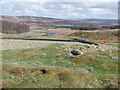
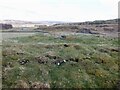
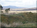
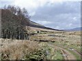
Remains of a broch preserved as a stony mound. Significant parts of the walls were destroyed in 19th century.
Read More at ScotlandsPlaces.
You may be viewing yesterday's version of this page. To see the most up to date information please register for a free account.
Do not use the above information on other web sites or publications without permission of the contributor.
Nearby Images from Geograph Britain and Ireland:
©2023(licence)
©2023(licence)
©2023(licence)
©2023(licence)
©2023(licence)
The above images may not be of the site on this page, they are loaded from Geograph.
Please Submit an Image of this site or go out and take one for us!
Click here to see more info for this site
Nearby sites
Key: Red: member's photo, Blue: 3rd party photo, Yellow: other image, Green: no photo - please go there and take one, Grey: site destroyed
Download sites to:
KML (Google Earth)
GPX (GPS waypoints)
CSV (Garmin/Navman)
CSV (Excel)
To unlock full downloads you need to sign up as a Contributory Member. Otherwise downloads are limited to 50 sites.
Turn off the page maps and other distractions
Nearby sites listing. In the following links * = Image available
3.6km ENE 68° Feranach* Broch or Nuraghe (NC84412730)
6.3km NNE 14° Kinbrace Stone Rows* Multiple Stone Rows / Avenue (NC8273332160)
6.7km ENE 59° Kinbrace Hill 2* Chambered Cairn (NC86882935)
6.9km ENE 62° Kinbrace Hill 1* Cairn (NC87172915)
7.0km ENE 69° Kinbrace Burn* Chambered Cairn (NC87572830)
7.4km NE 46° Creag Nan Caorach Hut Circles* Ancient Village or Settlement (NC865310)
7.6km NE 48° Creag Nan Caorach Cairn Cairn (NC868310)
7.7km NE 49° Creag Nan Caorach Chambered Cairn* Chambered Cairn (NC870309)
7.8km E 94° Suisgill Broch* Broch or Nuraghe (NC88752530)
8.1km NE 43° Creag Nan Caorach Hut Circles* Ancient Village or Settlement (NC867318)
8.2km E 95° Suisgill Souterrian* Souterrain (Fogou, Earth House) (NC89172511)
8.5km ESE 106° Learable Hill S* Stone Circle (NC89162351)
8.6km ESE 105° Learable Hill Row 1* Stone Row / Alignment (NC8920923546)
8.6km ESE 105° Learable Hill Row 2* Stone Row / Alignment (NC8920523530)
8.6km ESE 105° Learable Hill* Multiple Stone Rows / Avenue (NC8925123550)
8.6km ESE 105° Learable Hill Cross Incised Stone* Early Christian Sculptured Stone (NC8925723493)
8.7km ESE 105° Learable Hill Row 3* Stone Row / Alignment (NC8928123496)
8.7km ESE 106° Learable Hill Row 4* Stone Row / Alignment (NC8927423466)
8.7km E 101° Learable Hill N* Stone Circle (NC895241)
9.0km E 95° Carn Nam Buth* Broch or Nuraghe (NC89892498)
9.5km NNW 342° Badanloch* Multiple Stone Rows / Avenue (NC78263516)
12.5km NW 325° Cnoc na h-Uide Hut Circle Ancient Village or Settlement (NC740365)
12.6km NNW 347° Ben Griam Mor Burnt Mound Artificial Mound (NC786384)
12.7km NNW 348° Ben Griam Mor, Hut Circles and Field systems Ancient Village or Settlement (NC786385)
12.7km S 185° Caisteal Na Coille* Broch or Nuraghe (NC79571337)
View more nearby sites and additional images


 We would like to know more about this location. Please feel free to add a brief description and any relevant information in your own language.
 Wir möchten mehr über diese Stätte erfahren. Bitte zögern Sie nicht, eine kurze Beschreibung und relevante Informationen in Deutsch hinzuzufügen.
 Nous aimerions en savoir encore un peu sur les lieux. S'il vous plaît n'hesitez pas à ajouter une courte description et tous les renseignements pertinents dans votre propre langue.
 Quisieramos informarnos un poco más de las lugares. No dude en añadir una breve descripción y otros datos relevantes en su propio idioma.