


<< Our Photo Pages >> Ffynnon Ddrewllyd - Holy Well or Sacred Spring in Wales in West Glamorgan
Submitted by coldrum on Tuesday, 12 January 2010 Page Views: 7163
Springs and Holy WellsSite Name: Ffynnon Ddrewllyd Alternative Name: Felindre Cwm-twrchCountry: Wales County: West Glamorgan Type: Holy Well or Sacred Spring
Map Ref: SN764104
Latitude: 51.778576N Longitude: 3.793015W
Condition:
| 5 | Perfect |
| 4 | Almost Perfect |
| 3 | Reasonable but with some damage |
| 2 | Ruined but still recognisable as an ancient site |
| 1 | Pretty much destroyed, possibly visible as crop marks |
| 0 | No data. |
| -1 | Completely destroyed |
| 5 | Superb |
| 4 | Good |
| 3 | Ordinary |
| 2 | Not Good |
| 1 | Awful |
| 0 | No data. |
| 5 | Can be driven to, probably with disabled access |
| 4 | Short walk on a footpath |
| 3 | Requiring a bit more of a walk |
| 2 | A long walk |
| 1 | In the middle of nowhere, a nightmare to find |
| 0 | No data. |
| 5 | co-ordinates taken by GPS or official recorded co-ordinates |
| 4 | co-ordinates scaled from a detailed map |
| 3 | co-ordinates scaled from a bad map |
| 2 | co-ordinates of the nearest village |
| 1 | co-ordinates of the nearest town |
| 0 | no data |
Be the first person to rate this site - see the 'Contribute!' box in the right hand menu.
Internal Links:
External Links:
I have visited· I would like to visit
Fallow would like to visit
geoffstickland has visited here
")
Sulphur spring.
Wikipedia
You may be viewing yesterday's version of this page. To see the most up to date information please register for a free account.
")
")
Do not use the above information on other web sites or publications without permission of the contributor.
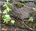
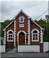
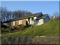
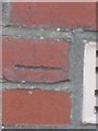
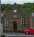
Nearby Images from Geograph Britain and Ireland:
©2020(licence)
©2020(licence)
©2005(licence)
©2013(licence)
©2020(licence)
The above images may not be of the site on this page, they are loaded from Geograph.
Please Submit an Image of this site or go out and take one for us!
Click here to see more info for this site
Nearby sites
Key: Red: member's photo, Blue: 3rd party photo, Yellow: other image, Green: no photo - please go there and take one, Grey: site destroyed
Download sites to:
KML (Google Earth)
GPX (GPS waypoints)
CSV (Garmin/Navman)
CSV (Excel)
To unlock full downloads you need to sign up as a Contributory Member. Otherwise downloads are limited to 50 sites.
Turn off the page maps and other distractions
Nearby sites listing. In the following links * = Image available
2.2km W 281° Pen Rhiw Fawr Cairn* Cairn (SN7424410863)
2.5km WNW 285° Pen Rhiw fawr Standing Stone* Standing Stone (Menhir) (SN740111)
2.8km WNW 284° Brynmelyn Quarry Cairn 2* Cairn (SN73661113)
3.0km WNW 283° Brynmelyn Quarry Cairn 1* Cairn (SN7353211152)
3.6km WSW 242° Cefn Gwrhyd Stone* Standing Stone (Menhir) (SN732088)
3.9km NNE 12° Dorwen* Standing Stones (SN7730414239)
4.0km W 271° Pen Y Waun NW 2 Cairn* Cairn (SN7234810576)
4.1km W 272° Pen Y Waun NW 1 Cairn* Cairn (SN7231810629)
4.3km N 1° Derlwyn Isaf* Cairn (SN76611467)
4.9km NNE 16° Llwyncwmstabl* Cairn (SN77851509)
5.1km NNE 24° Llorfa* Stone Circle (SN7861915010)
6.0km WSW 250° Nant-Y-Gaseg modern stone circle* Modern Stone Circle etc (SN7063408515)
6.3km SW 218° Llangiwg* Holy Well or Sacred Spring (SN72380559)
6.8km N 2° Carn Fadog* Cairn (SN76861721)
7.2km W 265° Llety'r-crydd cairn cemetery* Barrow Cemetery (SN69200991)
7.2km ESE 104° Cwm Irfon Standing Stones (Seven Sisters) Standing Stones (SN834085)
7.4km W 265° Bancbryn platform cairn* Cairn (SN68950998)
7.4km W 268° Mynydd y Betws* Stone Row / Alignment (SN6893610326)
7.4km N 1° Nant-y-Llyn (Carmarthenshire)* Standing Stone (Menhir) (SN76701784)
7.5km ENE 58° Cribarth Cairns* Cairn (SN8283514203)
7.6km W 272° Plas-y-coed cairns* Barrow Cemetery (SN68771089)
7.6km SSW 196° Rhos Standing Stones* Standing Stones (SN741031)
7.7km W 267° Bancbryn cairn cemetery* Barrow Cemetery (SN68631021)
7.8km ENE 57° The Sleeping Giant* Natural Stone / Erratic / Other Natural Feature (SN830145)
7.8km WSW 237° Carn Llechart Cairn Circle* Ring Cairn (SN69730627)
View more nearby sites and additional images


 We would like to know more about this location. Please feel free to add a brief description and any relevant information in your own language.
 Wir möchten mehr über diese Stätte erfahren. Bitte zögern Sie nicht, eine kurze Beschreibung und relevante Informationen in Deutsch hinzuzufügen.
 Nous aimerions en savoir encore un peu sur les lieux. S'il vous plaît n'hesitez pas à ajouter une courte description et tous les renseignements pertinents dans votre propre langue.
 Quisieramos informarnos un poco más de las lugares. No dude en añadir una breve descripción y otros datos relevantes en su propio idioma.