

<< Our Photo Pages >> Randirmwyn Standing Stone - Standing Stone (Menhir) in Wales in Carmarthenshire
Submitted by geoffstickland on Saturday, 03 August 2019 Page Views: 864
Neolithic and Bronze AgeSite Name: Randirmwyn Standing StoneCountry: Wales
NOTE: This site is 0.2 km away from the location you searched for.
County: Carmarthenshire Type: Standing Stone (Menhir)
Nearest Town: Llandovery Nearest Village: Randirmwyn
Map Ref: SN758470
Latitude: 52.107341N Longitude: 3.814939W
Condition:
| 5 | Perfect |
| 4 | Almost Perfect |
| 3 | Reasonable but with some damage |
| 2 | Ruined but still recognisable as an ancient site |
| 1 | Pretty much destroyed, possibly visible as crop marks |
| 0 | No data. |
| -1 | Completely destroyed |
| 5 | Superb |
| 4 | Good |
| 3 | Ordinary |
| 2 | Not Good |
| 1 | Awful |
| 0 | No data. |
| 5 | Can be driven to, probably with disabled access |
| 4 | Short walk on a footpath |
| 3 | Requiring a bit more of a walk |
| 2 | A long walk |
| 1 | In the middle of nowhere, a nightmare to find |
| 0 | No data. |
| 5 | co-ordinates taken by GPS or official recorded co-ordinates |
| 4 | co-ordinates scaled from a detailed map |
| 3 | co-ordinates scaled from a bad map |
| 2 | co-ordinates of the nearest village |
| 1 | co-ordinates of the nearest town |
| 0 | no data |
Internal Links:
External Links:
I have visited· I would like to visit
geoffstickland has visited here
")
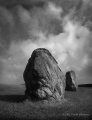
A standing stone with dimensions similar to a modern headstone, about 3 feet high, standing alone on the mountain top.
No indication of its existence is found on the OS 1:25,000 map or in Ancient Monuments of the UK
Photograph available
You may be viewing yesterday's version of this page. To see the most up to date information please register for a free account.
Do not use the above information on other web sites or publications without permission of the contributor.
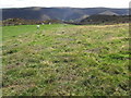
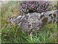
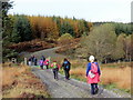
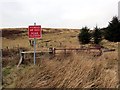
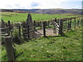
Nearby Images from Geograph Britain and Ireland:
©2009(licence)
©2023(licence)
©2015(licence)
©2015(licence)
©2009(licence)
The above images may not be of the site on this page, they are loaded from Geograph.
Please Submit an Image of this site or go out and take one for us!
Click here to see more info for this site
Nearby sites
Key: Red: member's photo, Blue: 3rd party photo, Yellow: other image, Green: no photo - please go there and take one, Grey: site destroyed
Download sites to:
KML (Google Earth)
GPX (GPS waypoints)
CSV (Garmin/Navman)
CSV (Excel)
To unlock full downloads you need to sign up as a Contributory Member. Otherwise downloads are limited to 50 sites.
Turn off the page maps and other distractions
Nearby sites listing. In the following links * = Image available
382m NW 309° Cefn Gwenffrwd Maenhir* Standing Stone (Menhir) (SN75514725)
1.7km SE 132° Gelli Burial Chamber* Chambered Cairn (SN7703845843)
2.1km ESE 118° Ty Newydd Standing Stone* Standing Stone (Menhir) (SN776460)
2.6km N 356° Cefn Cnwcheithinog* Standing Stone (Menhir) (SN757496)
3.1km NW 317° Cefn Gwernffrwd Row* Stone Row / Alignment (SN7370049328)
3.1km NW 317° Cefn Gwernffrwd stone circle* Stone Circle (SN7370049328)
3.2km SW 223° Mynydd Mallaen* Standing Stone (Menhir) (SN73564471)
3.3km SW 233° Maen Bach* Standing Stone (Menhir) (SN73084507)
3.4km WNW 285° Esgair Nant-y-Maen cairn* Ring Cairn (SN72544798)
3.8km WSW 246° Crugiau Merched Cairn 2 Cairn (SN72324557)
3.8km WSW 246° Crugiau Merched* Cairn (SN72274555)
3.9km WSW 246° Crugiau Merched, Cairn 1* Cairn (SN72214553)
4.3km SSE 153° Dinas Bach (Cilycwm)* Hillfort (SN77704310)
4.4km E 95° Cerrig Cedny* Cairn (SN80144651)
4.4km ESE 112° Carn Wen (Rhandirmwyn)* Cairn (SN79834527)
4.6km E 97° Carn Twrch* Cairn (SN80344630)
4.7km ESE 103° Carreg Craig y Moch Standing Stone (Menhir) (SN804458)
5.2km ESE 122° Cerrig Cynant* Stone Circle (SN80114411)
5.3km SE 136° Garreg Garn Fair* Standing Stone (Menhir) (SN79334310)
5.3km SE 137° Garn fawr (Carmarthenshire)* Cairn (SN79334304)
5.3km SE 125° Bryn Poeth Uchaf (North & South)* Ring Cairn (SN80054382)
5.5km E 81° Cefn Ystrad Ffin Cairn* Cairn (SN81234776)
5.6km SW 232° Rhiwgaregog Standing Stone (recumbent)* Standing Stone (Menhir) (SN71274364)
5.7km SW 231° Rhiw Garegog Standing Stone II* Standing Stone (Menhir) (SN71264349)
5.7km SW 227° Rhiw Garegog Scoop Grave 2 Misc. Earthwork (SN71474323)
View more nearby sites and additional images


 We would like to know more about this location. Please feel free to add a brief description and any relevant information in your own language.
 Wir möchten mehr über diese Stätte erfahren. Bitte zögern Sie nicht, eine kurze Beschreibung und relevante Informationen in Deutsch hinzuzufügen.
 Nous aimerions en savoir encore un peu sur les lieux. S'il vous plaît n'hesitez pas à ajouter une courte description et tous les renseignements pertinents dans votre propre langue.
 Quisieramos informarnos un poco más de las lugares. No dude en añadir una breve descripción y otros datos relevantes en su propio idioma.