


<< Our Photo Pages >> Castlecreavie Settlement - Ancient Village or Settlement in Scotland in Dumfries and Galloway
Submitted by SolarMegalith on Tuesday, 04 October 2016 Page Views: 1494
Multi-periodSite Name: Castlecreavie Settlement Alternative Name: Castle CreavieCountry: Scotland County: Dumfries and Galloway Type: Ancient Village or Settlement
Nearest Town: Kirkcudbright
Map Ref: NX72374925
Latitude: 54.821788N Longitude: 3.988005W
Condition:
| 5 | Perfect |
| 4 | Almost Perfect |
| 3 | Reasonable but with some damage |
| 2 | Ruined but still recognisable as an ancient site |
| 1 | Pretty much destroyed, possibly visible as crop marks |
| 0 | No data. |
| -1 | Completely destroyed |
| 5 | Superb |
| 4 | Good |
| 3 | Ordinary |
| 2 | Not Good |
| 1 | Awful |
| 0 | No data. |
| 5 | Can be driven to, probably with disabled access |
| 4 | Short walk on a footpath |
| 3 | Requiring a bit more of a walk |
| 2 | A long walk |
| 1 | In the middle of nowhere, a nightmare to find |
| 0 | No data. |
| 5 | co-ordinates taken by GPS or official recorded co-ordinates |
| 4 | co-ordinates scaled from a detailed map |
| 3 | co-ordinates scaled from a bad map |
| 2 | co-ordinates of the nearest village |
| 1 | co-ordinates of the nearest town |
| 0 | no data |
Internal Links:
External Links:
I have visited· I would like to visit
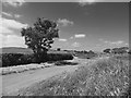
markj99 visited on 24th May 2021 - their rating: Cond: 3 Amb: 4 Access: 4 Castlecreavie Settlement is situated on the road to Castlecreavie Farm between Kirkcudbright and Dundrennan. There is room to park at NX 72424 49258, c. 500 yards up the narrow road to Castlecreavie Farm. There is a style leading up to Castlecreavie Settlement. The natural hillock has an enclosure measuring c. 75 yards NE-SW and 40 yards NW-SE. There are remains of a c. 4 feet rampart on the SW and NE of the enclosure. There are steep slopes all round except for the SW which slopes away at a shallow angle. There is a prominent terrace from c. 12 to 15 feet wide round the settlement, except on the SW side.
SolarMegalith visited on 23rd Sep 2016 - their rating: Cond: 2 Amb: 4 Access: 5
Average ratings for this site from all visit loggers: Condition: 2.5 Ambience: 4 Access: 4.5
")
Remains of a settlement are located on a natural hillock NW of Castlecreavie dun. The rampart is in best condition in the northern part of the settlement. Below the settlement there is a terrace of 3-4m width.
For more information see Canmore entry 64427 which adds: Although this may be contemporary with the settlement it has clearly been used for later cultivation. The interior is featureless. The absence of multiple ramparts across the naturally weak SW side argues for this being a settlement rather than a fort."
You may be viewing yesterday's version of this page. To see the most up to date information please register for a free account.
")
")
")
Do not use the above information on other web sites or publications without permission of the contributor.
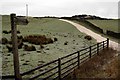
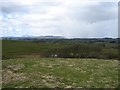
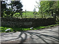
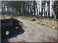
Nearby Images from Geograph Britain and Ireland:
©2010(licence)
©2008(licence)
©2009(licence)
©2008(licence)
©2013(licence)
The above images may not be of the site on this page, they are loaded from Geograph.
Please Submit an Image of this site or go out and take one for us!
Click here to see more info for this site
Nearby sites
Key: Red: member's photo, Blue: 3rd party photo, Yellow: other image, Green: no photo - please go there and take one, Grey: site destroyed
Download sites to:
KML (Google Earth)
GPX (GPS waypoints)
CSV (Garmin/Navman)
CSV (Excel)
To unlock full downloads you need to sign up as a Contributory Member. Otherwise downloads are limited to 50 sites.
Turn off the page maps and other distractions
Nearby sites listing. In the following links * = Image available
353m SSE 150° Castlecreavie Dun* Stone Fort or Dun (NX72544894)
358m SSE 147° Castlecreavie Rock Art* Rock Art (NX7255748944)
498m N 11° Bombie 2* Rock Art (NX7248049736)
586m NNE 11° Bombie 3* Rock Art (NX7250349821)
662m N 9° Bombie North* Rock Art (NX7249449901)
694m N 352° Bombie 1 Rock Art (NX72294994)
1.0km ESE 110° Newlaw Hill* Rock Art (NX73324887)
1.3km SW 232° Galtway Hill Cairn (NX71294845)
1.5km WSW 257° High Banks Farm* Rock Art (NX70914895)
1.9km W 275° High Banks Northern Cairn* Cairn (NX70454947)
2.0km W 271° High Banks Southern Cairn* Cairn (NX70394934)
3.5km SW 229° Townhead* Rock Art (NX69644705)
3.6km NNW 333° Culdoach* Rock Art (NX70835250)
3.9km WSW 242° Grange 3 (Dumfries and Galloway)* Rock Art (NX6883947526)
3.9km WNW 290° Kirkcudbright Standing Stones* Standing Stones (NX6870450736)
4.0km SW 228° Blackhill Cottage* Rock Art (NX69334663)
4.2km W 281° Butter Well (Kirkcudbright) Holy Well or Sacred Spring (NX6821250148)
4.3km ESE 122° St Glassen's Well (Rerrick) Holy Well or Sacred Spring (NX75964691)
4.3km WNW 293° Soaperie Gardens Well (Kirkcudbright)* Holy Well or Sacred Spring (NX6843251039)
4.3km WNW 290° Stewartry Museum* Museum (NX68335086)
4.6km WNW 289° Mercat Cross (Kirkcudbright)* Ancient Cross (NX6807650896)
4.9km SW 225° Drummore Castle* Stone Circle (NX688459)
4.9km SW 225° Drummore* Stone Circle (NX688459)
5.0km SW 224° Drummore Hillfort* Hillfort (NX688458)
5.0km NW 324° Carse Moat* Hillfort (NX69555336)
View more nearby sites and additional images


 We would like to know more about this location. Please feel free to add a brief description and any relevant information in your own language.
 Wir möchten mehr über diese Stätte erfahren. Bitte zögern Sie nicht, eine kurze Beschreibung und relevante Informationen in Deutsch hinzuzufügen.
 Nous aimerions en savoir encore un peu sur les lieux. S'il vous plaît n'hesitez pas à ajouter une courte description et tous les renseignements pertinents dans votre propre langue.
 Quisieramos informarnos un poco más de las lugares. No dude en añadir una breve descripción y otros datos relevantes en su propio idioma.