


<< Text Pages >> Bombie 1 - Rock Art in Scotland in Dumfries and Galloway
Submitted by SolarMegalith on Thursday, 13 October 2016 Page Views: 1450
Rock ArtSite Name: Bombie 1Country: Scotland County: Dumfries and Galloway Type: Rock Art
Nearest Town: Kirkcudbright
Map Ref: NX72294994
Latitude: 54.827964N Longitude: 3.989554W
Condition:
| 5 | Perfect |
| 4 | Almost Perfect |
| 3 | Reasonable but with some damage |
| 2 | Ruined but still recognisable as an ancient site |
| 1 | Pretty much destroyed, possibly visible as crop marks |
| 0 | No data. |
| -1 | Completely destroyed |
| 5 | Superb |
| 4 | Good |
| 3 | Ordinary |
| 2 | Not Good |
| 1 | Awful |
| 0 | No data. |
| 5 | Can be driven to, probably with disabled access |
| 4 | Short walk on a footpath |
| 3 | Requiring a bit more of a walk |
| 2 | A long walk |
| 1 | In the middle of nowhere, a nightmare to find |
| 0 | No data. |
| 5 | co-ordinates taken by GPS or official recorded co-ordinates |
| 4 | co-ordinates scaled from a detailed map |
| 3 | co-ordinates scaled from a bad map |
| 2 | co-ordinates of the nearest village |
| 1 | co-ordinates of the nearest town |
| 0 | no data |
Internal Links:
External Links:
Rock Art in Dumfries and Galloway
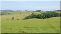
A turf-covered cup with seven rings located few meters west of an old quarry.
Canmore entry.
You may be viewing yesterday's version of this page. To see the most up to date information please register for a free account.
Do not use the above information on other web sites or publications without permission of the contributor.
Nearby Images from Geograph Britain and Ireland:
©2018(licence)
©2010(licence)
©2018(licence)
©2013(licence)
©2013(licence)
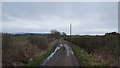
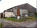
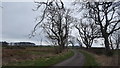
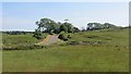
The above images may not be of the site on this page, they are loaded from Geograph.
Please Submit an Image of this site or go out and take one for us!
Click here to see more info for this site
Nearby sites
Key: Red: member's photo, Blue: 3rd party photo, Yellow: other image, Green: no photo - please go there and take one, Grey: site destroyed
Download sites to:
KML (Google Earth)
GPX (GPS waypoints)
CSV (Garmin/Navman)
CSV (Excel)
To unlock full downloads you need to sign up as a Contributory Member. Otherwise downloads are limited to 50 sites.
Turn off the page maps and other distractions
Nearby sites listing. In the following links * = Image available
207m E 99° Bombie North* Rock Art (NX7249449901)
243m ESE 118° Bombie 3* Rock Art (NX7250349821)
278m SE 135° Bombie 2* Rock Art (NX7248049736)
694m S 172° Castlecreavie Settlement* Ancient Village or Settlement (NX72374925)
1.0km SSE 164° Castlecreavie Dun* Stone Fort or Dun (NX72544894)
1.0km SSE 163° Castlecreavie Rock Art* Rock Art (NX7255748944)
1.5km SE 135° Newlaw Hill* Rock Art (NX73324887)
1.7km SW 233° High Banks Farm* Rock Art (NX70914895)
1.8km SSW 212° Galtway Hill Cairn (NX71294845)
1.9km WSW 254° High Banks Northern Cairn* Cairn (NX70454947)
2.0km WSW 251° High Banks Southern Cairn* Cairn (NX70394934)
2.9km NNW 329° Culdoach* Rock Art (NX70835250)
3.7km W 281° Kirkcudbright Standing Stones* Standing Stones (NX6870450736)
3.9km SW 221° Townhead* Rock Art (NX69644705)
4.0km WNW 284° Soaperie Gardens Well (Kirkcudbright)* Holy Well or Sacred Spring (NX6843251039)
4.1km WNW 281° Stewartry Museum* Museum (NX68335086)
4.1km W 271° Butter Well (Kirkcudbright) Holy Well or Sacred Spring (NX6821250148)
4.2km SW 233° Grange 3 (Dumfries and Galloway)* Rock Art (NX6883947526)
4.3km W 281° Mercat Cross (Kirkcudbright)* Ancient Cross (NX6807650896)
4.4km NW 320° Carse Moat* Hillfort (NX69555336)
4.4km SW 220° Blackhill Cottage* Rock Art (NX69334663)
4.7km SE 128° St Glassen's Well (Rerrick) Holy Well or Sacred Spring (NX75964691)
5.1km WSW 256° Monk's Well (Kirkcudbright) Holy Well or Sacred Spring (NX6730048892)
5.3km SW 219° Drummore Castle* Stone Circle (NX688459)
5.3km SW 219° Drummore* Stone Circle (NX688459)
View more nearby sites and additional images


 We would like to know more about this location. Please feel free to add a brief description and any relevant information in your own language.
 Wir möchten mehr über diese Stätte erfahren. Bitte zögern Sie nicht, eine kurze Beschreibung und relevante Informationen in Deutsch hinzuzufügen.
 Nous aimerions en savoir encore un peu sur les lieux. S'il vous plaît n'hesitez pas à ajouter une courte description et tous les renseignements pertinents dans votre propre langue.
 Quisieramos informarnos un poco más de las lugares. No dude en añadir una breve descripción y otros datos relevantes en su propio idioma.