


<< Our Photo Pages >> Woolhanger henge - Henge in England in Devon
Submitted by Bladup on Thursday, 25 September 2014 Page Views: 2832
Neolithic and Bronze AgeSite Name: Woolhanger hengeCountry: England County: Devon Type: Henge
Map Ref: SS692449
Latitude: 51.188314N Longitude: 3.873039W
Condition:
| 5 | Perfect |
| 4 | Almost Perfect |
| 3 | Reasonable but with some damage |
| 2 | Ruined but still recognisable as an ancient site |
| 1 | Pretty much destroyed, possibly visible as crop marks |
| 0 | No data. |
| -1 | Completely destroyed |
| 5 | Superb |
| 4 | Good |
| 3 | Ordinary |
| 2 | Not Good |
| 1 | Awful |
| 0 | No data. |
| 5 | Can be driven to, probably with disabled access |
| 4 | Short walk on a footpath |
| 3 | Requiring a bit more of a walk |
| 2 | A long walk |
| 1 | In the middle of nowhere, a nightmare to find |
| 0 | No data. |
| 5 | co-ordinates taken by GPS or official recorded co-ordinates |
| 4 | co-ordinates scaled from a detailed map |
| 3 | co-ordinates scaled from a bad map |
| 2 | co-ordinates of the nearest village |
| 1 | co-ordinates of the nearest town |
| 0 | no data |
Internal Links:
External Links:
")
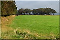
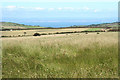
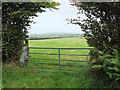
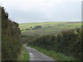
Pastscape says - SS 692449 Class 1 Henge Monument, Parracombe Common. A circular earthwork with an internal ditch which has been almost obliterated by ploughing. It has an overall diameter of 130 feet and is bisected by a hedge bank to the north-east of which the enclosure bank still survives to a height of 1 foot. It is not possible to establish the number of entrances with any degree of certainty but it seems likely that this is a Class 1 Henge.
You may be viewing yesterday's version of this page. To see the most up to date information please register for a free account.
")
")
")
")
Do not use the above information on other web sites or publications without permission of the contributor.
Nearby Images from Geograph Britain and Ireland:
©2021(licence)
©2007(licence)
©2017(licence)
©2017(licence)
©2017(licence)
The above images may not be of the site on this page, they are loaded from Geograph.
Please Submit an Image of this site or go out and take one for us!
Click here to see more info for this site
Nearby sites
Key: Red: member's photo, Blue: 3rd party photo, Yellow: other image, Green: no photo - please go there and take one, Grey: site destroyed
Download sites to:
KML (Google Earth)
GPX (GPS waypoints)
CSV (Garmin/Navman)
CSV (Excel)
To unlock full downloads you need to sign up as a Contributory Member. Otherwise downloads are limited to 50 sites.
Turn off the page maps and other distractions
Nearby sites listing. In the following links * = Image available
1.5km SSE 155° Chapman Barrows* Barrow Cemetery (SS698435)
1.6km W 280° Parracombe Standing Stone* Standing Stone (Menhir) (SS67654522)
1.7km SSE 158° Chapman Barrows Quincunx* Standing Stones (SS69794333)
1.9km SSE 153° Chapman Down Barrow* Round Barrow(s) (SS700432)
2.2km SE 143° Longstone (Challacombe)* Standing Stone (Menhir) (SS70514307)
2.3km ESE 116° Thornworthy Little Common* Stone Row / Alignment (SS71264381)
2.6km SE 143° Longstone Barrow* Round Barrow(s) (SS707428)
2.7km E 89° Ilkerton Ridge Barrows* Barrow Cemetery (SS719449)
2.8km SE 145° Longstone Barrow Row* Stone Row / Alignment (SS70774252)
2.9km E 92° Ilkerton Ridge stones* Standing Stones (SS72074475)
3.1km SE 130° Woodbarrow Hangings* Multiple Stone Rows / Avenue (SS71514283)
3.3km ESE 109° Winnaway* Stone Row / Alignment (SS72264376)
3.4km SE 134° Woodbarrow (Exmoor)* Round Barrow(s) (SS716425)
3.4km SE 137° Woodbarrow Stone Setting* Multiple Stone Rows / Avenue (SS71474233)
3.7km E 99° Warcombe Water row* Stone Row / Alignment (SS72864424)
3.7km E 100° Warcombe Water stone* Standing Stone (Menhir) (SS72854417)
3.9km ESE 111° Benjamy* Stone Row / Alignment (SS72804344)
4.0km E 96° Furzehill Common Barrow* Round Barrow(s) (SS732444)
4.0km SW 228° Brockenburrow Lane S Stone Row / Alignment (SS661423)
4.1km WNW 291° Heale Down* Standing Stone (Menhir) (SS65384645)
4.1km E 94° Furzehill Common 0* Standing Stones (SS73324451)
4.2km E 94° Furzehill Common cairn* Cairn (SS73444451)
4.4km NE 52° Long Stone (Lyn Down)* Standing Stones (SS7272247528)
4.4km ESE 101° Furzehill Common 1* Stone Row / Alignment (SS7351843922)
4.5km W 280° West Middleton Multiple Stone Rows / Avenue (SS648458)
View more nearby sites and additional images


 We would like to know more about this location. Please feel free to add a brief description and any relevant information in your own language.
 Wir möchten mehr über diese Stätte erfahren. Bitte zögern Sie nicht, eine kurze Beschreibung und relevante Informationen in Deutsch hinzuzufügen.
 Nous aimerions en savoir encore un peu sur les lieux. S'il vous plaît n'hesitez pas à ajouter une courte description et tous les renseignements pertinents dans votre propre langue.
 Quisieramos informarnos un poco más de las lugares. No dude en añadir una breve descripción y otros datos relevantes en su propio idioma.