


<< Our Photo Pages >> Nant-Y-Gaseg modern stone circle - Modern Stone Circle etc in Wales in Carmarthenshire
Submitted by Enki on Wednesday, 12 October 2022 Page Views: 508
Modern SitesSite Name: Nant-Y-Gaseg modern stone circleCountry: Wales
NOTE: This site is 1.7 km away from the location you searched for.
County: Carmarthenshire Type: Modern Stone Circle etc
Map Ref: SN7063408515
Latitude: 51.760332N Longitude: 3.875844W
Condition:
| 5 | Perfect |
| 4 | Almost Perfect |
| 3 | Reasonable but with some damage |
| 2 | Ruined but still recognisable as an ancient site |
| 1 | Pretty much destroyed, possibly visible as crop marks |
| 0 | No data. |
| -1 | Completely destroyed |
| 5 | Superb |
| 4 | Good |
| 3 | Ordinary |
| 2 | Not Good |
| 1 | Awful |
| 0 | No data. |
| 5 | Can be driven to, probably with disabled access |
| 4 | Short walk on a footpath |
| 3 | Requiring a bit more of a walk |
| 2 | A long walk |
| 1 | In the middle of nowhere, a nightmare to find |
| 0 | No data. |
| 5 | co-ordinates taken by GPS or official recorded co-ordinates |
| 4 | co-ordinates scaled from a detailed map |
| 3 | co-ordinates scaled from a bad map |
| 2 | co-ordinates of the nearest village |
| 1 | co-ordinates of the nearest town |
| 0 | no data |
Internal Links:
External Links:
")
On Nant-Y-Gaseg farm, nr. Pontardawe, SA8 4SY
The farm has holiday accommodation listed as The Old Barn At Nant Y Gaseg Farm and advertises the stone circle as one of the features of the site.
Circle built by Ros Briagha and stonedancers.co.uk
You may be viewing yesterday's version of this page. To see the most up to date information please register for a free account.
")
")
Do not use the above information on other web sites or publications without permission of the contributor.
Nearby Images from Geograph Britain and Ireland:
©2020(licence)
©2019(licence)
©2020(licence)
©2008(licence)
©2013(licence)
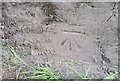
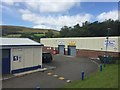
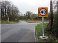
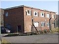
The above images may not be of the site on this page, they are loaded from Geograph.
Please Submit an Image of this site or go out and take one for us!
Click here to see more info for this site
Nearby sites
Key: Red: member's photo, Blue: 3rd party photo, Yellow: other image, Green: no photo - please go there and take one, Grey: site destroyed
Download sites to:
KML (Google Earth)
GPX (GPS waypoints)
CSV (Garmin/Navman)
CSV (Excel)
To unlock full downloads you need to sign up as a Contributory Member. Otherwise downloads are limited to 50 sites.
Turn off the page maps and other distractions
Nearby sites listing. In the following links * = Image available
2.0km NW 313° Llety'r-crydd cairn cemetery* Barrow Cemetery (SN69200991)
2.2km NW 310° Bancbryn platform cairn* Cairn (SN68950998)
2.4km SSW 200° Carn Llechart Cairn Circle* Ring Cairn (SN69730627)
2.4km SSW 202° Carn Llechart Chambered Tomb* Chambered Tomb (SN69670627)
2.5km NW 315° Mynydd y Betws* Stone Row / Alignment (SN6893610326)
2.6km E 82° Cefn Gwrhyd Stone* Standing Stone (Menhir) (SN732088)
2.6km NW 309° Bancbryn cairn cemetery* Barrow Cemetery (SN68631021)
2.7km NE 38° Pen Y Waun NW 2 Cairn* Cairn (SN7234810576)
2.7km NE 37° Pen Y Waun NW 1 Cairn* Cairn (SN7231810629)
2.9km SSW 198° Carn Llechart Megalithic Complex* Modern Stone Circle etc (SN69670576)
3.0km NW 320° Plas-y-coed cairns* Barrow Cemetery (SN68771089)
3.4km SSE 148° Llangiwg* Holy Well or Sacred Spring (SN72380559)
3.9km NE 46° Brynmelyn Quarry Cairn 1* Cairn (SN7353211152)
4.0km NE 48° Brynmelyn Quarry Cairn 2* Cairn (SN73661113)
4.1km WNW 295° Henrhyd Cairns* Cairn (SN66991033)
4.1km WNW 297° Llech Yr Halen Marker Stone (SN670105)
4.2km NE 51° Pen Rhiw fawr Standing Stone* Standing Stone (Menhir) (SN740111)
4.3km NE 55° Pen Rhiw Fawr Cairn* Cairn (SN7424410863)
5.6km NW 308° Bodyst Uchaf ring cairn* Ring Cairn (SN66281213)
6.0km ENE 70° Ffynnon Ddrewllyd* Holy Well or Sacred Spring (SN764104)
6.1km W 266° Pentwyn Mawr Round Cairn (SN64530826)
6.4km SE 146° Rhos Standing Stones* Standing Stones (SN741031)
6.7km W 263° Blaenffynhonnau Hut Circle Ancient Village or Settlement (SN63900783)
7.4km N 357° Deg Arbedd* Cairn (SN70501591)
7.6km W 259° Graig Fawr (East) Burnt Mound Misc. Earthwork (SN63080729)
View more nearby sites and additional images


 We would like to know more about this location. Please feel free to add a brief description and any relevant information in your own language.
 Wir möchten mehr über diese Stätte erfahren. Bitte zögern Sie nicht, eine kurze Beschreibung und relevante Informationen in Deutsch hinzuzufügen.
 Nous aimerions en savoir encore un peu sur les lieux. S'il vous plaît n'hesitez pas à ajouter une courte description et tous les renseignements pertinents dans votre propre langue.
 Quisieramos informarnos un poco más de las lugares. No dude en añadir una breve descripción y otros datos relevantes en su propio idioma.