


<< Our Photo Pages >> Grange 3 (Dumfries and Galloway) - Rock Art in Scotland in Dumfries and Galloway
Submitted by wolfnighthunter on Sunday, 23 November 2008 Page Views: 7792
Rock ArtSite Name: Grange 3 (Dumfries and Galloway)Country: Scotland County: Dumfries and Galloway Type: Rock Art
Nearest Town: Kirkcudbright Nearest Village: Townhead
Map Ref: NX6883947526
Latitude: 54.805393N Longitude: 4.042143W
Condition:
| 5 | Perfect |
| 4 | Almost Perfect |
| 3 | Reasonable but with some damage |
| 2 | Ruined but still recognisable as an ancient site |
| 1 | Pretty much destroyed, possibly visible as crop marks |
| 0 | No data. |
| -1 | Completely destroyed |
| 5 | Superb |
| 4 | Good |
| 3 | Ordinary |
| 2 | Not Good |
| 1 | Awful |
| 0 | No data. |
| 5 | Can be driven to, probably with disabled access |
| 4 | Short walk on a footpath |
| 3 | Requiring a bit more of a walk |
| 2 | A long walk |
| 1 | In the middle of nowhere, a nightmare to find |
| 0 | No data. |
| 5 | co-ordinates taken by GPS or official recorded co-ordinates |
| 4 | co-ordinates scaled from a detailed map |
| 3 | co-ordinates scaled from a bad map |
| 2 | co-ordinates of the nearest village |
| 1 | co-ordinates of the nearest town |
| 0 | no data |
Internal Links:
External Links:
 (PID:44088)")
This prehistoric cup and ring marked rock is on Dam Park Grange private land, please contact me should you wish to visit this site.
This rock with its special motif based around four tear drop cups linked and surrounded by rings is recorded as Canmore ID 63889.
Nearby are some other cup and ring mark rocks - see Canmore ID 63889 which tells us these panels are "located 260 metres west south west of the road and 9 metres north east of the south west hedge of the second field south the Grange"
The latter Canmore entry tells us that in 1979, six carved outcrop sheets had been discovered: " (a) has four cups-and-one-gapped-ring; at least one has a radial groove from its cup; also twelve cups. (b) has a cup-and-one-ring, also a single cup. (c) has two cups-and-one-gapped-ring, three cups in a broken-off oval 29cm by 14cm, and five cups. (d) has two cups-and-one-ring. (e) has four cups-and-one-gapped-ring, two with a radial groove from the cup, also another four cups. (f), not visible in 1969-76 and probably turfed over, 'on the summit rock' has four cups-and-one-incomplete-ring, two cups inside an oval, with a third cup as 'runner' in the groove, two long grooves and twelve cups. A further rock, NW of the others, bears a single cupmark."
In 1989 a further panel was discovered between outcrops a-e and f.
You may be viewing yesterday's version of this page. To see the most up to date information please register for a free account.
 (PID:44087)")
Do not use the above information on other web sites or publications without permission of the contributor.
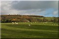
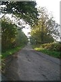
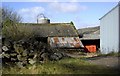
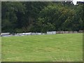
Nearby Images from Geograph Britain and Ireland:
©2011(licence)
©2005(licence)
©2008(licence)
©2010(licence)
©2010(licence)
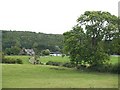
The above images may not be of the site on this page, they are loaded from Geograph.
Please Submit an Image of this site or go out and take one for us!
Click here to see more info for this site
Nearby sites
Key: Red: member's photo, Blue: 3rd party photo, Yellow: other image, Green: no photo - please go there and take one, Grey: site destroyed
Download sites to:
KML (Google Earth)
GPX (GPS waypoints)
CSV (Garmin/Navman)
CSV (Excel)
To unlock full downloads you need to sign up as a Contributory Member. Otherwise downloads are limited to 50 sites.
Turn off the page maps and other distractions
Nearby sites listing. In the following links * = Image available
929m ESE 119° Townhead* Rock Art (NX69644705)
1.0km SSE 150° Blackhill Cottage* Rock Art (NX69334663)
1.6km S 180° Drummore Castle* Stone Circle (NX688459)
1.6km S 180° Drummore* Stone Circle (NX688459)
1.7km S 180° Drummore Hillfort* Hillfort (NX688458)
1.8km SSW 204° Torrs 2* Rock Art (NX68054586)
2.1km NW 310° Monk's Well (Kirkcudbright) Holy Well or Sacred Spring (NX6730048892)
2.4km NE 39° High Banks Southern Cairn* Cairn (NX70394934)
2.5km SSW 200° Torrs 3* Rock Art (NX67924522)
2.5km NE 54° High Banks Farm* Rock Art (NX70914895)
2.5km NE 38° High Banks Northern Cairn* Cairn (NX70454947)
2.6km ENE 68° Galtway Hill Cairn (NX71294845)
2.6km SSW 195° Knockshinnie Stone Circle (NX681450)
2.7km S 179° Craikness Hill 1* Rock Art (NX6879644847)
2.7km NNW 345° Butter Well (Kirkcudbright) Holy Well or Sacred Spring (NX6821250148)
2.8km S 173° Little Balmae Stone Circle (NX691447)
3.2km N 356° Kirkcudbright Standing Stones* Standing Stones (NX6870450736)
3.4km N 350° Stewartry Museum* Museum (NX68335086)
3.5km NNW 346° Mercat Cross (Kirkcudbright)* Ancient Cross (NX6807650896)
3.5km N 352° Soaperie Gardens Well (Kirkcudbright)* Holy Well or Sacred Spring (NX6843251039)
3.9km SSE 161° St Margaret's Well (Kirkcudbright) Holy Well or Sacred Spring (NX69994378)
3.9km ENE 62° Castlecreavie Settlement* Ancient Village or Settlement (NX72374925)
4.0km ENE 67° Castlecreavie Dun* Stone Fort or Dun (NX72544894)
4.0km ENE 67° Castlecreavie Rock Art* Rock Art (NX7255748944)
4.2km NE 53° Bombie 1 Rock Art (NX72294994)
View more nearby sites and additional images


 We would like to know more about this location. Please feel free to add a brief description and any relevant information in your own language.
 Wir möchten mehr über diese Stätte erfahren. Bitte zögern Sie nicht, eine kurze Beschreibung und relevante Informationen in Deutsch hinzuzufügen.
 Nous aimerions en savoir encore un peu sur les lieux. S'il vous plaît n'hesitez pas à ajouter une courte description et tous les renseignements pertinents dans votre propre langue.
 Quisieramos informarnos un poco más de las lugares. No dude en añadir una breve descripción y otros datos relevantes en su propio idioma.