 with our Megalithic Portal iPhone app")


<< Our Photo Pages >> Drummore Hillfort - Hillfort in Scotland in Dumfries and Galloway
Submitted by nicoladidsbury on Thursday, 03 June 2004 Page Views: 5001
Iron Age and Later PrehistorySite Name: Drummore HillfortCountry: Scotland
NOTE: This site is 0.5 km away from the location you searched for.
County: Dumfries and Galloway Type: Hillfort
Map Ref: NX688458 Landranger Map Number: 83
Latitude: 54.789882N Longitude: 4.041968W
Condition:
| 5 | Perfect |
| 4 | Almost Perfect |
| 3 | Reasonable but with some damage |
| 2 | Ruined but still recognisable as an ancient site |
| 1 | Pretty much destroyed, possibly visible as crop marks |
| 0 | No data. |
| -1 | Completely destroyed |
| 5 | Superb |
| 4 | Good |
| 3 | Ordinary |
| 2 | Not Good |
| 1 | Awful |
| 0 | No data. |
| 5 | Can be driven to, probably with disabled access |
| 4 | Short walk on a footpath |
| 3 | Requiring a bit more of a walk |
| 2 | A long walk |
| 1 | In the middle of nowhere, a nightmare to find |
| 0 | No data. |
| 5 | co-ordinates taken by GPS or official recorded co-ordinates |
| 4 | co-ordinates scaled from a detailed map |
| 3 | co-ordinates scaled from a bad map |
| 2 | co-ordinates of the nearest village |
| 1 | co-ordinates of the nearest town |
| 0 | no data |
Internal Links:
External Links:
I have visited· I would like to visit
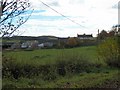
markj99 visited on 17th Jan 2019 - their rating: Cond: 3 Amb: 3 Access: 3 Drummore Castle is in a commanding defensive location with a view to the coast. The trees are blurring the edges of the double ditch and rampart defences. There is no evidence of occupation on the enclosure. The fort is 300m South of Drummore Stone Circle, up the slope and obscured by trees.
")
We recently visited Drummore Castle and stone circle. This is an extract from the "Old Kirkcudbright Website" , taken from a description of a walk in 1876. Visit the remains of an ancient British Fort, situated on the farm of Drummore, and supposed to be the Caerbantorigum of Ptolemy, a name said to signify in the ancient British language "the fort on the conspicuous height." Whatever other purposes this encampment may have been designed to serve, it must have been well adapted for a look-out station. From its elevated position it commands an extensive prospect of the surrounding country, and overlooks the Solway Firth and the Irish Sea. The two primitive tribes which held the province of Galloway are known in history as the Novantes and the Selgovae. The Novantes possessed the portion lying between the Dee and the Irish Sea, extending on the north as far as the chain of hills which now separates Galloway from Ayrshire. The Selgovae inhabited the eastern part of Galloway, as far as the Dee, which was their western boundary. To both of these tribes belonged many forts, particularly along the Dee, numerous vestiges of which are still observable in this district. The most important in size and strength, however, is Caerbantorigum, which may be considered to have been their frontier garrison. Chalmers, in his learned work Caledonia, the first volume of which was published in 1807, says - "This was in situation, size, and strength, one of the most important British fortresses in this country. It is of an oval form, and a rampart composed of stone and earth with a deep fosse surround it, which remain pretty entire." At the present time the site of the fort is quite discernible, the rampart and fosse being easily traced. At the bottom of the hill was a well, now covered with stones, which is thought to have supplied the garrison with water. A plate of gold is said to have been found in the neighbourhood of the fortress, on the lands of Balmae, by some men engaged in making ditches; it is supposed, however, that it had probably been deposited here long after the erection of the fort. There was a circle of large stones at the foot of the hill, of the kind popularly known as Druidical, but a few years ago they were split up and removed for building purposes. (Only four stones remain). About a mile and a half from Drummore Hill, on the farm of Milton, there are the remains of a British fort, which, like other native encampments, is of a circular form; and on Bombie Mains, and near Whinnyligget, not far from Kirkcudbright, there are two Roman camps in the vicinity of many small British forts. The views from this stone circle are incredible, although the area is very strange, as it is in the middle of MoD restricted access areas.
You may be viewing yesterday's version of this page. To see the most up to date information please register for a free account.
")
")
")
")
Do not use the above information on other web sites or publications without permission of the contributor.
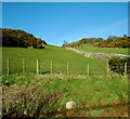
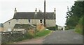
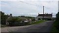
Nearby Images from Geograph Britain and Ireland:
©2010(licence)
©2007(licence)
©2022(licence)
©2017(licence)
©2010(licence)
The above images may not be of the site on this page, they are loaded from Geograph.
Please Submit an Image of this site or go out and take one for us!
Click here to see more info for this site
Nearby sites
Key: Red: member's photo, Blue: 3rd party photo, Yellow: other image, Green: no photo - please go there and take one, Grey: site destroyed
Download sites to:
KML (Google Earth)
GPX (GPS waypoints)
CSV (Garmin/Navman)
CSV (Excel)
To unlock full downloads you need to sign up as a Contributory Member. Otherwise downloads are limited to 50 sites.
Turn off the page maps and other distractions
Nearby sites listing. In the following links * = Image available
100m N 358° Drummore Castle* Stone Circle (NX688459)
100m N 358° Drummore* Stone Circle (NX688459)
750m W 273° Torrs 2* Rock Art (NX68054586)
952m S 179° Craikness Hill 1* Rock Art (NX6879644847)
983m NNE 31° Blackhill Cottage* Rock Art (NX69334663)
1.1km SW 235° Torrs 3* Rock Art (NX67924522)
1.1km SW 219° Knockshinnie Stone Circle (NX681450)
1.1km SSE 163° Little Balmae Stone Circle (NX691447)
1.5km NNE 32° Townhead* Rock Art (NX69644705)
1.7km N 360° Grange 3 (Dumfries and Galloway)* Rock Art (NX6883947526)
2.3km SSE 148° St Margaret's Well (Kirkcudbright) Holy Well or Sacred Spring (NX69994378)
3.4km NNW 333° Monk's Well (Kirkcudbright) Holy Well or Sacred Spring (NX6730048892)
3.6km NE 41° Galtway Hill Cairn (NX71294845)
3.8km NNE 32° High Banks Farm* Rock Art (NX70914895)
3.9km NNE 22° High Banks Southern Cairn* Cairn (NX70394934)
4.0km NNE 22° High Banks Northern Cairn* Cairn (NX70454947)
4.4km N 351° Butter Well (Kirkcudbright) Holy Well or Sacred Spring (NX6821250148)
4.5km WNW 287° Clauchandolly 8* Rock Art (NX64474722)
4.6km WNW 285° Clauchandolly 6 Rock Art (NX64384711)
4.7km WNW 285° Clauchandolly 1* Rock Art (NX64244714)
4.8km W 265° Brighouse* Standing Stone (Menhir) (NX64024555)
4.9km NE 48° Castlecreavie Dun* Stone Fort or Dun (NX72544894)
4.9km NE 48° Castlecreavie Rock Art* Rock Art (NX7255748944)
4.9km N 357° Kirkcudbright Standing Stones* Standing Stones (NX6870450736)
5.0km NE 44° Castlecreavie Settlement* Ancient Village or Settlement (NX72374925)
View more nearby sites and additional images


 We would like to know more about this location. Please feel free to add a brief description and any relevant information in your own language.
 Wir möchten mehr über diese Stätte erfahren. Bitte zögern Sie nicht, eine kurze Beschreibung und relevante Informationen in Deutsch hinzuzufügen.
 Nous aimerions en savoir encore un peu sur les lieux. S'il vous plaît n'hesitez pas à ajouter une courte description et tous les renseignements pertinents dans votre propre langue.
 Quisieramos informarnos un poco más de las lugares. No dude en añadir una breve descripción y otros datos relevantes en su propio idioma.