


<< Text Pages >> Meuryn Isaf - Cairn in Wales in Gwynedd
Submitted by postman on Wednesday, 23 July 2014 Page Views: 1623
Neolithic and Bronze AgeSite Name: Meuryn IsafCountry: Wales County: Gwynedd Type: Cairn
Nearest Town: Llanfairfechan Nearest Village: Abergwyngregyn
Map Ref: SH671709
Latitude: 53.218482N Longitude: 3.991894W
Condition:
| 5 | Perfect |
| 4 | Almost Perfect |
| 3 | Reasonable but with some damage |
| 2 | Ruined but still recognisable as an ancient site |
| 1 | Pretty much destroyed, possibly visible as crop marks |
| 0 | No data. |
| -1 | Completely destroyed |
| 5 | Superb |
| 4 | Good |
| 3 | Ordinary |
| 2 | Not Good |
| 1 | Awful |
| 0 | No data. |
| 5 | Can be driven to, probably with disabled access |
| 4 | Short walk on a footpath |
| 3 | Requiring a bit more of a walk |
| 2 | A long walk |
| 1 | In the middle of nowhere, a nightmare to find |
| 0 | No data. |
| 5 | co-ordinates taken by GPS or official recorded co-ordinates |
| 4 | co-ordinates scaled from a detailed map |
| 3 | co-ordinates scaled from a bad map |
| 2 | co-ordinates of the nearest village |
| 1 | co-ordinates of the nearest town |
| 0 | no data |
Internal Links:
External Links:
Cairn in Gwynedd
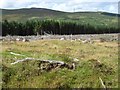
This is a pretty good kerb cairn, some stones are gone, some are still contiguous, some are over a foot tall and some are just peeping above the grass. One long stone occupies a central depression, probably from the exhausted cist.
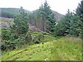
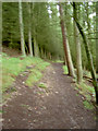
It's a long and laborious walk from the car park at Aber Falls, but the monument is worthy of a bit of exercise. The views would have been very nice, had we not been in low and deep cloud.
Do not believe the map, the cairn is on the west side of the T junction in the forest. Unless the heather gets higher you will be able to spot it, but no body cares for it so the heather will get higher and the stones will disappear.
You may be viewing yesterday's version of this page. To see the most up to date information please register for a free account.
")
")
")
")
")
Do not use the above information on other web sites or publications without permission of the contributor.
Nearby Images from Geograph Britain and Ireland:
©2006(licence)
©2006(licence)
©2008(licence)
©2009(licence)
©2009(licence)
The above images may not be of the site on this page, they are loaded from Geograph.
Please Submit an Image of this site or go out and take one for us!
Click here to see more info for this site
Nearby sites
Key: Red: member's photo, Blue: 3rd party photo, Yellow: other image, Green: no photo - please go there and take one, Grey: site destroyed
Download sites to:
KML (Google Earth)
GPX (GPS waypoints)
CSV (Garmin/Navman)
CSV (Excel)
To unlock full downloads you need to sign up as a Contributory Member. Otherwise downloads are limited to 50 sites.
Turn off the page maps and other distractions
Nearby sites listing. In the following links * = Image available
628m SSW 213° Coed Aber Roundhouse* Ancient Village or Settlement (SH6674570381)
813m NNE 19° Anafon Valley Cairns* Cairn (SH67397166)
935m NE 39° Foel Dduarth (West)* Ancient Village or Settlement (SH67717161)
1.0km NNE 27° Wern-y-Pandy Settlement* Ancient Village or Settlement (SH676718)
1.1km NE 40° Carnedd y Saeson* Cairn (SH6783471738)
1.2km NE 45° Foel Dduarth (Centre)* Ancient Village or Settlement (SH68007174)
1.3km NNE 24° Bod-Silin Cairns* Barrow Cemetery (SH67647205)
1.5km NE 37° Nant y Felin-fach Cairn* Cairn (SH68027203)
1.5km NE 46° Foel Dduarth (East)* Ancient Village or Settlement (SH68217191)
1.7km W 268° Cras (Gwynedd)* Cairn (SH65397089)
1.8km NNW 332° Maes Y Gaer* Hillfort (SH663725)
1.9km W 263° Cairn N of Moel Wnion* Cairn (SH65197071)
2.0km NE 47° Foel Ganol* Cairn (SH68597221)
2.2km E 86° Afon Anafon Arrow Stone* Sculptured Stone (SH69267098)
2.4km NE 55° Carn yr Llechwedd* Cairn (SH691722)
2.4km WSW 239° Moel Wnion (Gwynedd)* Cairn (SH64966971)
2.6km NE 54° Ffridd Newydd Arrow stones* Rock Art (SH69237238)
2.7km ENE 57° Maen Ffordd Rufeinig* Standing Stone (Menhir) (SH694723)
3.0km SSW 194° Drosgl* Cairn (SH663680)
3.2km NE 44° Garreg Fawr* Carving (SH6939373132)
3.6km E 93° Carnedd y Ddelw* Clava Cairn (SH707706)
3.7km SW 233° Hut Circle at Twll Pant Hiriol* Ancient Village or Settlement (SH641688)
3.9km ENE 72° Llanerch Fedw* Cairn (SH709720)
4.0km ESE 108° Carnedd Penyborth Goch Cairn Cairn (SH70846959)
4.1km NE 43° Dinas Settlement* Ancient Village or Settlement (SH700738)
View more nearby sites and additional images


 We would like to know more about this location. Please feel free to add a brief description and any relevant information in your own language.
 Wir möchten mehr über diese Stätte erfahren. Bitte zögern Sie nicht, eine kurze Beschreibung und relevante Informationen in Deutsch hinzuzufügen.
 Nous aimerions en savoir encore un peu sur les lieux. S'il vous plaît n'hesitez pas à ajouter une courte description et tous les renseignements pertinents dans votre propre langue.
 Quisieramos informarnos un poco más de las lugares. No dude en añadir una breve descripción y otros datos relevantes en su propio idioma.