


<< Text Pages >> Cairn Edward Well (Kells) - Holy Well or Sacred Spring in Scotland in Dumfries and Galloway
Submitted by Anne T on Saturday, 25 June 2022 Page Views: 408
Springs and Holy WellsSite Name: Cairn Edward Well (Kells)Country: Scotland
NOTE: This site is 3.5 km away from the location you searched for.
County: Dumfries and Galloway Type: Holy Well or Sacred Spring
Nearest Town: New Galloway Nearest Village: Corselands
Map Ref: NX6343073408
Latitude: 55.036370N Longitude: 4.138531W
Condition:
| 5 | Perfect |
| 4 | Almost Perfect |
| 3 | Reasonable but with some damage |
| 2 | Ruined but still recognisable as an ancient site |
| 1 | Pretty much destroyed, possibly visible as crop marks |
| 0 | No data. |
| -1 | Completely destroyed |
| 5 | Superb |
| 4 | Good |
| 3 | Ordinary |
| 2 | Not Good |
| 1 | Awful |
| 0 | No data. |
| 5 | Can be driven to, probably with disabled access |
| 4 | Short walk on a footpath |
| 3 | Requiring a bit more of a walk |
| 2 | A long walk |
| 1 | In the middle of nowhere, a nightmare to find |
| 0 | No data. |
| 5 | co-ordinates taken by GPS or official recorded co-ordinates |
| 4 | co-ordinates scaled from a detailed map |
| 3 | co-ordinates scaled from a bad map |
| 2 | co-ordinates of the nearest village |
| 1 | co-ordinates of the nearest town |
| 0 | no data |
Be the first person to rate this site - see the 'Contribute!' box in the right hand menu.
Internal Links:
External Links:
Holy Well or Sacred Spring in Dumfries and Galloway
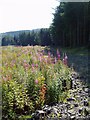
From the Google Earth images, this well is in the middle of no-where, on the eastern side of Cairn Edward Hill, to the west of Loch Ken, in the parish of Kells.
Information about this well has been collected by the Can You Dig It: Lost Wells of Galloway (LWoG) project, who tell us that this well first appeared on the 1st edition Ordnance Survey 6-inch map of 1853, and "continues to appear through to current mapping (2022)."
Keith Hamblin, the LWoG researcher quotes from the OS name book, which describes this as: "a chalybeate well on the [?] of Clone and situated near the east base of Cairn Edward (Hill) hence the name. This well was much frequented too by diseased persons to which its water had proved beneficial." There is no record on Canmore for this site.
If anyone has visited this well and has photographs, we'd welcome contributions to this site page. Or if you have any information about what diseases the water was used to treat, please let us know by adding a comment here. Thank you.
The Lost Wells of Galloway project is a community project, "setting out to map and better understand lost wells in Galloway, considering how we relate to these historic features now and how this has changed over time".
You may be viewing yesterday's version of this page. To see the most up to date information please register for a free account.
Do not use the above information on other web sites or publications without permission of the contributor.
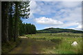
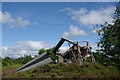
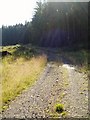
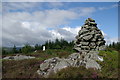
Nearby Images from Geograph Britain and Ireland:
©2008(licence)
©2008(licence)
©2007(licence)
©2008(licence)
©2007(licence)
The above images may not be of the site on this page, they are loaded from Geograph.
Please Submit an Image of this site or go out and take one for us!
Click here to see more info for this site
Nearby sites
Key: Red: member's photo, Blue: 3rd party photo, Yellow: other image, Green: no photo - please go there and take one, Grey: site destroyed
Download sites to:
KML (Google Earth)
GPX (GPS waypoints)
CSV (Garmin/Navman)
CSV (Excel)
To unlock full downloads you need to sign up as a Contributory Member. Otherwise downloads are limited to 50 sites.
Turn off the page maps and other distractions
Nearby sites listing. In the following links * = Image available
799m NW 314° Milldown Well (Kells) Holy Well or Sacred Spring (NX6287273982)
2.6km SSE 165° Loch Stroan Stone Circle (NX640709)
4.5km N 349° Physic Well (Kells) Holy Well or Sacred Spring (NX6270677877)
4.9km N 9° Lady's Well (Balmaclellan) Holy Well or Sacred Spring (NX6435678263)
5.8km N 3° Dalarran Holm* Standing Stone (Menhir) (NX6388179164)
8.2km ESE 114° St Ninian's Well (Parton) Holy Well or Sacred Spring (NX7079369806)
8.5km S 169° Lochenbreck Well (Balmaghie) Holy Well or Sacred Spring (NX6479065025)
8.8km WNW 288° Clatteringshaws Loch Roundhouse* Ancient Village or Settlement (NX5513176340)
9.0km S 175° Spa Well (Balmaghie) Holy Well or Sacred Spring (NX6400964416)
9.0km WNW 291° Bruce's Stone (Clatteringshaws)* Natural Stone / Erratic / Other Natural Feature (NX55107696)
10.6km W 275° Clatteringshaws White Cairn* Cairn (NX52867458)
11.0km NNE 24° Corriedoo* Cairn (NX6814083327)
12.3km SSE 165° Lairdmannoch* Stone Circle (NX66286143)
13.4km NNE 28° Spa Well (Dalry) Holy Well or Sacred Spring (NX7009385098)
13.4km N 352° Mackilston S* Cairn (NX61968678)
13.5km N 352° Mackilston N* Cairn (NX61968682)
13.8km SSE 156° Giant's Dike* Hillfort (NX68736065)
14.2km NNW 340° Stroangassel Stone Circle (NX589869)
14.7km WSW 243° Cairnsmore of Fleet* Cairn (NX50116704)
14.8km SW 235° Knee of Cairnsmore* Cairn (NX50946539)
15.0km SE 127° Greenlaw Cairn (NX75186404)
15.0km WSW 247° Billy Marshall's Cave* Cave or Rock Shelter (NX494679)
15.5km SE 134° Little Wood Hill* Causewayed Enclosure (NX7433862318)
15.8km NNW 331° Physic Well (Kells) Holy Well or Sacred Spring (NX5622587525)
16.3km NNE 32° Hole Stone (Blackmark)* Standing Stone (Menhir) (NX72568698)
View more nearby sites and additional images


 We would like to know more about this location. Please feel free to add a brief description and any relevant information in your own language.
 Wir möchten mehr über diese Stätte erfahren. Bitte zögern Sie nicht, eine kurze Beschreibung und relevante Informationen in Deutsch hinzuzufügen.
 Nous aimerions en savoir encore un peu sur les lieux. S'il vous plaît n'hesitez pas à ajouter une courte description et tous les renseignements pertinents dans votre propre langue.
 Quisieramos informarnos un poco más de las lugares. No dude en añadir una breve descripción y otros datos relevantes en su propio idioma.