 with our Megalithic Portal iPhone app")


<< Our Photo Pages >> Lower Glasscombe - Cist in England in Devon
Submitted by Anne T on Sunday, 16 October 2016 Page Views: 1529
Neolithic and Bronze AgeSite Name: Lower Glasscombe Alternative Name: Lower Glass Combe; Grinsell Ugborough 11; Dixon 106; Butler Glaze Meet (V4 56.3)Country: England County: Devon Type: Cist
Nearest Town: Ivybridge Nearest Village: Harford / South Brent
Map Ref: SX6650660502
Latitude: 50.429155N Longitude: 3.880843W
Condition:
| 5 | Perfect |
| 4 | Almost Perfect |
| 3 | Reasonable but with some damage |
| 2 | Ruined but still recognisable as an ancient site |
| 1 | Pretty much destroyed, possibly visible as crop marks |
| 0 | No data. |
| -1 | Completely destroyed |
| 5 | Superb |
| 4 | Good |
| 3 | Ordinary |
| 2 | Not Good |
| 1 | Awful |
| 0 | No data. |
| 5 | Can be driven to, probably with disabled access |
| 4 | Short walk on a footpath |
| 3 | Requiring a bit more of a walk |
| 2 | A long walk |
| 1 | In the middle of nowhere, a nightmare to find |
| 0 | No data. |
| 5 | co-ordinates taken by GPS or official recorded co-ordinates |
| 4 | co-ordinates scaled from a detailed map |
| 3 | co-ordinates scaled from a bad map |
| 2 | co-ordinates of the nearest village |
| 1 | co-ordinates of the nearest town |
| 0 | no data |
Be the first person to rate this site - see the 'Contribute!' box in the right hand menu.
Internal Links:
External Links:
")
This site is featured on Prehistoric Dartmoor Walks (PDW)website as the Lower Glasscombe Cist. Their notes tell us: "there is a very slight trace of a mound and scattered rocks indicate the remains of a cairn ... Only one sidestone and one endstone now remain with the coverstone lying 11 feet away to the south-east. Overall dimensions of the coverstone are 49 inches by 24 inches". Also see PDW's page for the The Neolithic tombs of Cuckoo Ball & Corringdon Ball.
Further information can be found on Pastscape, Monument Number 441989, which adds: (this is) "a cist (which) lies some 400 feet up the lower slopes of Glass Combe Ball, from the West Glaze Brook, and 1000 feet upstream from Glaze Meet."
The cist is also recorded as MDV5652 (Cist north-west of Glazemeet) on the Devon and Dartmoor HER. This site is not a Scheduled Ancient Monument.
You may be viewing yesterday's version of this page. To see the most up to date information please register for a free account.
Do not use the above information on other web sites or publications without permission of the contributor.
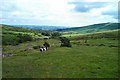
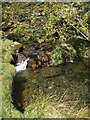
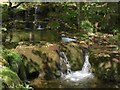
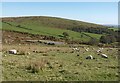
Nearby Images from Geograph Britain and Ireland:
©2006(licence)
©2011(licence)
©2011(licence)

©2010(licence)
©2010(licence)
The above images may not be of the site on this page, they are loaded from Geograph.
Please Submit an Image of this site or go out and take one for us!
Click here to see more info for this site
Nearby sites
Key: Red: member's photo, Blue: 3rd party photo, Yellow: other image, Green: no photo - please go there and take one, Grey: site destroyed
Download sites to:
KML (Google Earth)
GPX (GPS waypoints)
CSV (Garmin/Navman)
CSV (Excel)
To unlock full downloads you need to sign up as a Contributory Member. Otherwise downloads are limited to 50 sites.
Turn off the page maps and other distractions
Nearby sites listing. In the following links * = Image available
504m NW 305° Glasscombe Ball NE* Multiple Stone Rows / Avenue (SX6610060802)
515m WNW 285° Glasscombe Corner SW Terminal Cairn* Cairn (SX6601060646)
524m WNW 290° Glasscombe Corner Stone Row* Stone Row / Alignment (SX6601660691)
548m SSE 160° Scad Brook* Ancient Village or Settlement (SX6667759981)
582m NE 48° Corringdon Ball settlement* Ancient Village or Settlement (SX66956088)
674m N 7° Corringdon Ball* Multiple Stone Rows / Avenue (SX6660761169)
711m N 9° Corringdon Ball Central* Multiple Stone Rows / Avenue (SX66646120)
715m N 7° Corringdon Ball N.* Stone Row / Alignment (SX66616121)
721m W 266° Glasscombe Ball North (North Cairn)* Cairn (SX6578360473)
725m NNE 13° Corringdon Ball South* Multiple Stone Rows / Avenue (SX6668461205)
730m N 11° Corringdon Ball Multiple Cairn Circle* Cairn (SX6666561215)
733m NNE 12° Corringdon Ball S.E.* Stone Circle (SX6667961215)
756m N 7° Corringdon Ball Cairns* Cairn (SX66626125)
772m NNW 348° Upper Glazebrook* Ancient Village or Settlement (SX66366126)
774m W 263° Glasscombe Ball North* Stone Row / Alignment (SX6573360429)
779m W 262° Glasscombe Ball North (South Cairn)* Cairn (SX65736041)
798m SW 227° Spurrell's Cross* Ancient Cross (SX65915997)
871m NW 313° Piles Hill NE* Multiple Stone Rows / Avenue (SX65886111)
901m SW 226° Spurrells Cross Row* Multiple Stone Rows / Avenue (SX6583759896)
902m NNE 20° Brent Fore Hill* Multiple Stone Rows / Avenue (SX66846134)
908m SW 224° Spurrell's Cross Row Terminal Cairn Cairn (SX6585859864)
917m NNE 27° Corringdon Ball Tomb* Chambered Tomb (SX6694561308)
922m NNE 21° Brent Forehill Encircled Cairn* Cairn (SX6685461356)
946m NNE 30° Ball Gate* Ring Cairn (SX67006131)
994m W 267° Hobajons Cross* Standing Stone (Menhir) (SX65516047)
View more nearby sites and additional images


 We would like to know more about this location. Please feel free to add a brief description and any relevant information in your own language.
 Wir möchten mehr über diese Stätte erfahren. Bitte zögern Sie nicht, eine kurze Beschreibung und relevante Informationen in Deutsch hinzuzufügen.
 Nous aimerions en savoir encore un peu sur les lieux. S'il vous plaît n'hesitez pas à ajouter une courte description et tous les renseignements pertinents dans votre propre langue.
 Quisieramos informarnos un poco más de las lugares. No dude en añadir una breve descripción y otros datos relevantes en su propio idioma.