 with our Megalithic Portal iPhone app")


<< Text Pages >> Kyleoag Chambered Cairn - Chambered Cairn in Scotland in Sutherland
Submitted by coldrum on Tuesday, 06 May 2008 Page Views: 4885
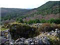
Neolithic and Bronze AgeSite Name: Kyleoag Chambered CairnCountry: Scotland County: Sutherland Type: Chambered Cairn
Map Ref: NH662911
Latitude: 57.889213N Longitude: 4.258503W
Condition:
| 5 | Perfect |
| 4 | Almost Perfect |
| 3 | Reasonable but with some damage |
| 2 | Ruined but still recognisable as an ancient site |
| 1 | Pretty much destroyed, possibly visible as crop marks |
| 0 | No data. |
| -1 | Completely destroyed |
| 5 | Superb |
| 4 | Good |
| 3 | Ordinary |
| 2 | Not Good |
| 1 | Awful |
| 0 | No data. |
| 5 | Can be driven to, probably with disabled access |
| 4 | Short walk on a footpath |
| 3 | Requiring a bit more of a walk |
| 2 | A long walk |
| 1 | In the middle of nowhere, a nightmare to find |
| 0 | No data. |
| 5 | co-ordinates taken by GPS or official recorded co-ordinates |
| 4 | co-ordinates scaled from a detailed map |
| 3 | co-ordinates scaled from a bad map |
| 2 | co-ordinates of the nearest village |
| 1 | co-ordinates of the nearest town |
| 0 | no data |
Be the first person to rate this site - see the 'Contribute!' box in the right hand menu.
Internal Links:
External Links:
Chambered Cairn in Sutherland
Chambered Cairn.
http://www.ambaile.org.uk/smr/item/item_archaeology.jsp?item_id=9885
You may be viewing yesterday's version of this page. To see the most up to date information please register for a free account.
Do not use the above information on other web sites or publications without permission of the contributor.
Nearby Images from Geograph Britain and Ireland:
©2009(licence)
©2021(licence)
©2016(licence)
©2022(licence)
©2007(licence)
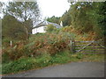
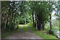
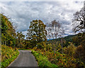
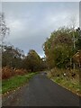
The above images may not be of the site on this page, they are loaded from Geograph.
Please Submit an Image of this site or go out and take one for us!
Click here to see more info for this site
Nearby sites
Key: Red: member's photo, Blue: 3rd party photo, Yellow: other image, Green: no photo - please go there and take one, Grey: site destroyed
Download sites to:
KML (Google Earth)
GPX (GPS waypoints)
CSV (Garmin/Navman)
CSV (Excel)
To unlock full downloads you need to sign up as a Contributory Member. Otherwise downloads are limited to 50 sites.
Turn off the page maps and other distractions
Nearby sites listing. In the following links * = Image available
897m E 88° Achaidh Chambered Cairn* Chambered Cairn (NH671911)
1.2km ESE 123° Allt nan Eun Chambered Cairn Chambered Cairn (NH672904)
1.2km ESE 123° Cairn, Fairy Glen, Bailenacile Cairn (NH672904)
3.2km SW 232° St Demhan's Cross* Early Christian Sculptured Stone (NH636892)
3.8km W 276° Loch Migdale Henge (NH62429160)
4.2km SSE 149° Ardvannie* Chambered Cairn (NH68238740)
4.3km S 185° Dun Alascaig Broch or Nuraghe (NH65698682)
5.6km SSE 155° Lower Lechanich North Chambered Tomb (NH684859)
5.7km ESE 105° Clach a' Charra* Standing Stone (Menhir) (NH7164789493)
5.7km SSE 156° Lower Lechanich South Chambered Tomb (NH684858)
5.9km SSE 159° Leachonich Broch or Nuraghe (NH68128546)
7.3km W 259° Carn Deasgan Broch or Nuraghe (NH5990)
7.6km SE 141° Edderton 1* Class I Pictish Symbol Stone (NH70828507)
7.6km SE 140° Edderton Stone Circle* Cairn (NH70908511)
8.9km SE 139° Edderton 2 Class III Pictish Cross Slab (NH7190984203)
9.0km NNE 27° Strath Tollidh* Broch or Nuraghe (NH705990)
10.1km SE 138° Red Burn Chambered Cairn (NH72788341)
10.3km WNW 301° Invershin Farm* Standing Stone (Menhir) (NH5760796742)
10.5km SE 135° Edderton Hill Cairn (NH734834)
11.3km W 267° Gruinards Broch or Nuraghe (NH549908)
11.5km NE 41° Carn Liath (Dornoch) Chambered Cairn (NH74119945)
11.8km NE 46° Thor's Tower Broch or Nuraghe (NH7599)
12.4km ENE 73° Skelbo Wood Broch or Nuraghe (NH78209443)
12.4km NW 320° Auchinduich* Stone Circle (NC58450084)
13.1km SSE 147° Morangie Forest Chambered Cairn (NH729798)
View more nearby sites and additional images


 We would like to know more about this location. Please feel free to add a brief description and any relevant information in your own language.
 Wir möchten mehr über diese Stätte erfahren. Bitte zögern Sie nicht, eine kurze Beschreibung und relevante Informationen in Deutsch hinzuzufügen.
 Nous aimerions en savoir encore un peu sur les lieux. S'il vous plaît n'hesitez pas à ajouter une courte description et tous les renseignements pertinents dans votre propre langue.
 Quisieramos informarnos un poco más de las lugares. No dude en añadir una breve descripción y otros datos relevantes en su propio idioma.