<< Our Photo Pages >> Shovel Down row 5 - Multiple Stone Rows / Avenue in England in Devon
Submitted by TheCaptain on Saturday, 16 October 2004 Page Views: 5703
Neolithic and Bronze AgeSite Name: Shovel Down row 5 Alternative Name: Shoveldown ECountry: England County: Devon Type: Multiple Stone Rows / Avenue
Nearest Town: Chagford Nearest Village: Teigncombe
Map Ref: SX66028581 Landranger Map Number: 191
Latitude: 50.656514N Longitude: 3.896788W
Condition:
| 5 | Perfect |
| 4 | Almost Perfect |
| 3 | Reasonable but with some damage |
| 2 | Ruined but still recognisable as an ancient site |
| 1 | Pretty much destroyed, possibly visible as crop marks |
| 0 | No data. |
| -1 | Completely destroyed |
| 5 | Superb |
| 4 | Good |
| 3 | Ordinary |
| 2 | Not Good |
| 1 | Awful |
| 0 | No data. |
| 5 | Can be driven to, probably with disabled access |
| 4 | Short walk on a footpath |
| 3 | Requiring a bit more of a walk |
| 2 | A long walk |
| 1 | In the middle of nowhere, a nightmare to find |
| 0 | No data. |
| 5 | co-ordinates taken by GPS or official recorded co-ordinates |
| 4 | co-ordinates scaled from a detailed map |
| 3 | co-ordinates scaled from a bad map |
| 2 | co-ordinates of the nearest village |
| 1 | co-ordinates of the nearest town |
| 0 | no data |
Internal Links:
External Links:
I have visited· I would like to visit
Catrinm would like to visit
Anne T visited on 16th May 2019 - their rating: Cond: 3 Amb: 4 Access: 3 Shovel Down Row 5: Having been a little mystified by trying to find Rows 3 and 1, and having to rely on Sandy G to point out a few of the ground-level small stones, to find this stone row, running towards the Longstone, was really good. Glorious views over to Kes Tor, although it was still a little misty to get great photos.
graemefield visited on 15th May 2016 - their rating: Cond: 2 Amb: 4 Access: 3
SandyG visited on 28th Apr 2013 - their rating: Cond: 3 Amb: 5 Access: 4 Car parking is available at SX 66205 86548. From here head SSW across open moorland to the stone rows.
TheCaptain have visited here
Average ratings for this site from all visit loggers: Condition: 2.67 Ambience: 4.33 Access: 3.33

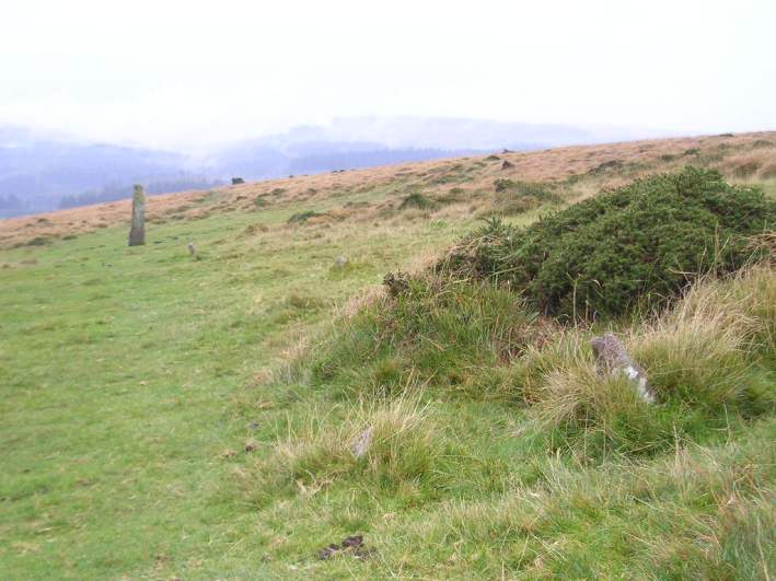
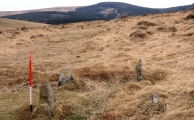
Shovel Down double stone row 5 runs southwards from the top of the hill above where row 4 finishes, towards The Longstone, about 150 metres away.
Apart from a couple of nice pairs of stones at the upper end, most of the stones in this avenue are either small and mostly buried in the turf, or have been removed, although traces of the row can be seen almost right to the Longstone. There are no traces of a cairn at its upper, northern, end where one would be expected.
Update November 2019: This row is recorded as row E in Pastscape's entry for Monument No. 443524, as MDV6179 (Alignment E on Shovel Down) on the Devon and Dartmoor HER and scheduled as part of Historic England List Entry No. 1017874 (The North Teign coaxial field system (western part) and associated later remains at Shovel Down, Stonetor Hill and Long Ridge).
It also features on Prehistoric Dartmoor Walks - see their entries for Shoveldown E-F (rows 5 and 6) and the Shovel Down Complex.
For a description, plan of the monuments in this area showing their relationship to each other, plus photographs, access information and a list of online resource for more information, also see The Stone Rows of Great Britain's entry for Shoveldown 5.
You may be viewing yesterday's version of this page. To see the most up to date information please register for a free account.


Do not use the above information on other web sites or publications without permission of the contributor.
Click here to see more info for this site
Nearby sites
Key: Red: member's photo, Blue: 3rd party photo, Yellow: other image, Green: no photo - please go there and take one, Grey: site destroyed
Download sites to:
KML (Google Earth)
GPX (GPS waypoints)
CSV (Garmin/Navman)
CSV (Excel)
To unlock full downloads you need to sign up as a Contributory Member. Otherwise downloads are limited to 50 sites.
Turn off the page maps and other distractions
Nearby sites listing. In the following links * = Image available
82m NNW 345° Shovel Down Cairn Row 4* Cairn (SX66008589)
130m S 174° The Longstone (Shovel Down)* Standing Stone (Menhir) (SX66038568)
146m NNW 343° Shovel Down row 4* Multiple Stone Rows / Avenue (SX65988595)
193m NNW 337° Shovel Down* Multiple Stone Rows / Avenue (SX65958599)
211m S 184° Shovel Down row 6* Multiple Stone Rows / Avenue (SX660856)
231m NNW 341° Shovel Down Fourfold Circle* Stone Circle (SX65958603)
237m WNW 291° Shovel Down Settlement* Ancient Village or Settlement (SX658859)
330m S 177° Three Boys* Standing Stone (Menhir) (SX66038548)
361m SSE 164° Thornworthy Corner North Cist (SX66118546)
373m NNW 338° Shovel Down row 3* Multiple Stone Rows / Avenue (SX65898616)
390m N 356° Shovel Down row 1* Stone Row / Alignment (SX660862)
396m NNW 348° Shovel Down row 2* Multiple Stone Rows / Avenue (SX65958620)
410m S 181° Shovel Down row 7* Multiple Stone Rows / Avenue (SX660854)
438m NNW 331° Shovel Down stone circle* Stone Circle (SX65828620)
692m NE 46° Kes Tor Cairn* Cairn (SX6653286277)
707m NE 47° Kes Tor Rock Basin* Natural Stone / Erratic / Other Natural Feature (SX66558628)
727m NE 43° Kestor Settlement* Ancient Village or Settlement (SX66538633)
759m WSW 255° Stonetor Brookhead East Cist (SX65288563)
840m WSW 245° Stonetor Hill Cairn Circle* Cairn (SX6525085470)
947m WSW 239° Stonetor Hill Stone Ring Cairn Circle Ring Cairn (SX65198535)
1.0km SE 138° Thornworthy Down Stone Row / Alignment (SX66688505)
1.0km NE 44° Modern Stone Circle near Kestor Rock* Modern Stone Circle etc (SX66748652)
1.1km NNE 18° The Round Pound* Ancient Village or Settlement (SX66398685)
1.4km NNW 336° The Tolmen Stone (Dartmoor)* Natural Stone / Erratic / Other Natural Feature (SX65508708)
1.5km NNW 337° Scorhill Cairn and Rows* Multiple Stone Rows / Avenue (SX65488721)
View more nearby sites and additional images


 We would like to know more about this location. Please feel free to add a brief description and any relevant information in your own language.
 Wir möchten mehr über diese Stätte erfahren. Bitte zögern Sie nicht, eine kurze Beschreibung und relevante Informationen in Deutsch hinzuzufügen.
 Nous aimerions en savoir encore un peu sur les lieux. S'il vous plaît n'hesitez pas à ajouter une courte description et tous les renseignements pertinents dans votre propre langue.
 Quisieramos informarnos un poco más de las lugares. No dude en añadir una breve descripción y otros datos relevantes en su propio idioma.