


<< Text Pages >> Dun Alascaig - Broch or Nuraghe in Scotland in Highlands
Submitted by SolarMegalith on Tuesday, 20 December 2011 Page Views: 2919
Iron Age and Later PrehistorySite Name: Dun Alascaig Alternative Name: Dun Alisaig, Dun AliscaigCountry: Scotland
NOTE: This site is 1.5 km away from the location you searched for.
County: Highlands Type: Broch or Nuraghe
Map Ref: NH65698682
Latitude: 57.850647N Longitude: 4.264682W
Condition:
| 5 | Perfect |
| 4 | Almost Perfect |
| 3 | Reasonable but with some damage |
| 2 | Ruined but still recognisable as an ancient site |
| 1 | Pretty much destroyed, possibly visible as crop marks |
| 0 | No data. |
| -1 | Completely destroyed |
| 5 | Superb |
| 4 | Good |
| 3 | Ordinary |
| 2 | Not Good |
| 1 | Awful |
| 0 | No data. |
| 5 | Can be driven to, probably with disabled access |
| 4 | Short walk on a footpath |
| 3 | Requiring a bit more of a walk |
| 2 | A long walk |
| 1 | In the middle of nowhere, a nightmare to find |
| 0 | No data. |
| 5 | co-ordinates taken by GPS or official recorded co-ordinates |
| 4 | co-ordinates scaled from a detailed map |
| 3 | co-ordinates scaled from a bad map |
| 2 | co-ordinates of the nearest village |
| 1 | co-ordinates of the nearest town |
| 0 | no data |
Internal Links:
External Links:
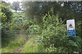
Broch in Highlands
Remains of a broch of 17.3 m diameter. 18th century sources claim, that the walls were standing up to 4.5 m high.
Read More at Canmore.
You may be viewing yesterday's version of this page. To see the most up to date information please register for a free account.
Do not use the above information on other web sites or publications without permission of the contributor.
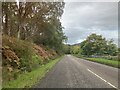
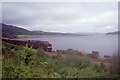
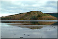
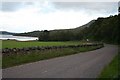
Nearby Images from Geograph Britain and Ireland:
©2022(licence)
©2009(licence)
©2015(licence)
©2006(licence)
©2015(licence)
The above images may not be of the site on this page, they are loaded from Geograph.
Please Submit an Image of this site or go out and take one for us!
Click here to see more info for this site
Nearby sites
Key: Red: member's photo, Blue: 3rd party photo, Yellow: other image, Green: no photo - please go there and take one, Grey: site destroyed
Download sites to:
KML (Google Earth)
GPX (GPS waypoints)
CSV (Garmin/Navman)
CSV (Excel)
To unlock full downloads you need to sign up as a Contributory Member. Otherwise downloads are limited to 50 sites.
Turn off the page maps and other distractions
Nearby sites listing. In the following links * = Image available
2.6km ENE 75° Ardvannie* Chambered Cairn (NH68238740)
2.8km ESE 117° Leachonich Broch or Nuraghe (NH68128546)
2.9km ESE 107° Lower Lechanich North Chambered Tomb (NH684859)
2.9km ESE 109° Lower Lechanich South Chambered Tomb (NH684858)
3.2km NW 317° St Demhan's Cross* Early Christian Sculptured Stone (NH636892)
3.9km NNE 21° Cairn, Fairy Glen, Bailenacile Cairn (NH672904)
3.9km NNE 21° Allt nan Eun Chambered Cairn Chambered Cairn (NH672904)
4.3km N 5° Kyleoag Chambered Cairn Chambered Cairn (NH662911)
4.5km NNE 16° Achaidh Chambered Cairn* Chambered Cairn (NH671911)
5.4km ESE 107° Edderton 1* Class I Pictish Symbol Stone (NH70828507)
5.5km ESE 106° Edderton Stone Circle* Cairn (NH70908511)
5.8km NW 324° Loch Migdale Henge (NH62429160)
6.5km ENE 64° Clach a' Charra* Standing Stone (Menhir) (NH7164789493)
6.7km ESE 111° Edderton 2 Class III Pictish Cross Slab (NH7190984203)
7.4km WNW 294° Carn Deasgan Broch or Nuraghe (NH5990)
7.8km ESE 114° Red Burn Chambered Cairn (NH72788341)
8.4km ESE 112° Edderton Hill Cairn (NH734834)
10.0km SE 132° Morangie Forest Chambered Cairn (NH729798)
11.1km S 190° Baldoon Chambered Cairn (NH63317591)
11.5km WNW 288° Gruinards Broch or Nuraghe (NH549908)
12.0km SE 146° Scotsburn Wood West Chambered Tomb (NH721767)
12.1km SSE 150° Scotsburn House Dun* Stone Fort or Dun (NH71487616)
12.1km SSE 149° Scotsburn House Chambered Cairn Chambered Cairn (NH71537618)
12.1km SE 144° Scotsburn Wood East Chambered Tomb (NH726768)
12.2km SSE 158° Kinrive West Chambered Cairn (NH69937538)
View more nearby sites and additional images


 We would like to know more about this location. Please feel free to add a brief description and any relevant information in your own language.
 Wir möchten mehr über diese Stätte erfahren. Bitte zögern Sie nicht, eine kurze Beschreibung und relevante Informationen in Deutsch hinzuzufügen.
 Nous aimerions en savoir encore un peu sur les lieux. S'il vous plaît n'hesitez pas à ajouter une courte description et tous les renseignements pertinents dans votre propre langue.
 Quisieramos informarnos un poco más de las lugares. No dude en añadir una breve descripción y otros datos relevantes en su propio idioma.