


<< Text Pages >> Glenbanchor - Cairn in Scotland in Moray
Submitted by vicky on Tuesday, 12 August 2003 Page Views: 5633
Neolithic and Bronze AgeSite Name: GlenbanchorCountry: Scotland
NOTE: This site is 3.1 km away from the location you searched for.
County: Moray Type: Cairn
Nearest Village: Newtonmore
Map Ref: NN678994 Landranger Map Number: 35
Latitude: 57.066602N Longitude: 4.181886W
Condition:
| 5 | Perfect |
| 4 | Almost Perfect |
| 3 | Reasonable but with some damage |
| 2 | Ruined but still recognisable as an ancient site |
| 1 | Pretty much destroyed, possibly visible as crop marks |
| 0 | No data. |
| -1 | Completely destroyed |
| 5 | Superb |
| 4 | Good |
| 3 | Ordinary |
| 2 | Not Good |
| 1 | Awful |
| 0 | No data. |
| 5 | Can be driven to, probably with disabled access |
| 4 | Short walk on a footpath |
| 3 | Requiring a bit more of a walk |
| 2 | A long walk |
| 1 | In the middle of nowhere, a nightmare to find |
| 0 | No data. |
| 5 | co-ordinates taken by GPS or official recorded co-ordinates |
| 4 | co-ordinates scaled from a detailed map |
| 3 | co-ordinates scaled from a bad map |
| 2 | co-ordinates of the nearest village |
| 1 | co-ordinates of the nearest town |
| 0 | no data |
Be the first person to rate this site - see the 'Contribute!' box in the right hand menu.
Internal Links:
External Links:
Long Cairn in Moray
"Doubtful cairn. Probably a glacial knoll", "clearly a linear glacial feature".
Canmore site no. 24627
You may be viewing yesterday's version of this page. To see the most up to date information please register for a free account.
Do not use the above information on other web sites or publications without permission of the contributor.
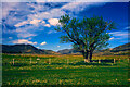
Nearby Images from Geograph Britain and Ireland:
©2016(licence)
©2009(licence)
©2013(licence)
©2018(licence)
©2023(licence)
The above images may not be of the site on this page, they are loaded from Geograph.
Please Submit an Image of this site or go out and take one for us!
Click here to see more info for this site
Nearby sites
Key: Red: member's photo, Blue: 3rd party photo, Yellow: other image, Green: no photo - please go there and take one, Grey: site destroyed
Download sites to:
KML (Google Earth)
GPX (GPS waypoints)
CSV (Garmin/Navman)
CSV (Excel)
To unlock full downloads you need to sign up as a Contributory Member. Otherwise downloads are limited to 50 sites.
Turn off the page maps and other distractions
Nearby sites listing. In the following links * = Image available
1.6km NE 50° Sidhean Mor Dail A' Chaorainn* Hillfort (NH69060039)
4.8km E 87° Altlarie* Cairn (NN726995)
8.3km E 83° Kingussie Standing Stones (NH761001)
10.2km ENE 74° Lynchat* Souterrain (Fogou, Earth House) (NH77670193)
11.6km SW 234° Dun da Lamh* Stone Fort or Dun (NN582929)
15.1km ENE 68° Dunachton* Class I Pictish Symbol Stone (NH820046)
16.9km ENE 63° Kincraig Chambered Cairn Chambered Cairn (NH83140660)
18.9km ENE 59° Delfour* Cairn (NH844086)
21.3km ENE 59° Ballinluig Cairn* Chambered Cairn (NH86380989)
25.9km NE 55° Aviemore* Stone Circle (NH89681347)
27.5km N 351° Dhuallow Clava Cairn (NH644267)
28.0km NE 53° Grenish* Stone Circle (NH90781550)
28.7km NE 51° Avielochan* Chambered Tomb (NH908167)
29.9km ENE 56° Pityoulish Standing Stone* Standing Stone (Menhir) (NH93251521)
30.5km ENE 56° Lynchurn Class I Pictish Symbol Stone (NH93841551)
31.1km WNW 288° Cherry Island* Crannog (NH385102)
31.2km NW 313° Boulder near Creag Dhearg Natural Stone / Erratic / Other Natural Feature (NH456215)
32.4km NE 48° Deishar* Round Cairn (NH928201)
33.2km N 352° Eastertown Cairn* Cairn (NH64203245)
33.6km NNW 349° West Town* Chambered Cairn (NH62173258)
33.6km NE 49° Drumuillie* Round Cairn (NH940206)
33.7km N 359° Croftcroy Chambered Tomb Chambered Tomb (NH683331)
33.8km N 359° Croftcroy Stone Circle* Stone Circle (NH6835133191)
33.9km NNW 332° Holy Well (Drumnadrochit)* Holy Well or Sacred Spring (NH530300)
34.0km N 359° Tordarroch Cairn* Clava Cairn (NH68013349)
View more nearby sites and additional images


 We would like to know more about this location. Please feel free to add a brief description and any relevant information in your own language.
 Wir möchten mehr über diese Stätte erfahren. Bitte zögern Sie nicht, eine kurze Beschreibung und relevante Informationen in Deutsch hinzuzufügen.
 Nous aimerions en savoir encore un peu sur les lieux. S'il vous plaît n'hesitez pas à ajouter une courte description et tous les renseignements pertinents dans votre propre langue.
 Quisieramos informarnos un poco más de las lugares. No dude en añadir una breve descripción y otros datos relevantes en su propio idioma.