


<< Text Pages >> Tombreck (01) - Rock Art in Scotland in Perth and Kinross
Submitted by Anne T on Thursday, 11 January 2018 Page Views: 884
Rock ArtSite Name: Tombreck (01)Country: Scotland
NOTE: This site is 0.8 km away from the location you searched for.
County: Perth and Kinross Type: Rock Art
Nearest Town: Killin Nearest Village: Carie
Map Ref: NN6479838284
Latitude: 56.517104N Longitude: 4.198995W
Condition:
| 5 | Perfect |
| 4 | Almost Perfect |
| 3 | Reasonable but with some damage |
| 2 | Ruined but still recognisable as an ancient site |
| 1 | Pretty much destroyed, possibly visible as crop marks |
| 0 | No data. |
| -1 | Completely destroyed |
| 5 | Superb |
| 4 | Good |
| 3 | Ordinary |
| 2 | Not Good |
| 1 | Awful |
| 0 | No data. |
| 5 | Can be driven to, probably with disabled access |
| 4 | Short walk on a footpath |
| 3 | Requiring a bit more of a walk |
| 2 | A long walk |
| 1 | In the middle of nowhere, a nightmare to find |
| 0 | No data. |
| 5 | co-ordinates taken by GPS or official recorded co-ordinates |
| 4 | co-ordinates scaled from a detailed map |
| 3 | co-ordinates scaled from a bad map |
| 2 | co-ordinates of the nearest village |
| 1 | co-ordinates of the nearest town |
| 0 | no data |
Be the first person to rate this site - see the 'Contribute!' box in the right hand menu.
Internal Links:
External Links:
Rock Art in Perth and Kinross
This cup marked stone is recorded as Canmore ID 289069 which tells us: "This earthfast boulder, lying in pasture about 100m N of a modern sheep fank, measures 1.4m by 1m and 0.6m in height. It bears two cupmarks and a further two possible cups along its NNW edge, the largest measuring 70mm in diameter and 20mm in depth."
The Northern Antiquarian (TNA) also feature a page for this stone - see their entry for Tombreck 01, Kenmore, Perthshire, which gives directions for finding this stone together with photographs and a description. TNA adds: "This is a reasonably large boulder near the top of the hillock above the trackside. Several rocks have what may be single cup-markings on them, but this roughly oblong-shaped block has four or five of them running along the more northern edge of the stone, in a rough line sloping gently down the surface of the rock. No carved rings or other lines were immediately notable here. It’s nothing special to look at and will probably be of interest only to the hardcore petroglyph enthusiasts amongst you. However, there are many more ornate cup-and-rings found further along the ridges close by (which we’ll add as the weeks and months go by); as well as the remains of a prehistoric enclosure about 200 yards southeast. The small standing stone of Carie is roughly the same distance to the south."
Note: Have you seen this carved stone? Do you have any photographs or information to add?
You may be viewing yesterday's version of this page. To see the most up to date information please register for a free account.
Do not use the above information on other web sites or publications without permission of the contributor.
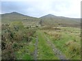
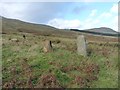
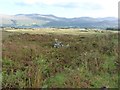
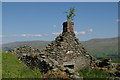
Nearby Images from Geograph Britain and Ireland:
©2012(licence)
©2012(licence)
©2012(licence)
©2011(licence)
©2011(licence)
The above images may not be of the site on this page, they are loaded from Geograph.
Please Submit an Image of this site or go out and take one for us!
Click here to see more info for this site
Nearby sites
Key: Red: member's photo, Blue: 3rd party photo, Yellow: other image, Green: no photo - please go there and take one, Grey: site destroyed
Download sites to:
KML (Google Earth)
GPX (GPS waypoints)
CSV (Garmin/Navman)
CSV (Excel)
To unlock full downloads you need to sign up as a Contributory Member. Otherwise downloads are limited to 50 sites.
Turn off the page maps and other distractions
Nearby sites listing. In the following links * = Image available
223m E 88° Tombreck (07) Rock Art (NN6502238285)
267m S 184° Carie (Kenmore) Sculptured Stone (NN6477238018)
364m N 358° Tombreck (08) Rock Art (NN6479538648)
764m SSE 160° Tombreck (10) Ring Cairn (NN6504237559)
1.2km NNE 13° Alt a' Choire Chireinich 1 Rock Art (NN6509639442)
1.3km NNE 17° Allt a' Choire Chireinich 2 Rock Art (NN6521839525)
1.4km NNE 17° Allt a' Choire Chireinich 3 Rock Art (NN6524939579)
1.4km NNE 20° Allt a' Choire Chireinich 4 Rock Art (NN6530639560)
1.6km NW 320° Beinn Ghlas Rock Art (NN6382839501)
2.5km ENE 62° Easter Croftintygan Farm Standing Stone (Menhir) (NN6706839421)
2.6km E 79° Balnasuim* Rock Art (NN6733438677)
3.3km SE 136° Dull Farm Stone Marker Stone (NN6704235826)
3.9km ENE 59° Machuinn* Stone Circle (NN6820140156)
4.9km SSW 206° Creag Ard* Rock Art (NN6250433969)
6.1km NE 42° Allt Coire Phadairlidh 1* Rock Art (NN690427)
6.5km SW 223° Firbush Point (Killin) Hillfort (NN602337)
6.7km WSW 237° Tir Artair 1 (Killin) Rock Art (NN5906334807)
6.9km WSW 237° Tir Artair Standing Stone (Killin) Standing Stone (Menhir) (NN5887034720)
8.4km W 260° Creag na Cailleach (Killin) Ancient Mine, Quarry or other Industry (NN56403715)
8.6km WSW 255° Allt na Ceardaich Knoll Rock Art (NN564364)
8.9km SW 230° Kinnell* Stone Circle (NN5770032803)
9.0km NNW 333° Glen Lyon - Praying Hands of Mary* Natural Stone / Erratic / Other Natural Feature (NN610465)
9.3km SW 234° Fingal's Stone* Standing Stone (Menhir) (NN5712933021)
9.4km N 8° Dericambus Standing Stone (Menhir) (NN66484757)
9.5km SW 231° Innis Bhuidhe* Stone Fort or Dun (NN57223255)
View more nearby sites and additional images


 We would like to know more about this location. Please feel free to add a brief description and any relevant information in your own language.
 Wir möchten mehr über diese Stätte erfahren. Bitte zögern Sie nicht, eine kurze Beschreibung und relevante Informationen in Deutsch hinzuzufügen.
 Nous aimerions en savoir encore un peu sur les lieux. S'il vous plaît n'hesitez pas à ajouter une courte description et tous les renseignements pertinents dans votre propre langue.
 Quisieramos informarnos un poco más de las lugares. No dude en añadir una breve descripción y otros datos relevantes en su propio idioma.