 with our Megalithic Portal iPhone app")


<< Text Pages >> Tombreck (10) - Ring Cairn in Scotland in Perth and Kinross
Submitted by Anne T on Thursday, 11 January 2018 Page Views: 1031
Neolithic and Bronze AgeSite Name: Tombreck (10)Country: Scotland
NOTE: This site is 1.3 km away from the location you searched for.
County: Perth and Kinross Type: Ring Cairn
Nearest Town: Killin Nearest Village: Carie
Map Ref: NN6504237559
Latitude: 56.510666N Longitude: 4.194656W
Condition:
| 5 | Perfect |
| 4 | Almost Perfect |
| 3 | Reasonable but with some damage |
| 2 | Ruined but still recognisable as an ancient site |
| 1 | Pretty much destroyed, possibly visible as crop marks |
| 0 | No data. |
| -1 | Completely destroyed |
| 5 | Superb |
| 4 | Good |
| 3 | Ordinary |
| 2 | Not Good |
| 1 | Awful |
| 0 | No data. |
| 5 | Can be driven to, probably with disabled access |
| 4 | Short walk on a footpath |
| 3 | Requiring a bit more of a walk |
| 2 | A long walk |
| 1 | In the middle of nowhere, a nightmare to find |
| 0 | No data. |
| 5 | co-ordinates taken by GPS or official recorded co-ordinates |
| 4 | co-ordinates scaled from a detailed map |
| 3 | co-ordinates scaled from a bad map |
| 2 | co-ordinates of the nearest village |
| 1 | co-ordinates of the nearest town |
| 0 | no data |
Be the first person to rate this site - see the 'Contribute!' box in the right hand menu.
Internal Links:
External Links:
Ring Cairn in Perth and Kinross
The Northern Antiquarian (TNA) features a page for this cup marked stone - see their entry for Tombreck (10), Kenmore, Perthshire, which gives directions for finding this stone together with photographs and a description.
TNA adds: "Although this cup-marked rock has been known about for sometime by local people, it is one of many that are not in the archaeological record. It’s nothing like as impressive as some of its petroglyphic neighbours on the slopes of Ben Lawers, as this simple carving comprises of two well-defined simple cup-marks, and another two that appear to have been worked slightly into natural cracks in the rock. These two remain incomplete."
Note: Have you seen this stone? Do you have any photographs or information to add?
You may be viewing yesterday's version of this page. To see the most up to date information please register for a free account.
Do not use the above information on other web sites or publications without permission of the contributor.
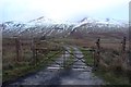
Nearby Images from Geograph Britain and Ireland:
©2023(licence)
©2008(licence)
©2011(licence)
©2011(licence)
©2014(licence)
The above images may not be of the site on this page, they are loaded from Geograph.
Please Submit an Image of this site or go out and take one for us!
Click here to see more info for this site
Nearby sites
Key: Red: member's photo, Blue: 3rd party photo, Yellow: other image, Green: no photo - please go there and take one, Grey: site destroyed
Download sites to:
KML (Google Earth)
GPX (GPS waypoints)
CSV (Garmin/Navman)
CSV (Excel)
To unlock full downloads you need to sign up as a Contributory Member. Otherwise downloads are limited to 50 sites.
Turn off the page maps and other distractions
Nearby sites listing. In the following links * = Image available
532m NNW 328° Carie (Kenmore) Sculptured Stone (NN6477238018)
725m N 357° Tombreck (07) Rock Art (NN6502238285)
764m NNW 340° Tombreck (01) Rock Art (NN6479838284)
1.1km NNW 345° Tombreck (08) Rock Art (NN6479538648)
1.9km N 360° Alt a' Choire Chireinich 1 Rock Art (NN6509639442)
2.0km N 3° Allt a' Choire Chireinich 2 Rock Art (NN6521839525)
2.0km N 6° Allt a' Choire Chireinich 4 Rock Art (NN6530639560)
2.0km N 4° Allt a' Choire Chireinich 3 Rock Art (NN6524939579)
2.3km NW 326° Beinn Ghlas Rock Art (NN6382839501)
2.5km ENE 62° Balnasuim* Rock Art (NN6733438677)
2.6km SE 129° Dull Farm Stone Marker Stone (NN6704235826)
2.7km NE 46° Easter Croftintygan Farm Standing Stone (Menhir) (NN6706839421)
4.1km NE 49° Machuinn* Stone Circle (NN6820140156)
4.4km SSW 213° Creag Ard* Rock Art (NN6250433969)
6.2km SW 230° Firbush Point (Killin) Hillfort (NN602337)
6.5km NE 36° Allt Coire Phadairlidh 1* Rock Art (NN690427)
6.6km WSW 243° Tir Artair 1 (Killin) Rock Art (NN5906334807)
6.8km WSW 243° Tir Artair Standing Stone (Killin) Standing Stone (Menhir) (NN5887034720)
8.6km W 265° Creag na Cailleach (Killin) Ancient Mine, Quarry or other Industry (NN56403715)
8.7km W 261° Allt na Ceardaich Knoll Rock Art (NN564364)
8.7km SW 235° Kinnell* Stone Circle (NN5770032803)
9.1km WSW 238° Fingal's Stone* Standing Stone (Menhir) (NN5712933021)
9.3km SW 235° Innis Bhuidhe* Stone Fort or Dun (NN57223255)
9.8km NNW 334° Glen Lyon - Praying Hands of Mary* Natural Stone / Erratic / Other Natural Feature (NN610465)
9.9km NE 45° Oakbank Crannog* Crannog (NN723443)
View more nearby sites and additional images


 We would like to know more about this location. Please feel free to add a brief description and any relevant information in your own language.
 Wir möchten mehr über diese Stätte erfahren. Bitte zögern Sie nicht, eine kurze Beschreibung und relevante Informationen in Deutsch hinzuzufügen.
 Nous aimerions en savoir encore un peu sur les lieux. S'il vous plaît n'hesitez pas à ajouter une courte description et tous les renseignements pertinents dans votre propre langue.
 Quisieramos informarnos un poco más de las lugares. No dude en añadir una breve descripción y otros datos relevantes en su propio idioma.