Featured: Ark of Secrets - Neolithic spirit alive in the Middle Ages

Ark of Secrets - Neolithic spirit alive in the Middle Ages

Random Image


Thetford Castle

Singing Up the Country: The Songlines of Avebury and Beyond

Singing Up the Country: The Songlines of Avebury and Beyond

Who's Online

There are currently, 318 guests and 2 members online.

You are a guest. To join in, please register for free by clicking here

Sponsors

<< Our Photo Pages >> Burford Down Stone Row - Stone Row / Alignment in England in Devon

Submitted by Tom_Bullock on Tuesday, 01 October 2002  Page Views: 7118

Neolithic and Bronze AgeSite Name: Burford Down Stone Row
Country: England County: Devon Type: Stone Row / Alignment
Nearest Town: Ivybridge  Nearest Village: Harford
Map Ref: SX63696016  Landranger Map Number: 202
Latitude: 50.425434N  Longitude: 3.920342W
Condition:
5Perfect
4Almost Perfect
3Reasonable but with some damage
2Ruined but still recognisable as an ancient site
1Pretty much destroyed, possibly visible as crop marks
0No data.
-1Completely destroyed
3 Ambience:
5Superb
4Good
3Ordinary
2Not Good
1Awful
0No data.
no data Access:
5Can be driven to, probably with disabled access
4Short walk on a footpath
3Requiring a bit more of a walk
2A long walk
1In the middle of nowhere, a nightmare to find
0No data.
no data Accuracy:
5co-ordinates taken by GPS or official recorded co-ordinates
4co-ordinates scaled from a detailed map
3co-ordinates scaled from a bad map
2co-ordinates of the nearest village
1co-ordinates of the nearest town
0no data
5

Internal Links:
External Links:

I have visited· I would like to visit

TheCaptain would like to visit

Catrinm visited on 19th Nov 2022 - their rating: Cond: 3 Amb: 4 Access: 3 beautiful day up there - and clear sea view re elation if you walk upwards

Catrinm visited on 19th Nov 2022 - their rating: Cond: 3 Amb: 4 Access: 3 Sea reveal particularly special on a sunny winters day

markj99 visited on 2nd Sep 2020 - their rating: Cond: 3 Amb: 5 Access: 3 The small stones which largely make up Burford Down Stone Row are not visually impressive but the length of the stone row is extensive. It was interesting to investigate gaps in the row for buried stones.

graemefield visited on 22nd Jan 2018 - their rating: Cond: 3 Amb: 4 Access: 3

tom_bullock have visited here

Average ratings for this site from all visit loggers: Condition: 3 Ambience: 4.25 Access: 3
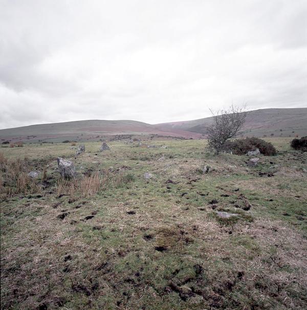
Burford Down Stone Row
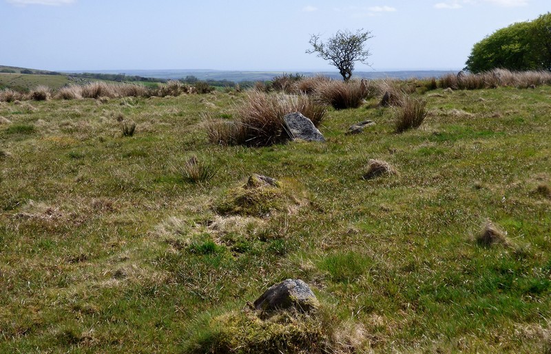
Burford Down Stone Row submitted by Tom_Bullock : The Burford Down stone row, one of the finest in Dartmoor, shows evidence of recent damage by whatever farmer is running huge tractors across the fields. S(he) has been driving right through the rows (perpendicular to them) along several tracks. I saw evidence of at least 3 stones that had been dislodged and pushed aside by the wheels of the tractor. I don't know if there is a procedure for r... (Vote or comment on this photo)
Stone Row in Devon with cairn circle: one of the finest in Dartmoor, shows evidence of recent damage by whatever farmer is running huge tractors across the fields.

S(he) has been driving right through the rows (perpendicular to them) along several tracks. I saw evidence of at least 3 stones that had been dislodged and pushed aside by the wheels of the tractor. I don't know if there is a procedure for reporting such damage, or even if the farmer is liable for such damage. I have never, in my 12 years of visiting sites (up to about 900 by now), seen such disregard for a National treasure such as this.

Update August 2019: Running from SX 6370 6017 to SX 6370 6054, this stone row is recorded as Pastscape Monument No. 442345 and scheduled as Historic England List ID 1013103. Pastscape tells us the row is: "a single stone row, length circa 200 feet, starting at a retaining circle, diameter 33 feet, at the south end, and dying out at a newtake wall. Some 120 yds beyond the newtake wall is another newtake wall cumbank running northeast-southwest and 30 yards beyond this again is a large earth set stone part of which has been broken off and lies nearby. Parsons considers that this stone is possibly the terminal menhir of the stone row."

The row also features on The Stone Rows of Great Britain - see their entry for Burford Down, which includes a description, photographs, and a plan of the stone row. Also see the SRoGB page for Sea Views at Burford Down, which discusses viewpoints which come in and out of view as you progress along the row.

This row also features on Prehistoric Dartmoor Walks page for the Burford Down Stone Row. Also see PDW's entry for the Burford Down Standing Stone, said by Pastscape to be considered the terminal menhirs, but which has been broken and lies nearby at SX 63703 60687.
You may be viewing yesterday's version of this page. To see the most up to date information please register for a free account.


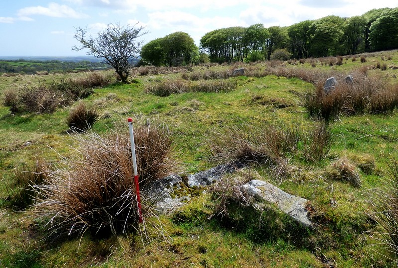
Burford Down Stone Row
Burford Down Stone Row submitted by Catrinm : Sea view revelation as go south (1 comment - Vote or comment on this photo)

Burford Down Stone Row
Burford Down Stone Row submitted by SandyG : Part of the kerb of the cairn at the top of the row. The row can be seen leading into the far distance. View from south (Scale 1m). (Vote or comment on this photo)

Burford Down Stone Row
Burford Down Stone Row submitted by SandyG : Two large recumbent orthostats denote the southern end of the row. The largest measures 1.5m long by 0.55m wide and protrudes 0.2m above the ground surface. The largest stones in a row are often found at the upper end. View from north east (Scale 1m). (Vote or comment on this photo)

Burford Down Stone Row
Burford Down Stone Row submitted by SandyG : The row at SX 63703 60216 approaching the kerbed cairn at the top (southern) end. The landscape and sea view previously hidden by raising ground is now apparent. View from north. (Vote or comment on this photo)

Burford Down Stone Row
Burford Down Stone Row submitted by SandyG : The sinuous form of the stone row at SX 63702 60244 is clearly discernible in this photograph. View from north.

Burford Down Stone Row
Burford Down Stone Row submitted by SandyG : Stone row at SX 63703 60243. View from south (Scale 1m).

Burford Down Stone Row
Burford Down Stone Row submitted by SandyG : A length of the row to the north of SX 63703 60268. View from south.

Burford Down Stone Row
Burford Down Stone Row submitted by SandyG : A length of the row at SX 63703 60278. View from south (Scale 1m).

Burford Down Stone Row
Burford Down Stone Row submitted by SandyG : A length of the row at SX 63704 60285. View from south (Scale 1m).

Burford Down Stone Row
Burford Down Stone Row submitted by SandyG : A length of the row at SX 63704 60299. View from north (Scale 1m).

Burford Down Stone Row
Burford Down Stone Row submitted by SandyG : A length of the row at SX 63704 60299. View from south (Scale 1m).

Burford Down Stone Row
Burford Down Stone Row submitted by SandyG : Stones at SX 63704 60299. View from south west (Scale 1m).

Burford Down Stone Row
Burford Down Stone Row submitted by SandyG : A pair of upright stones at SX 63705 60409. View from the north west (Scale 1m).

Burford Down Stone Row
Burford Down Stone Row submitted by SandyG : Stone at SX 63707 60435 barely protruding through the turf. View from south.

Burford Down Stone Row
Burford Down Stone Row submitted by SandyG : A pair of tiny stones at SX 63707 60448. View from south (Scale 1m).

Burford Down Stone Row
Burford Down Stone Row submitted by SandyG : A large stone at SX63705 60521 measures 0.85m high. View from south east (Scale 1m).

Burford Down Stone Row
Burford Down Stone Row submitted by SandyG : Looking southward along the row (Scale 1m).

Burford Down Stone Row
Burford Down Stone Row submitted by SandyG : The northern end of the row at SX 63708 60631. View from east.

Burford Down Stone Row
Burford Down Stone Row submitted by Bladup : Burford Down stone (cairn) circle.

Burford Down Stone Row
Burford Down Stone Row submitted by Bladup : Burford Down stone row, a stone in the northern section at sunset.

Burford Down Stone Row
Burford Down Stone Row submitted by Bladup : Burford Down stone row.

Burford Down Stone Row
Burford Down Stone Row submitted by Bladup

Burford Down Stone Row
Burford Down Stone Row submitted by Bladup

Burford Down Stone Row
Burford Down Stone Row submitted by Bladup

These are just the first 25 photos of Burford Down Stone Row. If you log in with a free user account you will be able to see our entire collection.

Do not use the above information on other web sites or publications without permission of the contributor.
Click here to see more info for this site

Nearby sites

Click here to view sites on an interactive OS map

Key: Red: member's photo, Blue: 3rd party photo, Yellow: other image, Green: no photo - please go there and take one, Grey: site destroyed

Download sites to:
KML (Google Earth)
GPX (GPS waypoints)
CSV (Garmin/Navman)
CSV (Excel)

To unlock full downloads you need to sign up as a Contributory Member. Otherwise downloads are limited to 50 sites.

Stone Rows of Great Britain by Sandy Gerrard
Dartmoor Walks by Dave Parks
Prehistoric Monuments of Dartmoor by Bill Radcliffe

Prehistoric Circles and Rows by Ian Honeywood


Turn off the page maps and other distractions

Nearby sites listing. In the following links * = Image available
 14m NE 43° Burford Down Cairn Circle* Stone Circle (SX6370060170)
 80m E 96° Burford Down (Tristis Rock)* Cairn (SX63776015)
 527m N 360° Burford Down Standing Stone* Standing Stone (Menhir) (SX6370360687)
 750m ENE 63° Lower Piles Enclosed Settlement Ancient Village or Settlement (SX64376048)
 849m E 82° Lower Piles* Ring Cairn (SX6453660255)
 912m N 2° Stalldown South East* Stone Row / Alignment (SX63756107)
 936m ESE 120° Harford Moor Encircled Cairn* Stone Circle (SX6449459677)
 1.1km SE 137° Harford settlement* Ancient Village or Settlement (SX6444559313)
 1.3km N 11° Stalldown Settlement* Ancient Village or Settlement (SX6397361429)
 1.4km SE 130° Butter Brook* Standing Stone (Menhir) (SX64725926)
 1.4km E 99° Harford Moor N* Stone Row / Alignment (SX651599)
 1.5km ESE 103° Harford S.* Multiple Stone Rows / Avenue (SX651598)
 1.5km E 98° Butterbrook* Stone Row / Alignment (SX652599)
 1.7km NE 54° Piles Hill W* Multiple Stone Rows / Avenue (SX65056111)
 1.7km NNW 341° Stalldown Southern Terminal Cairn Circle* Cairn (SX6317661737)
 1.8km NNW 343° Stalldown Stone Row Cairn S* Cairn (SX63226186)
 1.8km ENE 64° Piles Hill Cairns* Cairn (SX653609)
 1.8km ENE 70° The Longstone (Piles Hill)* Standing Stone (Menhir) (SX65436074)
 1.8km E 79° Hobajons Cross* Standing Stone (Menhir) (SX65516047)
 1.8km E 86° Butterdon Hill Row* Stone Row / Alignment (SX6553960225)
 1.9km SE 129° Weatherdon Hill (Devon) Ring Cairn (SX65165889)
 2.0km E 82° Glasscombe Ball North (South Cairn)* Cairn (SX65736041)
 2.1km E 81° Glasscombe Ball North* Stone Row / Alignment (SX6573360429)
 2.1km NE 37° Sharp Tor cairn* Cairn (SX65006179)
 2.1km ESE 110° Butterdon Hill Barrow* Round Barrow(s) (SX6566059403)
View more nearby sites and additional images

<< Newbeggin Stone Row

Collard Tor E >>

Please add your thoughts on this site

Prehistoric Settlements

Prehistoric Settlements

Web Links for Burford Down Stone Row

Stone Rows of Great Britain by Sandy Gerrard
Dartmoor Walks by Dave Parks
Prehistoric Monuments of Dartmoor by Bill Radcliffe

Archived Web links for Burford Down Stone Row

Prehistoric Circles and Rows by Ian Honeywood

Sponsors

Auto-Translation (Google)

Translate from English into:

"Burford Down Stone Row" | Login/Create an Account | 2 News and Comments
  
Go back to top of page    Comments are owned by the poster. We aren't responsible for their content.
Re: Directions to Burford Down Stone Row by markj99 on Wednesday, 09 June 2021
(User Info | Send a Message)
On the E edge of Ivybridge on the B3213 there is a signed turn off for Harland/Lukesland at SX6454 5624 on Cole Lane. Follow Cole Lane for c. 0.5 miles There is a R turn signed for Harland/Lukesland on a narrow lane. After c. 2 miles on this narrow lane you will reach Harford. Turn R at the church. There should be room to park on the R beyond the farm at SX 63849 5930. If there is no space here there is a car park at the end of this lane at SX 64346 59546, 0.33 miles later. Walk back to the start of the lane and turn R at the church. Follow this leafy lane for c. 350 yards to cross Harford Bridge. A public path starts on the W side of the bridge heading NE through woodland. After c. 0.5 miles the trees thin out giving way to gorse bushes. Tristis Rock should become visible at the top of the slope to the W. Make your best way through scrubland uphill to Tristis rock located at SX 63845 60150. Burford Down Cairn is c. 70 yards W of Tristis Rock partially hidden by vegetation. Burford Down S Terminal ring cairn is c. 85 yards W of Burford Down Cairn. Burford Down Stone Row extends c. 500 yards N from the S terminal.
[ Reply to This ]

The Decoding or Burford Down Stone Row by Anonymous on Saturday, 24 November 2001
Countless books in the Plymouth Library services give ever varying lengths and stone numbers. The length as usual being estimated by elasticised metric tape measure and no idea as to what is being looked for. Fortunately the number of stones falls into a bracket for 324.
The row is 1620 ft with 324 stones the Gematrian tables or Building Regulations show this. As you will see.
Along with a 1:10.000ft map and the use of O.S. Co-ordinate Converter. (modern science at its best, what else).
Burford is the first of the structures in a line along the Erme Valley 4.8 by 0.6 miles approx., see drawing. All are intricately connected, this system is chosen for convenience because of the geographical layout. They link up with the rest of Dartmoor, Stonehenge and global networks.
The relationship of the Cist/Cairn near the base can be worked out by you, the data will be enclosed. Not all the information from Burford is here, enough is given for those interested to work out the rest for themselves.
So from two numbers lets go...........

The most striking visual impact is its straightness, like a 1, pointer, specific, definite, meaningful. Well it is because it tells us the distance from the equator to the North Pole, and not Pooh pole.

Grid co-ordinates for the base of the row. 50deg 25min 32sec. Latitude.
From Giza Prime. 35deg 3min 13.5782637sec Longitude
50 x 25 x 32 = 40000 Lat Grid Point
35 x 3 x 13.5782637 = 1425.461769 Lon Grid Point

Divide = 28.06108229 Global Grid Point.

Grid co-ordinates for the top of the row. 50deg 25min 48sec.
35deg 3min 13.71428791sec
50 x 25 x 48 = 60000
35 x 3 x 13.71428791 = 1440

Divide = 41. 666666 (lets keep it to six)
41.666666 is the GGP of a very very special place in Carnac.

GGP x GGP = 1169.211762. Here it comes, recognise it !
Get your calculator out and feed in Tan the distance from the equator to the pole and thats it.
Don’t know it, well its 6214.855279 miles. Some references give it as 6214.89924 so if that is the case someone is only 175.30128 feet wrong. Baring in mind the effects of the Barycenter, the pull and push of planets from time to time..... 175ft !!!

Latitude centre of the row 50 x 25 x 40 = 50000. So we get 4 - 5 - 6. All this later.

Let us just confirm the number of stones using PI. 1620Pi = 5089.380099 circumference.
Divide that by the 50deg so kindly put there on the matrix. = 101.787602
From the tables this is 324Pi. More simply 1620/50 = 324. Like it !

2.
Just one more as the row is 180deg. 180Pi = 324
So who needs a 3.2808ft length of scrap metal locked away in a air conditioned vault in Paris.

The 180deg strait line is 1deg off center by 9ft to the west at the top. So percieve this 9ft as the radius of a circle, 9ft west 9ft east a diameter of 18ft. (18-0.) A bit like the earths 1deg ‘wobble’. Because this 9ft is 1deg. Watch.
Imagine the 1620 circle representing a hemisphere of the equator to the pole on which the planets rise east to west. Planets when they go retrograde appear to go backward or circular at various points on their orbit. When this is done over Burford at a particular altitude a arc will be made of a 18ft circle. One planet that fits this is Mars with an orbit inclination of 1.8 and with a mass to Earth of 0.108. (see 108 later)

Let us look at more of Stone Age Megalithic Mans Maths it should not be to difficult for us, but not for me because I’ve got a sophisticated calculator and a Computer.
Some where there amongst this 1

Read the rest of this post...
[ Reply to This ]

Your Name: Anonymous [ Register Now ]
Subject:


Add your comment or contribution to this page. Spam or offensive posts are deleted immediately, don't even bother

<<< What is five plus one as a number? (Please type the answer to this question in the little box on the left)
You can also embed videos and other things. For Youtube please copy and paste the 'embed code'.
For Google Street View please include Street View in the text.
Create a web link like this: <a href="https://www.megalithic.co.uk">This is a link</a>  

Allowed HTML is:
<p> <b> <i> <a> <img> <em> <br> <strong> <blockquote> <tt> <li> <ol> <ul> <object> <param> <embed> <iframe>

We would like to know more about this location. Please feel free to add a brief description and any relevant information in your own language.
Wir möchten mehr über diese Stätte erfahren. Bitte zögern Sie nicht, eine kurze Beschreibung und relevante Informationen in Deutsch hinzuzufügen.
Nous aimerions en savoir encore un peu sur les lieux. S'il vous plaît n'hesitez pas à ajouter une courte description et tous les renseignements pertinents dans votre propre langue.
Quisieramos informarnos un poco más de las lugares. No dude en añadir una breve descripción y otros datos relevantes en su propio idioma.