


<< Our Photo Pages >> Bryn Goleu - Cairn in Wales in Ceredigion
Submitted by Kammer on Friday, 26 November 2004 Page Views: 6905
Neolithic and Bronze AgeSite Name: Bryn GoleuCountry: Wales County: Ceredigion Type: Cairn
Nearest Town: Lampeter Nearest Village: Ffarmers
Map Ref: SN62434712
Latitude: 52.105253N Longitude: 4.010088W
Condition:
| 5 | Perfect |
| 4 | Almost Perfect |
| 3 | Reasonable but with some damage |
| 2 | Ruined but still recognisable as an ancient site |
| 1 | Pretty much destroyed, possibly visible as crop marks |
| 0 | No data. |
| -1 | Completely destroyed |
| 5 | Superb |
| 4 | Good |
| 3 | Ordinary |
| 2 | Not Good |
| 1 | Awful |
| 0 | No data. |
| 5 | Can be driven to, probably with disabled access |
| 4 | Short walk on a footpath |
| 3 | Requiring a bit more of a walk |
| 2 | A long walk |
| 1 | In the middle of nowhere, a nightmare to find |
| 0 | No data. |
| 5 | co-ordinates taken by GPS or official recorded co-ordinates |
| 4 | co-ordinates scaled from a detailed map |
| 3 | co-ordinates scaled from a bad map |
| 2 | co-ordinates of the nearest village |
| 1 | co-ordinates of the nearest town |
| 0 | no data |
Internal Links:
External Links:
I have visited· I would like to visit
geoffstickland has visited here
")
You may be viewing yesterday's version of this page. To see the most up to date information please register for a free account.
")
Do not use the above information on other web sites or publications without permission of the contributor.
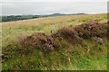
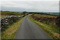
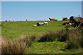
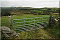
Nearby Images from Geograph Britain and Ireland:
©2015(licence)
©2015(licence)
©2008(licence)
©2015(licence)
©2008(licence)
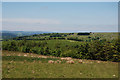
The above images may not be of the site on this page, they are loaded from Geograph.
Please Submit an Image of this site or go out and take one for us!
Click here to see more info for this site
Nearby sites
Key: Red: member's photo, Blue: 3rd party photo, Yellow: other image, Green: no photo - please go there and take one, Grey: site destroyed
Download sites to:
KML (Google Earth)
GPX (GPS waypoints)
CSV (Garmin/Navman)
CSV (Excel)
To unlock full downloads you need to sign up as a Contributory Member. Otherwise downloads are limited to 50 sites.
Turn off the page maps and other distractions
Nearby sites listing. In the following links * = Image available
670m S 177° Hirfaen Gwyddog* Standing Stone (Menhir) (SN62454645)
863m NNW 345° Caer Cadwgan Hillfort (SN62234796)
2.3km NNE 16° Tir Ifan (Cellan)* Misc. Earthwork (SN63134931)
2.3km ENE 69° Carreg Y Bwci* Cairn (SN646479)
3.0km WNW 293° Bryn Maen Caerau* Ancient Village or Settlement (SN59704836)
4.2km ENE 60° Craig Twrch* Cairn (SN66104910)
4.3km NW 313° Castell Allt-Goch* Hillfort (SN59335012)
4.4km NNW 330° Castell Goetre* Hillfort (SN60325095)
4.7km WNW 284° Lampeter Gorsedd Circle* Modern Stone Circle etc (SN57854841)
4.9km WNW 294° Castell Olwen* Hillfort (SN5801949254)
5.6km NW 318° Coed-Parc Gaer Hillfort (SN58795143)
6.0km NNW 340° Ffynnon-Wen* Holy Well or Sacred Spring (SN60535283)
6.3km SW 216° Blaen-Ceiment* Round Barrow(s) (SN58594216)
6.5km NW 309° St Sulien's Church Enclosure Ancient Village or Settlement (SN57445137)
6.7km SW 219° Cefn Blaenau* Cairn (SN58034208)
6.7km NW 306° St Sulien's Church Carved Stone* Early Christian Sculptured Stone (SN5714951242)
7.4km NE 35° Crug cairn* Cairn (SN66855311)
7.6km E 79° Crug Siarls* Stone Circle (SN69954830)
7.8km SSE 149° Carreg Pumsaint* Standing Stone (Menhir) (SN66334035)
7.9km SSE 149° Dolaucothi* Ancient Mine, Quarry or other Industry (SN66384025)
8.3km ESE 118° Maes-yr-haidd Round Barrow I* Cairn (SN6960042991)
8.3km ESE 119° Maes-yr-haidd Round Barrow II* Cairn (SN6954242882)
8.4km NE 36° Careg Samson* Standing Stone (Menhir) (SN67575384)
9.1km NNE 24° St David (Llandewi Brefi)* Ancient Cross (SN66385531)
9.4km ESE 111° Rhiw Gwaregog Standing Stone Standing Stone (Menhir) (SN71184354)
View more nearby sites and additional images


 We would like to know more about this location. Please feel free to add a brief description and any relevant information in your own language.
 Wir möchten mehr über diese Stätte erfahren. Bitte zögern Sie nicht, eine kurze Beschreibung und relevante Informationen in Deutsch hinzuzufügen.
 Nous aimerions en savoir encore un peu sur les lieux. S'il vous plaît n'hesitez pas à ajouter une courte description et tous les renseignements pertinents dans votre propre langue.
 Quisieramos informarnos un poco más de las lugares. No dude en añadir una breve descripción y otros datos relevantes en su propio idioma.