 with our Megalithic Portal iPhone app")


<< Our Photo Pages >> West Town - Chambered Cairn in Scotland in Highlands
Submitted by PeteCrane5 on Saturday, 16 December 2023 Page Views: 162
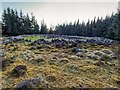
Neolithic and Bronze AgeSite Name: West TownCountry: Scotland County: Highlands Type: Chambered Cairn
Nearest Town: Inverness
Map Ref: NH62173258
Latitude: 57.362768N Longitude: 4.293061W
Condition:
| 5 | Perfect |
| 4 | Almost Perfect |
| 3 | Reasonable but with some damage |
| 2 | Ruined but still recognisable as an ancient site |
| 1 | Pretty much destroyed, possibly visible as crop marks |
| 0 | No data. |
| -1 | Completely destroyed |
| 5 | Superb |
| 4 | Good |
| 3 | Ordinary |
| 2 | Not Good |
| 1 | Awful |
| 0 | No data. |
| 5 | Can be driven to, probably with disabled access |
| 4 | Short walk on a footpath |
| 3 | Requiring a bit more of a walk |
| 2 | A long walk |
| 1 | In the middle of nowhere, a nightmare to find |
| 0 | No data. |
| 5 | co-ordinates taken by GPS or official recorded co-ordinates |
| 4 | co-ordinates scaled from a detailed map |
| 3 | co-ordinates scaled from a bad map |
| 2 | co-ordinates of the nearest village |
| 1 | co-ordinates of the nearest town |
| 0 | no data |
Internal Links:
External Links:
I have visited· I would like to visit
PeteCrane5 has visited here
")
The much disturbed remains of this Clava ring-cairn are situated on the top of a knoll in improved pasture. It measures about 20m in diameter overall by up to 1.5m in height, but the cairn has had a large quantity of field gathered stones added to it, masking its original appearance.
Source: Canmore.
You may be viewing yesterday's version of this page. To see the most up to date information please register for a free account.
Do not use the above information on other web sites or publications without permission of the contributor.
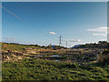
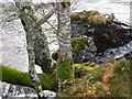
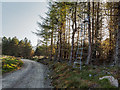
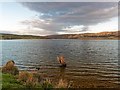
Nearby Images from Geograph Britain and Ireland:
©2016(licence)
©2009(licence)
©2016(licence)
©2017(licence)
©2016(licence)
The above images may not be of the site on this page, they are loaded from Geograph.
Please Submit an Image of this site or go out and take one for us!
Click here to see more info for this site
Nearby sites
Key: Red: member's photo, Blue: 3rd party photo, Yellow: other image, Green: no photo - please go there and take one, Grey: site destroyed
Download sites to:
KML (Google Earth)
GPX (GPS waypoints)
CSV (Garmin/Navman)
CSV (Excel)
To unlock full downloads you need to sign up as a Contributory Member. Otherwise downloads are limited to 50 sites.
Turn off the page maps and other distractions
Nearby sites listing. In the following links * = Image available
2.0km E 92° Eastertown Cairn* Cairn (NH64203245)
3.9km NW 325° Aldourie* Ring Cairn (NH59993587)
5.8km ENE 78° Tordarroch cup-marked stone* Rock Art (NH679336)
5.9km E 79° Tordarroch Cairn* Clava Cairn (NH68013349)
6.1km E 83° Croftcroy Chambered Tomb Chambered Tomb (NH683331)
6.2km E 82° Croftcroy Stone Circle* Stone Circle (NH6835133191)
6.3km SSE 157° Dhuallow Clava Cairn (NH644267)
6.3km NNE 24° Essich Moor* Chambered Cairn (NH649383)
6.4km N 358° Kinchyle Of Dores* Stone Circle (NH62153898)
6.5km ENE 58° Gask Henge* Henge (NH67833590)
6.6km ENE 58° Gask Cairn* Ring Cairn (NH6794435860)
7.4km NE 47° Tomfat Plantation* Chambered Cairn (NH678374)
8.1km NNE 14° Torbreck* Stone Circle (NH64384039)
9.5km WSW 252° Holy Well (Drumnadrochit)* Holy Well or Sacred Spring (NH530300)
10.1km ENE 63° Midlairgs Stone Circle (NH714368)
10.7km N 358° Ladystone Farm* Stone Row / Alignment (NH62204330)
11.3km NNE 32° Druidtemple* Stone Circle (NH685420)
11.6km N 2° Leachkin* Chambered Cairn (NH62964416)
12.4km NW 318° Castle Spynie Broch or Nuraghe (NH54144204)
12.5km NW 307° Allt Eoghainn* Chambered Tomb (NH5236240392)
12.7km W 263° Carn Daley* Clava Cairn (NH4945431458)
12.7km NNW 329° Giant's Grave (Highlands) Chambered Cairn (NH55904369)
12.7km N 6° Craig Phadraig* Vitrified Fort (NH640452)
12.7km W 263° Clachmhor, Culnakirk* Rock Art (NH49443145)
12.8km NNE 16° Knocknagael* Class I Pictish Symbol Stone (NH662448)
View more nearby sites and additional images


 We would like to know more about this location. Please feel free to add a brief description and any relevant information in your own language.
 Wir möchten mehr über diese Stätte erfahren. Bitte zögern Sie nicht, eine kurze Beschreibung und relevante Informationen in Deutsch hinzuzufügen.
 Nous aimerions en savoir encore un peu sur les lieux. S'il vous plaît n'hesitez pas à ajouter une courte description et tous les renseignements pertinents dans votre propre langue.
 Quisieramos informarnos un poco más de las lugares. No dude en añadir una breve descripción y otros datos relevantes en su propio idioma.