


<< Our Photo Pages >> Lower Hartor tor settlement. - Ancient Village or Settlement in England in Devon
Submitted by Bladup on Sunday, 16 April 2017 Page Views: 980
Multi-periodSite Name: Lower Hartor tor settlement.Country: England County: Devon Type: Ancient Village or Settlement
Map Ref: SX602673
Latitude: 50.488785N Longitude: 3.972112W
Condition:
| 5 | Perfect |
| 4 | Almost Perfect |
| 3 | Reasonable but with some damage |
| 2 | Ruined but still recognisable as an ancient site |
| 1 | Pretty much destroyed, possibly visible as crop marks |
| 0 | No data. |
| -1 | Completely destroyed |
| 5 | Superb |
| 4 | Good |
| 3 | Ordinary |
| 2 | Not Good |
| 1 | Awful |
| 0 | No data. |
| 5 | Can be driven to, probably with disabled access |
| 4 | Short walk on a footpath |
| 3 | Requiring a bit more of a walk |
| 2 | A long walk |
| 1 | In the middle of nowhere, a nightmare to find |
| 0 | No data. |
| 5 | co-ordinates taken by GPS or official recorded co-ordinates |
| 4 | co-ordinates scaled from a detailed map |
| 3 | co-ordinates scaled from a bad map |
| 2 | co-ordinates of the nearest village |
| 1 | co-ordinates of the nearest town |
| 0 | no data |
Internal Links:
External Links:
")
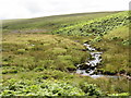
Enclosed settlement with four huts. Just outside the main enclosure to the South West is a cairn.
You may be viewing yesterday's version of this page. To see the most up to date information please register for a free account.
")
")
")
")
Do not use the above information on other web sites or publications without permission of the contributor.
Nearby Images from Geograph Britain and Ireland:
©2014(licence)
©2009(licence)
©2014(licence)
©2014(licence)
©2014(licence)
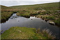
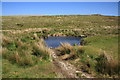
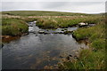
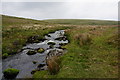
The above images may not be of the site on this page, they are loaded from Geograph.
Please Submit an Image of this site or go out and take one for us!
Click here to see more info for this site
Nearby sites
Key: Red: member's photo, Blue: 3rd party photo, Yellow: other image, Green: no photo - please go there and take one, Grey: site destroyed
Download sites to:
KML (Google Earth)
GPX (GPS waypoints)
CSV (Garmin/Navman)
CSV (Excel)
To unlock full downloads you need to sign up as a Contributory Member. Otherwise downloads are limited to 50 sites.
Turn off the page maps and other distractions
Nearby sites listing. In the following links * = Image available
297m SE 131° Plym Steps* Cairn (SX60426710)
420m SSE 153° Langcombe Brook 7* Cist (SX60386692)
576m ESE 116° Deadman's Bottom Cairn Circle* Cairn (SX60716703)
578m ESE 117° Deadman's Bottom Cists* Cairn (SX6071167027)
726m ENE 67° Calveslake* Cairn (SX60886756)
775m W 271° Drizzlecombe Cairn 23* Cairn (SX5942367331)
826m W 273° Cairn At Head of Drizzlecombe Row 4* Cairn (SX5937467361)
830m W 273° Drizzlecombe W row* Stone Row / Alignment (SX5937067360)
830m W 260° Drizzlecombe Cairn 18* Cairn (SX5937667182)
831m W 274° Standing Stone Near Cairn at Head of Drizzlecombe Row 4* Standing Stone (Menhir) (SX5937067374)
845m SW 225° Giant's Hill East* Cist (SX5958766717)
900m W 264° Drizzlecombe Settlement* Ancient Village or Settlement (SX59306723)
936m SW 233° Giant's Hill West* Cist (SX59446675)
948m SE 125° Deadman's Bottom D Cairn (SX60966673)
961m WSW 254° Drizzlecombe cairn 2* Ring Cairn (SX5926567065)
970m WSW 255° Drizzlecombe cairn 3* Ring Cairn (SX5925367080)
971m WSW 254° Drizzlecombe row 2* Stone Row / Alignment (SX5925867054)
977m SE 125° Deadman's Bottom E* Cairn (SX6098466714)
980m WSW 257° Drizzlecombe cairn 4* Stone Circle (SX5923867101)
981m WSW 255° Drizzlecombe row 3* Stone Row / Alignment (SX5924367071)
985m W 279° Drizzlecombe cist 21* Cist (SX5922867476)
1.0km WSW 253° Drizzlecombe* Multiple Stone Rows / Avenue (SX59216702)
1.0km WSW 252° Drizzlecombe menhir 2* Standing Stone (Menhir) (SX59216700)
1.0km ESE 106° Deadman's Bottom F* Cairn (SX61206698)
1.0km W 263° Drizzlecombe cairn 13* Cist (SX5915167208)
View more nearby sites and additional images


 We would like to know more about this location. Please feel free to add a brief description and any relevant information in your own language.
 Wir möchten mehr über diese Stätte erfahren. Bitte zögern Sie nicht, eine kurze Beschreibung und relevante Informationen in Deutsch hinzuzufügen.
 Nous aimerions en savoir encore un peu sur les lieux. S'il vous plaît n'hesitez pas à ajouter une courte description et tous les renseignements pertinents dans votre propre langue.
 Quisieramos informarnos un poco más de las lugares. No dude en añadir una breve descripción y otros datos relevantes en su propio idioma.