


<< Our Photo Pages >> Llanfair Standing Stone - Standing Stone (Menhir) in Wales in Gwynedd
Submitted by coldrum on Thursday, 23 July 2009 Page Views: 4119
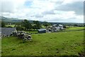
Neolithic and Bronze AgeSite Name: Llanfair Standing Stone Alternative Name: Hengaeau Standing StoneCountry: Wales County: Gwynedd Type: Standing Stone (Menhir)
Nearest Town: Barmouth Nearest Village: Llanfair
Map Ref: SH58432901
Latitude: 52.839944N Longitude: 4.103254W
Condition:
| 5 | Perfect |
| 4 | Almost Perfect |
| 3 | Reasonable but with some damage |
| 2 | Ruined but still recognisable as an ancient site |
| 1 | Pretty much destroyed, possibly visible as crop marks |
| 0 | No data. |
| -1 | Completely destroyed |
| 5 | Superb |
| 4 | Good |
| 3 | Ordinary |
| 2 | Not Good |
| 1 | Awful |
| 0 | No data. |
| 5 | Can be driven to, probably with disabled access |
| 4 | Short walk on a footpath |
| 3 | Requiring a bit more of a walk |
| 2 | A long walk |
| 1 | In the middle of nowhere, a nightmare to find |
| 0 | No data. |
| 5 | co-ordinates taken by GPS or official recorded co-ordinates |
| 4 | co-ordinates scaled from a detailed map |
| 3 | co-ordinates scaled from a bad map |
| 2 | co-ordinates of the nearest village |
| 1 | co-ordinates of the nearest town |
| 0 | no data |
Be the first person to rate this site - see the 'Contribute!' box in the right hand menu.
Internal Links:
External Links:
")
Coflein: https://www.coflein.gov.uk/en/site/302698
You may be viewing yesterday's version of this page. To see the most up to date information please register for a free account.
")
Do not use the above information on other web sites or publications without permission of the contributor.
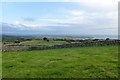
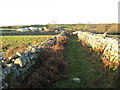
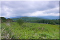
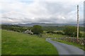
Nearby Images from Geograph Britain and Ireland:
©2015(licence)
©2007(licence)
©2014(licence)
©2015(licence)
©2023(licence)
The above images may not be of the site on this page, they are loaded from Geograph.
Please Submit an Image of this site or go out and take one for us!
Click here to see more info for this site
Nearby sites
Key: Red: member's photo, Blue: 3rd party photo, Yellow: other image, Green: no photo - please go there and take one, Grey: site destroyed
Download sites to:
KML (Google Earth)
GPX (GPS waypoints)
CSV (Garmin/Navman)
CSV (Excel)
To unlock full downloads you need to sign up as a Contributory Member. Otherwise downloads are limited to 50 sites.
Turn off the page maps and other distractions
Nearby sites listing. In the following links * = Image available
407m WNW 285° Ffynnon Fair Holy Well 2* Holy Well or Sacred Spring (SH58042913)
499m SE 142° Gwern Einion* Portal Tomb (SH58732861)
592m NNE 20° Brwyn Llynau* Ancient Village or Settlement (SH58652956)
678m SE 128° Gwern Einion Standing Stone* Standing Stone (Menhir) (SH5895328576)
782m ENE 65° Hen Gaeau Settlement* Ancient Village or Settlement (SH5915029320)
889m NNW 343° Fron Hill Enclosure Complex with Field System* Ancient Village or Settlement (SH5820029870)
1.0km SE 143° Standing Stone west of Hafod y Coed* Standing Stone (Menhir) (SH59012818)
1.0km NE 56° Llanfair Hut Circle* Ancient Village or Settlement (SH59302956)
1.2km ESE 106° Clogwyn Arllef Hillfort and Field System* Hillfort (SH59542866)
1.2km NE 38° Tyddyn Du Circular Enclosure* Ancient Village or Settlement (SH5918029900)
1.2km N 4° Muriau'r Gwyddelod Settlement* Ancient Village or Settlement (SH58543018)
1.2km NNW 333° Groes Las Prehistoric Settlement and Fields Ancient Village or Settlement (SH57933008)
1.2km SSE 148° Hafod y Coed Hut Circle* Ancient Village or Settlement (SH5903027990)
1.3km N 353° Muriau'r Gwyddelod Circular Enclosure* Ancient Village or Settlement (SH583303)
1.3km N 10° Cefnfilltir Cairn* Cairn (SH587303)
1.4km N 11° Cefnfilltir Standing Stone* Standing Stone (Menhir) (SH5872430360)
1.4km S 170° Ffynnon Delau Holy Well or Sacred Spring (SH58652758)
1.7km WSW 240° St Tanwg (Llandanwg)* Early Christian Sculptured Stone (SH569282)
2.0km S 181° Meini Hirion* Standing Stones (SH58332700)
2.1km S 176° Llanbedr* Rock Art (SH585269)
2.3km S 175° Ffynnon Fair Holy Well 1 Holy Well or Sacred Spring (SH58582668)
2.4km NE 35° Moel Goedog 8* Standing Stone (Menhir) (SH59883097)
2.4km NE 36° Garreg round cairn* Round Cairn (SH59913095)
2.8km NE 35° Moel Goedog 7* Standing Stone (Menhir) (SH60133130)
2.9km SSE 151° Pen-Y-Bryn Hut Circle Ancient Village or Settlement (SH598264)
View more nearby sites and additional images


 We would like to know more about this location. Please feel free to add a brief description and any relevant information in your own language.
 Wir möchten mehr über diese Stätte erfahren. Bitte zögern Sie nicht, eine kurze Beschreibung und relevante Informationen in Deutsch hinzuzufügen.
 Nous aimerions en savoir encore un peu sur les lieux. S'il vous plaît n'hesitez pas à ajouter une courte description et tous les renseignements pertinents dans votre propre langue.
 Quisieramos informarnos un poco más de las lugares. No dude en añadir una breve descripción y otros datos relevantes en su propio idioma.