


<< Our Photo Pages >> Lagganmullan 4 - Rock Art in Scotland in Dumfries and Galloway
Submitted by markj99 on Saturday, 13 February 2021 Page Views: 639
Rock ArtSite Name: Lagganmullan 4Country: Scotland County: Dumfries and Galloway Type: Rock Art
Nearest Town: Gatehouse of Fleet Nearest Village: Skyreburn
Map Ref: NX56095516
Latitude: 54.870444N Longitude: 4.244134W
Condition:
| 5 | Perfect |
| 4 | Almost Perfect |
| 3 | Reasonable but with some damage |
| 2 | Ruined but still recognisable as an ancient site |
| 1 | Pretty much destroyed, possibly visible as crop marks |
| 0 | No data. |
| -1 | Completely destroyed |
| 5 | Superb |
| 4 | Good |
| 3 | Ordinary |
| 2 | Not Good |
| 1 | Awful |
| 0 | No data. |
| 5 | Can be driven to, probably with disabled access |
| 4 | Short walk on a footpath |
| 3 | Requiring a bit more of a walk |
| 2 | A long walk |
| 1 | In the middle of nowhere, a nightmare to find |
| 0 | No data. |
| 5 | co-ordinates taken by GPS or official recorded co-ordinates |
| 4 | co-ordinates scaled from a detailed map |
| 3 | co-ordinates scaled from a bad map |
| 2 | co-ordinates of the nearest village |
| 1 | co-ordinates of the nearest town |
| 0 | no data |
Internal Links:
External Links:
")
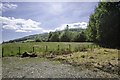
Lagganmullan 4 is a horizontal panel measuring c. 10x4 feet with multiple Cup Markings and Cup and Ring Markings. According to Canmore ID 83776, 34 cups with single rings, up to 165mm across, and at least 41 cups up to 75mm across and 20mm deep, are incised on a sheet of bedrock. Lagganmullan 4 lies c. 150 yards S of Lagganmullan 3.
Superior pictures of Lagganmullan 4, showing more of the Cup and Ring Markings are available at BRAC/Dumfries and Galloway/Lagganmullan-Anwoth .
You may be viewing yesterday's version of this page. To see the most up to date information please register for a free account.
")
")
")
Do not use the above information on other web sites or publications without permission of the contributor.
Nearby Images from Geograph Britain and Ireland:
©2017(licence)
©2011(licence)
©2014(licence)
©2014(licence)
©2014(licence)
The above images may not be of the site on this page, they are loaded from Geograph.
Please Submit an Image of this site or go out and take one for us!
Click here to see more info for this site
Nearby sites
Key: Red: member's photo, Blue: 3rd party photo, Yellow: other image, Green: no photo - please go there and take one, Grey: site destroyed
Download sites to:
KML (Google Earth)
GPX (GPS waypoints)
CSV (Garmin/Navman)
CSV (Excel)
To unlock full downloads you need to sign up as a Contributory Member. Otherwise downloads are limited to 50 sites.
Turn off the page maps and other distractions
Nearby sites listing. In the following links * = Image available
124m NNE 12° Lagganmullan 3* Rock Art (NX56125528)
214m NNW 327° Mill Knock Standing Stones* Standing Stones (NX5597855343)
388m ESE 106° Lagganmullan 9* Rock Art (NX56465504)
400m ESE 107° Lagganmullan 8* Rock Art (NX56475503)
415m SE 128° Stone Triangle (Lagganmullan)* Modern Stone Circle etc (NX5641154896)
864m N 358° Lady's Well (Anwoth) Holy Well or Sacred Spring (NX5608356025)
2.2km ENE 57° St John's Well (Anwoth) Holy Well or Sacred Spring (NX5800456296)
2.5km ENE 63° Rutherford's Well* Holy Well or Sacred Spring (NX58385622)
2.5km ENE 63° Rutherford's Well (Anwoth) Holy Well or Sacred Spring (NX5838856224)
2.7km NW 307° Cairnharrow Cup & Ring Marked Stone* Rock Art (NX54005684)
2.8km SW 229° High Auchenlarie* Stone Circle (NX53955342)
2.8km SSW 200° Newton Cairn* Chambered Cairn (NX55065256)
2.9km WNW 287° Cairnharrow Summit* Cairn (NX53335610)
2.9km ENE 71° Anwoth* Class I Pictish Symbol Stone (NX58895601)
2.9km ENE 71° Trusty's Hill* Hillfort (NX58895601)
3.4km SSW 202° Mossyard* Rock Art (NX54695204)
3.7km SSW 196° Mossyard 6* Rock Art (NX5497951658)
3.7km WNW 300° Cauldside Burn Stone Circle* Stone Circle (NX52955711)
3.7km WNW 300° Caulside Burn Cairn South* Cairn (NX52945714)
3.8km WSW 241° Bardristane 1* Rock Art (NX52735343)
3.8km WNW 301° Caulside Burn Stone Setting Stone Row / Alignment (NX52915722)
3.8km WNW 301° Caulside Burn Cairn North* Cairn (NX52905725)
3.9km WNW 303° Penny Stone (Cambret Moor)* Rock Art (NX52855738)
4.0km WNW 303° Cambret Moor Cairn* Cairn (NX52815744)
4.1km SSW 201° Mossyard 1* Rock Art (NX54525141)
View more nearby sites and additional images


 We would like to know more about this location. Please feel free to add a brief description and any relevant information in your own language.
 Wir möchten mehr über diese Stätte erfahren. Bitte zögern Sie nicht, eine kurze Beschreibung und relevante Informationen in Deutsch hinzuzufügen.
 Nous aimerions en savoir encore un peu sur les lieux. S'il vous plaît n'hesitez pas à ajouter une courte description et tous les renseignements pertinents dans votre propre langue.
 Quisieramos informarnos un poco más de las lugares. No dude en añadir una breve descripción y otros datos relevantes en su propio idioma.