


<< Our Photo Pages >> Mossyard 6 - Rock Art in Scotland in Dumfries and Galloway
Submitted by markj99 on Tuesday, 05 January 2021 Page Views: 450
Rock ArtSite Name: Mossyard 6Country: Scotland County: Dumfries and Galloway Type: Rock Art
Nearest Town: Gatehouse of Fleet Nearest Village: Skyreburn
Map Ref: NX5497951658
Latitude: 54.838677N Longitude: 4.259673W
Condition:
| 5 | Perfect |
| 4 | Almost Perfect |
| 3 | Reasonable but with some damage |
| 2 | Ruined but still recognisable as an ancient site |
| 1 | Pretty much destroyed, possibly visible as crop marks |
| 0 | No data. |
| -1 | Completely destroyed |
| 5 | Superb |
| 4 | Good |
| 3 | Ordinary |
| 2 | Not Good |
| 1 | Awful |
| 0 | No data. |
| 5 | Can be driven to, probably with disabled access |
| 4 | Short walk on a footpath |
| 3 | Requiring a bit more of a walk |
| 2 | A long walk |
| 1 | In the middle of nowhere, a nightmare to find |
| 0 | No data. |
| 5 | co-ordinates taken by GPS or official recorded co-ordinates |
| 4 | co-ordinates scaled from a detailed map |
| 3 | co-ordinates scaled from a bad map |
| 2 | co-ordinates of the nearest village |
| 1 | co-ordinates of the nearest town |
| 0 | no data |
Internal Links:
External Links:
")
There are four Cup and Ring Marks on the exposed top of the stone. There is a central line of 3 cups with a single ring measuring up to 4 inches across and a cup with two rings measuring c. 6 inches across on the NE corner of the stone. There is also an oval depression in the SW corner, measuring c. 3 inches across and 1 inch deep, which may be natural.
Mossyard on BRAC contains superior images of Mossyard 6 and other Mossyard Rock Art Sites.
Directions for Mossyard 6: Take the Mossyard road off the A75. After c. 0.5 mile turn sharp L at Mossyard Farm them sharp R to Mossyard Bay car park. Walk back along the road to Mossyard Caravan Park. Take the R fork into the park then follow the L fork for 130 yards. When the road bears R turn L onto a short row of static caravans. Mossyard 6 is on a wall on the N side of the second static caravan (see Pictures).
You may be viewing yesterday's version of this page. To see the most up to date information please register for a free account.
")
")
")
")
Do not use the above information on other web sites or publications without permission of the contributor.
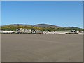
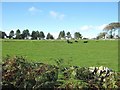
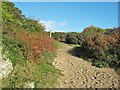
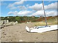
Nearby Images from Geograph Britain and Ireland:
©2011(licence)
©2011(licence)
©2011(licence)
©2011(licence)
©2011(licence)
The above images may not be of the site on this page, they are loaded from Geograph.
Please Submit an Image of this site or go out and take one for us!
Click here to see more info for this site
Nearby sites
Key: Red: member's photo, Blue: 3rd party photo, Yellow: other image, Green: no photo - please go there and take one, Grey: site destroyed
Download sites to:
KML (Google Earth)
GPX (GPS waypoints)
CSV (Garmin/Navman)
CSV (Excel)
To unlock full downloads you need to sign up as a Contributory Member. Otherwise downloads are limited to 50 sites.
Turn off the page maps and other distractions
Nearby sites listing. In the following links * = Image available
478m NW 321° Mossyard* Rock Art (NX54695204)
520m WSW 240° Mossyard 1* Rock Art (NX54525141)
905m N 3° Newton Cairn* Chambered Cairn (NX55065256)
2.0km NNW 328° High Auchenlarie* Stone Circle (NX53955342)
2.9km NW 306° Bardristane 1* Rock Art (NX52735343)
3.1km SE 131° Ardwall Island Chapel & Burial Ground* Cairn (NX57254956)
3.5km NNE 22° Stone Triangle (Lagganmullan)* Modern Stone Circle etc (NX5641154896)
3.7km NNE 16° Lagganmullan 4* Rock Art (NX56095516)
3.7km NNE 22° Lagganmullan 8* Rock Art (NX56475503)
3.7km NNE 22° Lagganmullan 9* Rock Art (NX56465504)
3.8km NNE 16° Lagganmullan 3* Rock Art (NX56125528)
3.8km NNE 13° Mill Knock Standing Stones* Standing Stones (NX5597855343)
3.9km NW 308° Kirkdale Burn* Cairn (NX5198354134)
3.9km WNW 303° Cairnholy 2 (Rock Art)* Rock Art (NX5177453889)
3.9km WNW 303° Cairnholy 1* Chambered Cairn (NX5176053890)
3.9km NW 305° Cairnholy 2* Chambered Cairn (NX5182054045)
4.4km NW 308° Cairnholy 9* Rock Art (NX51615445)
4.4km WNW 298° Clash Wood Cairn* Round Cairn (NX5117853862)
4.5km NNE 12° Lady's Well (Anwoth) Holy Well or Sacred Spring (NX5608356025)
4.5km NW 309° Cairnholy 4* Rock Art (NX51555463)
4.5km NW 315° Cairnholy 6* Rock Art (NX51855496)
4.6km NW 311° Cairnholy 5* Rock Art (NX51615480)
4.7km NNW 338° Cairnharrow Summit* Cairn (NX53335610)
5.3km NNW 347° Cairnharrow Cup & Ring Marked Stone* Rock Art (NX54005684)
5.4km NW 322° Claughreid* Stone Circle (NX5177356005)
View more nearby sites and additional images


 We would like to know more about this location. Please feel free to add a brief description and any relevant information in your own language.
 Wir möchten mehr über diese Stätte erfahren. Bitte zögern Sie nicht, eine kurze Beschreibung und relevante Informationen in Deutsch hinzuzufügen.
 Nous aimerions en savoir encore un peu sur les lieux. S'il vous plaît n'hesitez pas à ajouter une courte description et tous les renseignements pertinents dans votre propre langue.
 Quisieramos informarnos un poco más de las lugares. No dude en añadir una breve descripción y otros datos relevantes en su propio idioma.